The trail leads through the captivating regions of the Nałęczowski Plateau, the Kozi Bór Protected Landscape Area, located between the northern edge of the Lublin Upland and the Wieprz Ancient River Valley, as well as through the Wieprz Ancient River Valley Protected Landscape Area, which has successfully preserved its natural and landscape assets, as one of few such areas in the Lublin Region.
The trail section between Klementowice and Płonki features some elevations, while the remainder of the trail continues on the flat ground. The section between Olesin and Kurów has a slightly higher vehicle traffic volume.
The ride along the green trail begins at the level crossing in Klementowice. You encounter the red Rose Trail, which here crosses the railway tracks of the former Nadwiślańska Railway. The railway overhead line, which you can see at the level crossing, was erected over 130 years ago.
The Nadwiślańska Railroad was designed as a structure of great significance in case of the outbreak of a war and therefore, its construction was prioritized. The railway was supposed to enable the transportation of supplies, ammunition, arms, and the army between the most important fortresses of the Kingdom of Poland: Warsaw, Modlin and Dęblin and the Russian fortresses in Volhynia: Łuck, Rovno and Dubno. Levelling of the ground, building embankments and laying the tracks began in the late 1874. The construction was completed in the record time of three years, on July 24, 1877. The Nadwiślańska Railroad, later called the Nadwiślańska Railway, was officially opened on August 17, 1877.
The historical wooden Railway Station Klementowice, situated halfway between the stations in Nałęczów and Puławy, is located less than 500 m west from the level crossing. The construction of the eclectic building lasted one year and it was completed in 1878. Although dilapidated and inconspicuous today, the building can tell many interesting stories. You can learn about the most interesting stories, taking up the challenge of the “Stories with a Legend in the Background” Quest, which reveals numerous mysteries of the contemporary and old Klementowice.
It is not only a large but also a very old village. It was officially established by Klemens of the Szreniawa Coat of Arms in the late 14th century; however, people had settled here much earlier. The archaeological excavations carried out in the vicinity have provided very interesting information about the former residents of the area.
The first archaeologically confirmed traces of the human settlement in the region of the present Klementowice date back to the Paleolithic Age, that is, the early stone age and date from the time between the 13th and 11th centuries BCE. Several thousand of various flint artefacts were discovered in Klementowice-Kolonia, which constitutes the remnant of the reindeer hunters’ settlement from almost 13,000 years ago (the period of the so-called Magdalenian culture). It is one of the most interesting archaeological sites in Poland associated with the Magdalenian culture, and the farthest located settlement of this culture in Northeast Europe.
The archaeological excavations carried out in Klementowice provided significant data for research on the Neolithic Age – the new stone era, which began in the Lublin Region in the early 5th millennium BCE. The contemporary settlers in this area were already familiar with the methods of farming and animal breeding, and they knew how to shape and fire earthenware. They also used natural vegetable and animal fibres for spinning and weaving. They perfected methods of stone material processing and established small settlements.
In the end of the 4th millennium BCE, the communities of settlers identified by the archaeologists with the funnelbeaker culture, arrived in the Klementowice area. This was the time of intensifying the agricultural and breeding farming; the area of cultivated land was increased, since the forests were burnt down on a large scale and the soil was fertilized with ashes. The ox-drawn ards also came into use. A small settlement and eight cemeteries were discovered during the excavations. A number of clay pottery vessels, such as goblets, cups, amphorae, and vases were recreated on the basis of the excavated fragments of the earthenware. Other discovered items include carefully polished flint axes, stone hatchets, tools made of bones, and clay whorls. The graves placed under the thick layer of rock blocks (sometimes the presence of other stone structures was discovered as well) most often featured individual skeleton burials without furnishing, and rarely contained some gifts like pottery, tools or ornaments.
The population associated with the globular amphora culture settled in this area in the final phase of the Neolithic Age, around the middle of the 3rd millennium BCE. Their economy was based on shepherd raising a variety of large herds of livestock. Graves dating from this period were discovered in Klementowice. They were usually constructed from limestone and the dead were accompanied by earthenware, fully polished flint ornaments, and sometimes also by amulets made of boar’s teeth, bone arrowheads, and amber beads. Occasionally, the graves featured human or animal sacrifices.
You continue the ride along the green trail. You leave the railway tracks behind, and after less than 300 m you pass by a pharmacy on the left, with an adjacent bicycle-friendly place (a bicycle stand, a table with benches and a board providing information about Chambers of Local Products and other bicycle-friendly places).
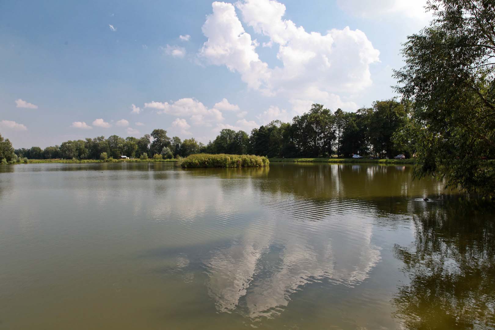
You pass by the intersection behind the pharmacy and continue the ride along a large pond located on the left (at 0.65 km). After 300 m the pond ends, and you can admire a splendid garden on the slope on the right with a rich collection of shrubs and impressive garden compositions. It is worth giving these beauties a closer look; perhaps they will inspire you to create your own garden.
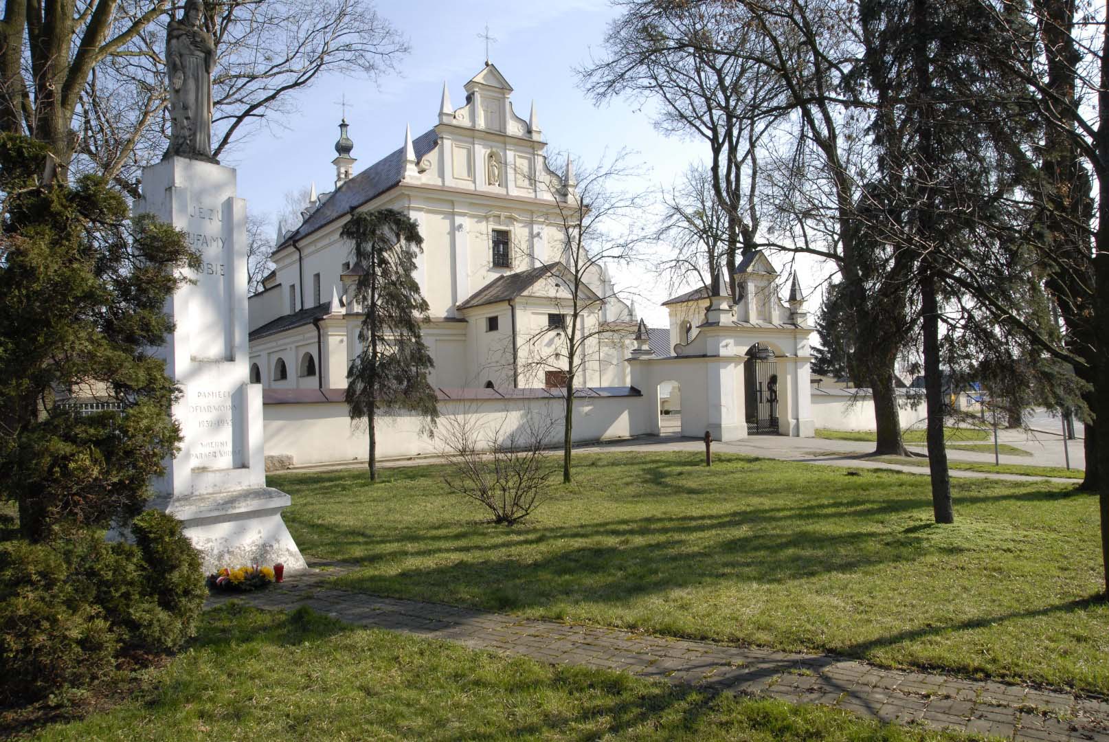
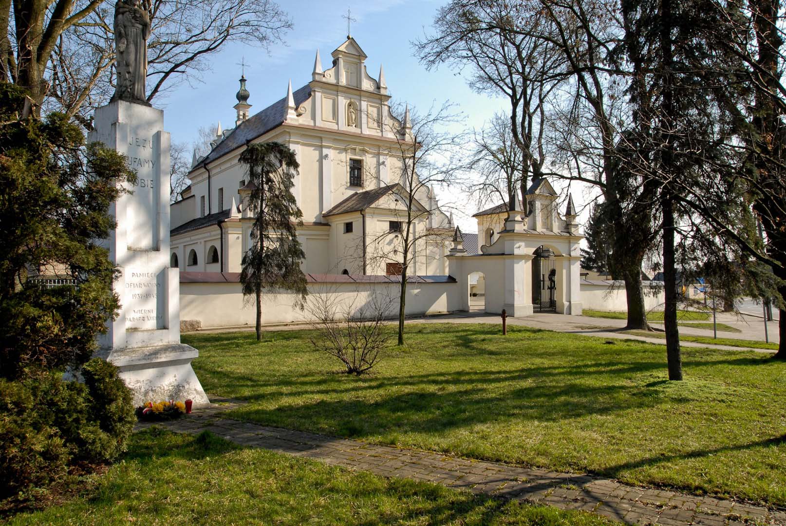
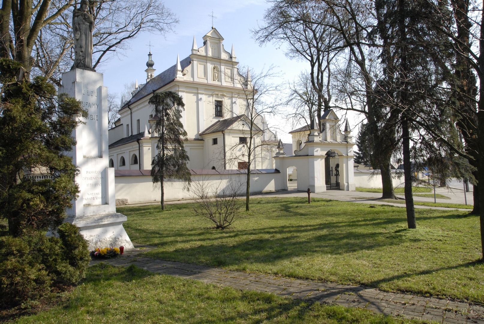
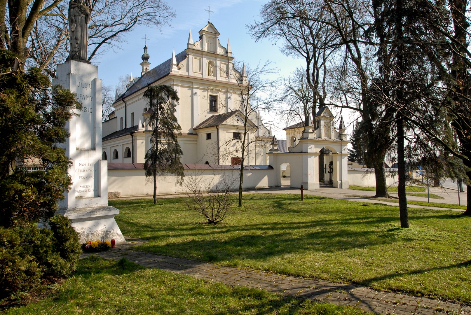
You continue the ride and make a left turn at the nearest fork road (at 1.18 km). If you continued straight on, you would reach a sheltered rest area for cyclists, located 200 m later in front of the Volunteer Fire Department Station in Klementowice. A noteworthy neo-Gothic church is located about 300 m later near the ravine.
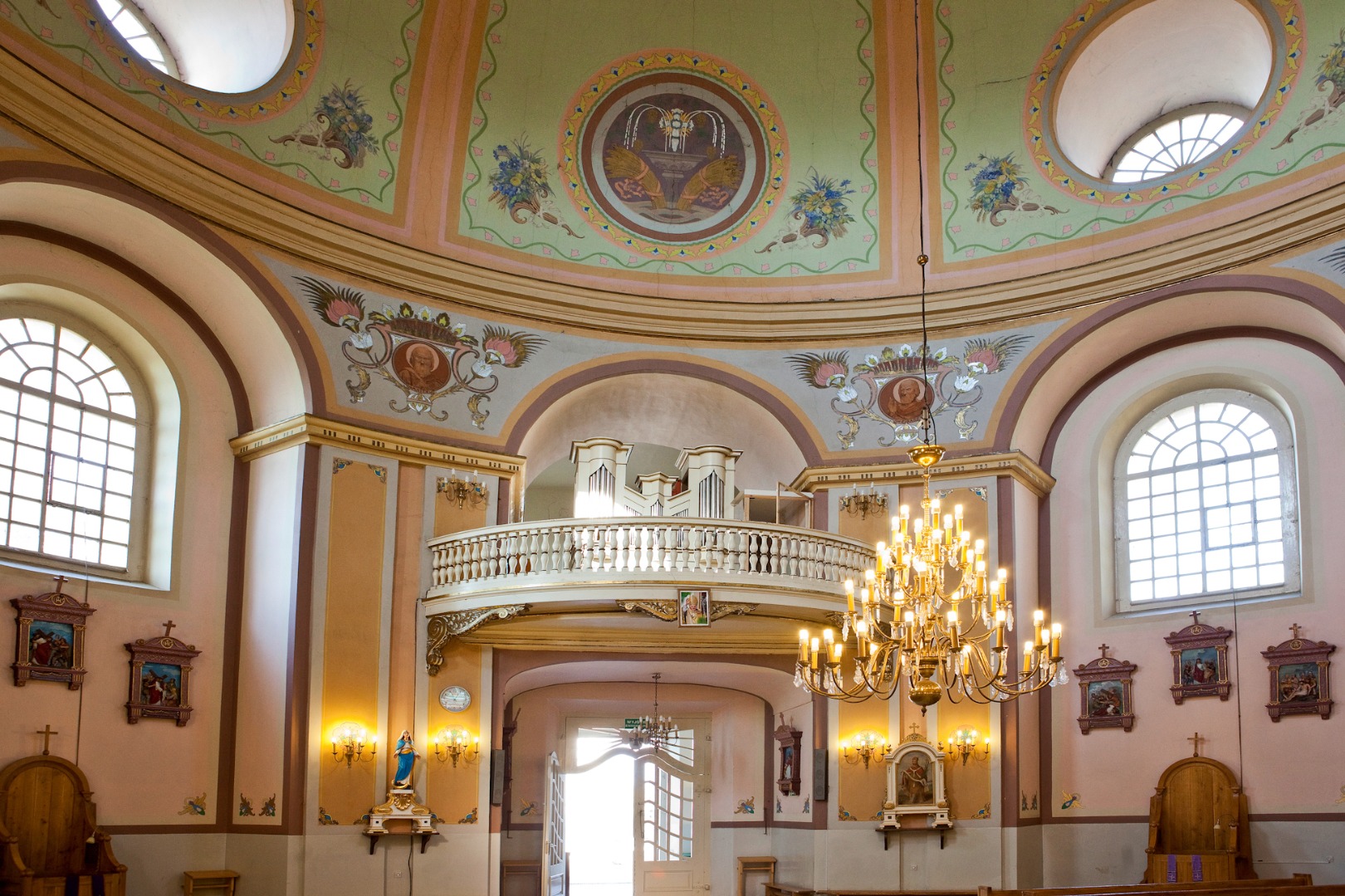
The Church of St. Clement and St. Margaret was erected in the years 1914–27. It is a brick, three-nave church in the neo-Gothic style. The fronton is flanked by two towers. Three wooden altars, the pulpit and a baptismal font designed by Tylman van Gameren in 1690 were transferred from the previous church existing on the site to the present building. The choir features an organ with eight ranks dating from 1899.
Adjacent to the church is a deep ravine with a small bridge leading to the presbytery placed over it. The bottom of the ravine features old graves. The exit from the ravine is guarded by a bicycle sculpture made by Roman Czerniec of Wojciechów, where you can take a souvenir shot. Also noteworthy is a historical cemetery adjacent to the church.
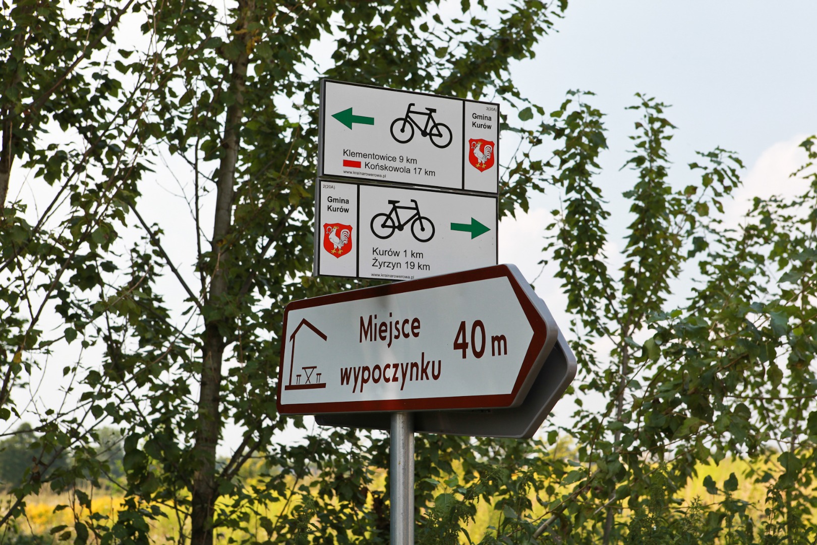
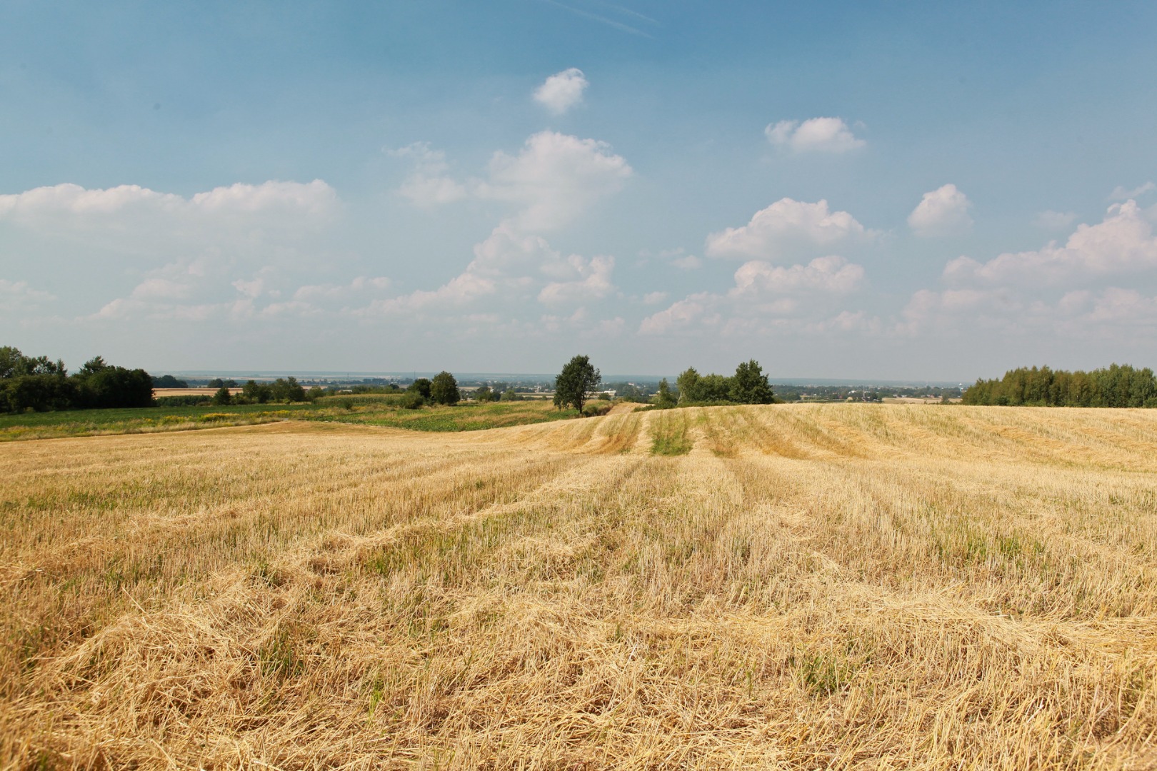
You return to the green trail. About 200 m after the bend, you can see the slender towers of the church in Klementowice on the right (at 1.4 km). You continue straight on for about 800 m and make a right turn (at 2.2 km). The even asphalt road runs between the fields and blueberry orchards. You ride straight ahead for about 3.5 km. You pass by a cold storage in Klementowice on the left (at 3.69 km), and then you pass by a brick roadside shrine surrounded by young cypresses and thujas on the right (at 3.95 km). You ride on the somewhat dilapidated asphalt road, but in exchange for this discomfort, a captivating view unfolds ahead of you over the vicinity with undulating hills, and buildings, fields and forests visible in the distance (at 5 km). Soon, the road surface improves. You proceed straight on, staying on the asphalt road near the old wooden cross and leaving the cross behind on the left (at 5.58 km). You turn left at the intersection in Buchałowice and head in the direction of the village of Płonki. After over 700 m you face a long (about 200 m) and rather steep ride downhill. Don’t pick up too much speed during the descent, since at its end you have to turn right onto a side road (at 6.91 km). Then, after 300 m you turn left at the fork road (at 7.21 km). Soon, you will see the water tower in Kurów in front of you on the right (at 8 km).
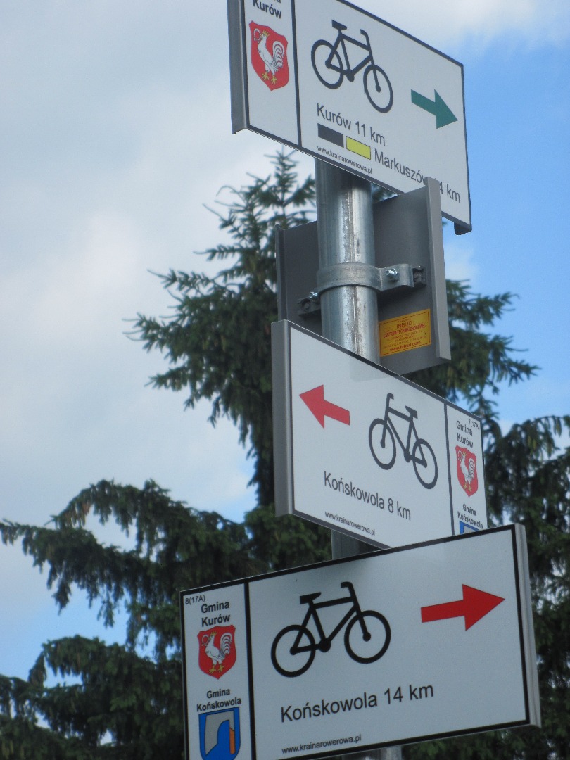
After less than 800 m you reach the intersection in Płonki, where the black connecting trail that is 2.5 km long begins, leading to the “In the Land of Jan Płocek” Markuszów yellow trail (at 8.78 km). You continue the ride, but you must be more careful now as the next several kilometres of the main road definitely feature much higher than before vehicle traffic volume. The road turns left, you cross the small bridge on the Kurówka River (at 9.30 km) and leaving Płonki, you turn right at the intersection (at 9.6 km). Then, you cross the Kurówka River again (at 9.74 km).
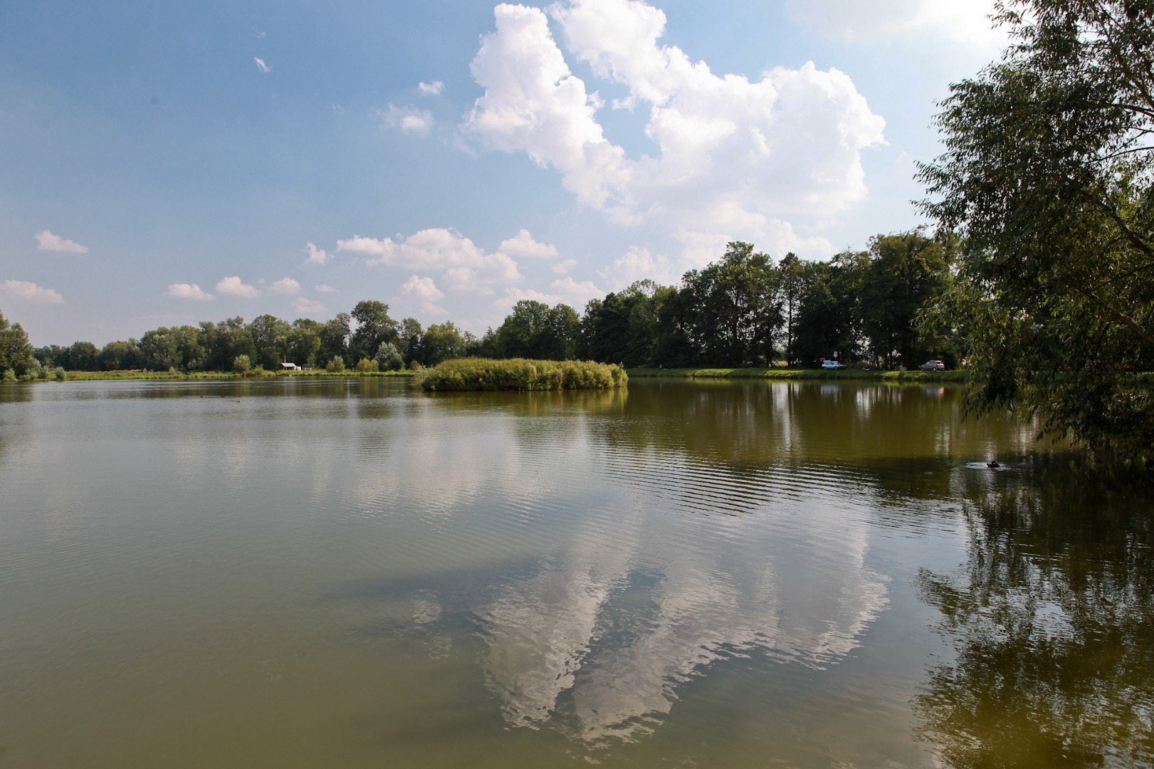
You arrive at the ponds in Olesin. The palace-park complex is located in their neighbourhood. The palace itself is currently dilapidated and it slowly decays, while the attempts to find a private investor and a new owner have so far been unsuccessful. It is interesting to know that General Wojciech Jaruzelski of the Ślepowron Coat of Arms was born in Olesin in 1923.
Olesin was once part of Kurów, and it became an independent village only in 1783, a year after a palace-park complex designed by Christian Piotr Aigner was established here at the request of Ignacy Potocki and his brother Stanisław Kostka Potocki. The name of the village was created in order to honour Aleksandra [Olesia is a dimunitive of Aleksandra] – the wife of Stanisław Potocki. Apart from the Potocki family, other people associated with Olesin include Julian Ursyn Niemcewicz of the Rawicz Coat of Arms, among others.
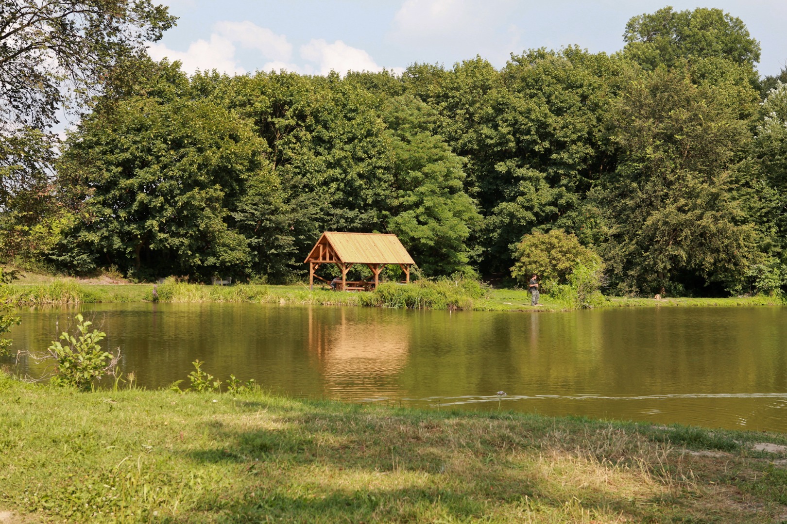
A rest area for cyclists is located near the ponds (at 9.9 km). At the shore you can also see anglers waiting for their “biiig fish.” You continue the ride and turn left at the cemetery into I Armii Wojska Polskiego Street (at 10.28 km) and after 570 m make a right turn. You are in the centre of Kurów.
For several hundred years, tanning, fur making and furriery, especially the sheepskin coat making, have been the specific and dominating type of manufacture in Kurów. The village is known for this type of manufacturing in the voivodeship, the country, and abroad. The centuries-long Kurów tradition is maintained by many small craftsmanship manufactures.
The origins of the village date back at least to the 12th century. At present, it has a character of a municipal settlement; in fact, it had been a town for 400 years (1442–1869). The historical urban layout, with the complexes of small town architecture, featuring many interesting buildings, have been preserved until the present day. The father of Ryszard Kaczorowski, the last President of the Polish Republic in Exile, came from Kurów.
You pass by the Parish Church of the Blessed Virgin Mary and St. Michael the Archangel on the right (at 11 km).
The late Renaissance three-nave church in Kurów was built in three stages. The first founder, Piotr Kurowski, erected the church in 1450. In the mid 16th century the side naves were added. The main nave was reconstructed in brick around 1660 at the request of the Zbąski family. The subsequent improvements were introduced in the first half of the 18th century by the local parish priest, Father Michał Szajkowski, (he renovated and reinforced the vault with anchor plates). In the second half of the 18th century, the roof was covered with tinplate and the laying of the marble floors was completed. At present, the church consists of the main nave and two side naves. It is worth seeing the original Baroque high altar and seven side altars inside the church.
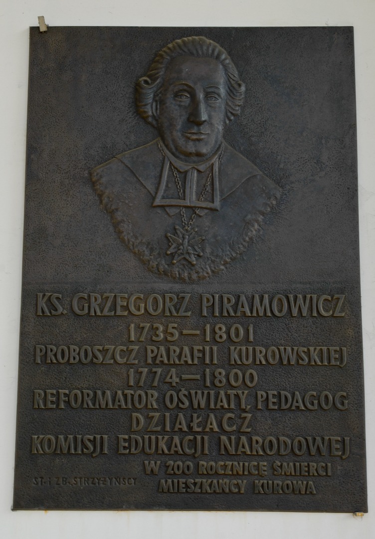
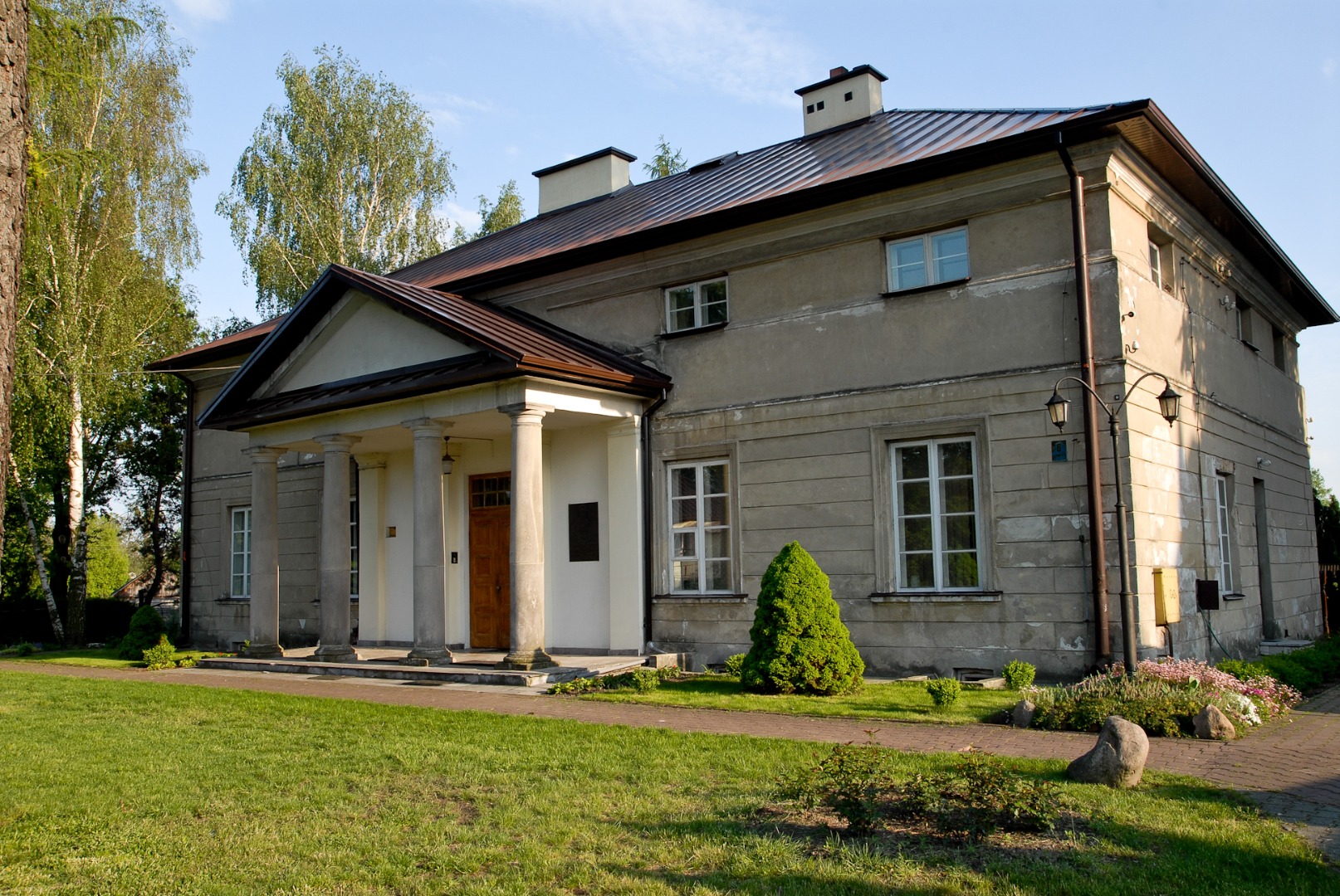
Father Grzegorz Piramowicz, pedagogue, educator activist and Enlightenment writer, conducted his pastoral work in the parish in the years 1775–85. Adjacent to the church is the building of the parish school (curacy) dating from 1738. It is an example of neo-Classical building with straight elevations divided by pilasters topped with cornices and the high mansard roof. The building was rebuilt in the late 18th century, and after the bombing of 1939, it was reconstructed and enlarged in the years 1953–58.
The church complex features other historical buildings, such as a bell tower and the neo-Classical presbytery, both dating from the 18th entury. The brick presbytery was erected in the years 1778–82 according to the design by Stanisław Kostka Potocki and architects Chrystian Piotr Aigner and Stanisław Zawadzki. Burnt down during the Second World War, the presbytery was rebuilt in 1945.
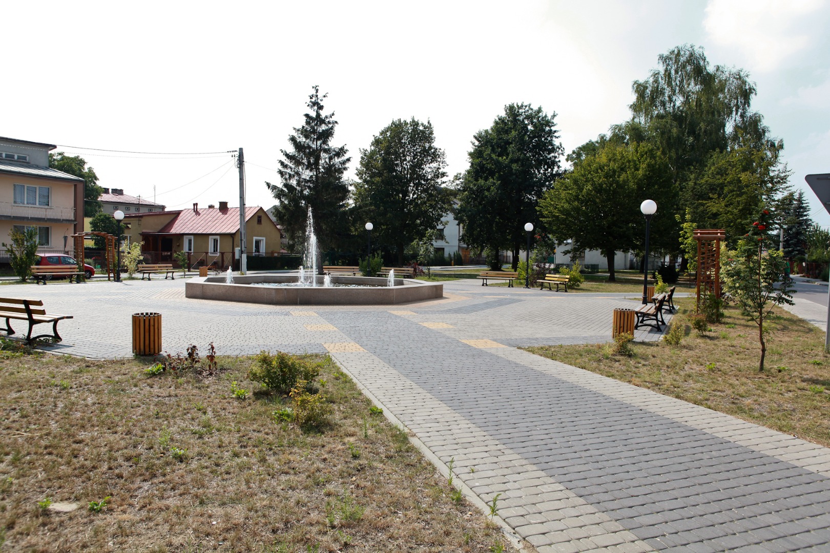
The recently revitalized market square, located on the left from the church, features a monument commemorating the civilian victims of the mass execution carried out here by the Nazi Germans in 1944.
You cross the very busy Route 17 via the pedestrian crossing, and riding along Głowackiego Street you reach a fountain with a signpost located nearby, indicating that from this point, you can reach the blue northern trail around Markuszów County, following the red connecting trail that is 7 km long.
The red connecting trail leads from Kurów through Kłoda to the village of Bobowiska, where it is joined by the blue trail around Markuszów, running through Bobowiska, Wólka Kątna, along Duży Ług and Rejowiec Lakes, until the school in Wola Przybysławska (the total distance from Bobowiska is 8.3 km). You can reach the village of Kozłówka from there, following the black trail around Garbów leading to Meszno (the total distance is 4.7 km). You then turn left and continue straight on along the yellow connecting trail (that is 7.31 km long), and then ride along the blue trail around Kamionka County for 3 km, until you arrive directly at the gate to the Zamoyski Museum in Kozłówka. The total distance from Kurów to Kozłówka, along the trails described above is about 30 km. In order to traverse the route you need an all-terrain bicycle suitable for riding on the field and forest roads.
The famous Kurów fairs that competed with the fairs organized in the nearby Markuszów were held until 1980s at the fountain, near which you stand. You now turn left into Nowy Rynek Street, and after 100 m you turn right into Kościuszki Street (at 11.27 km). Then you proceed straight on for 1.8 km and reach the village of Szumów.
One of the most famous people associated with this village was Stanisław Pękala, member of the Legislative Parliament of Poland, head of Kurów County, participant of the Polish-Soviet War, co-founder of the County Savings and Loan Association. He died on September 10, 1939 during the bombing of Kurów by the Nazi Germans.
At the end of the village of Szumów, the road turns left (at 13.06 km). You are over 2 km away from the next village. You cross the small bridge on the Kurówka River (at 13.19 km) and leave the village behind. You ride into the open space with fields on your left and vast meadows on your right. You now ride on the sandy, only partially paved road. Several hundred metres later you pass by an old wooden cross, barely visible underneath two massive lime trees. You pass it by riding on the main road, heading slightly right (at 13.59 km). You ride through a birch coppice (at 13.8 km), later you reach the asphalt road behind the pine trees and stay on the main road turning right at the fork road (at 13.91 km). You cross the small bridge on the Kurówka River for the last time.
The Kurówka River, a right-bank tributary of the Vistula River is ca. 45 km long and has its source in three springs located within the borders of Garbów County in the villages of Piotrowice Wielkie, Bogucin and Piotrowice Kolonia. The mouth of the river is located within the borders of Puławy. The Kurówka River flows through Garbów, Markuszów, Kurów, Końskowola and Puławy. The area of its basin is 395.4 km². About 200 m away from the bridge (down the river) Struga Wodna River flows into the Kurówka, having earlier flown through Dęba, Wólka Nowodworska and Szumów, whereas 500 m up the river, the Białka River flows into the Kurówka, flowing from Markuszów through Wola Przybysławska, Wólka Kątna, Zastawie, Kłoda and Szumów. In the last few years, rafting has been organized on the Kurówka River, between Szumów and Opoka and between Opoka and the ZDUNG Centre (Agricultural Experimental Centre in Puławy). The rafting is organized by the Municipal Centre for Sports and Recreation (MOSiR) in Puławy. The water sport equipment is available in the MOSiR rental shop located at ul. Portowej 3 in Puławy, where the kayaking enthusiasts can rent a certified kayak with a life guard equipment in order to try their hand in rafting.
You make a right turn about 700 m behind the bridge and reach the village of Wólka Nowodworska. You pass by a stork’s nest on the right (at 15.39 km), and then ride on the overpass above Express Road S17 (at 15.56 km).
You ride straight on at the intersection (at 17.41 km), where an information board with a map and signposts indicating a starting point of the yellow connecting trail (1.79 km long) are located. Following the yellow connecting trail will allow you to skip Choszczów and shorten the way to Żyrzyn by about 5 km. This route also circumvents the blue connecting trail to the yellow trail around Baranów County, which is located at the green trail less than 4 km away from your current location.
You enter the village of Dęba (at 17.54 km), pass by a modest building of the branch school in Dęba (closed in 2011) with the adjacent playground. You turn left and enter the village of Choszczów (at 19.4 km). You can see the Parish Church of Our Lady Mother of the Church in Dęba on the left (at 19.66 km).
A church was erected here in the years 1981–82 at the initiative of Father Canon Władysław Siudem, and in 1991 a small parish was established, concentrating about 1,000 parishioners from the villages of Bronisławka, Choszczów, Dęba, Marianka, Paluchów, Posiołek, and Wolica.
About 100 m later on the right you pass by a characteristic yellow roadside shrine with a heart-shaped ornamental motif (at 19.73 km). You leave Choszczów and an interesting view opens up in front of you over the patches of fields and forests (at 20.16 km). After some time, the quality of the road slightly deteriorates (the asphalt road full of holes and patches begins) and you enter the forest (at 21 km). After 200 m you reach the intersection featuring an information board, map and signposts. If you ride straight on along the blue connecting trail that starts here (and is 5.36 km long), you will reach the village of Śniadówka, located on the yellow trail around Baranów County (you are 12 km away from Baranów). But you continue following the green trail markers and turn left in the direction of Żyrzyn, which is about 12 km away.
You continue the ride and pass by a rest area on the right (at 21.68 km), located before a forest clearing (you will see a hunting blind in its corner). A fenced young forest with tree seedlings starts about 1 km away from the shelter (at 22.65 km). From time to time you encounter cords of wood on the way, and soon, you pass by the proverbial “door to the forest” (at 22.12 km). The forest, especially the young one when it is fenced, needs the door through which the foresters enter the tree-nursery. You proceed straight on behind the plantation and turn right at the intersection (at 24.13 km).
You reach the place featured on the yellow connecting trail – that you passed by earlier – which shortens the way to Żyrzyn. You are now about 9 km away from Żyrzyn. You ride straight on at the first intersection (at 24.98 km), and turn right at the next intersection located over 1 km later. Arriving at the second intersection, you can see a characteristic narrow and dark forest dirt road ahead of you. It looks like a tunnel with light at the end (at its end the road reaches a clearing). You turn left about 400 m later, and after nearly 1.7 km you leave the Kozi Bór Forest (at 28.51 km).
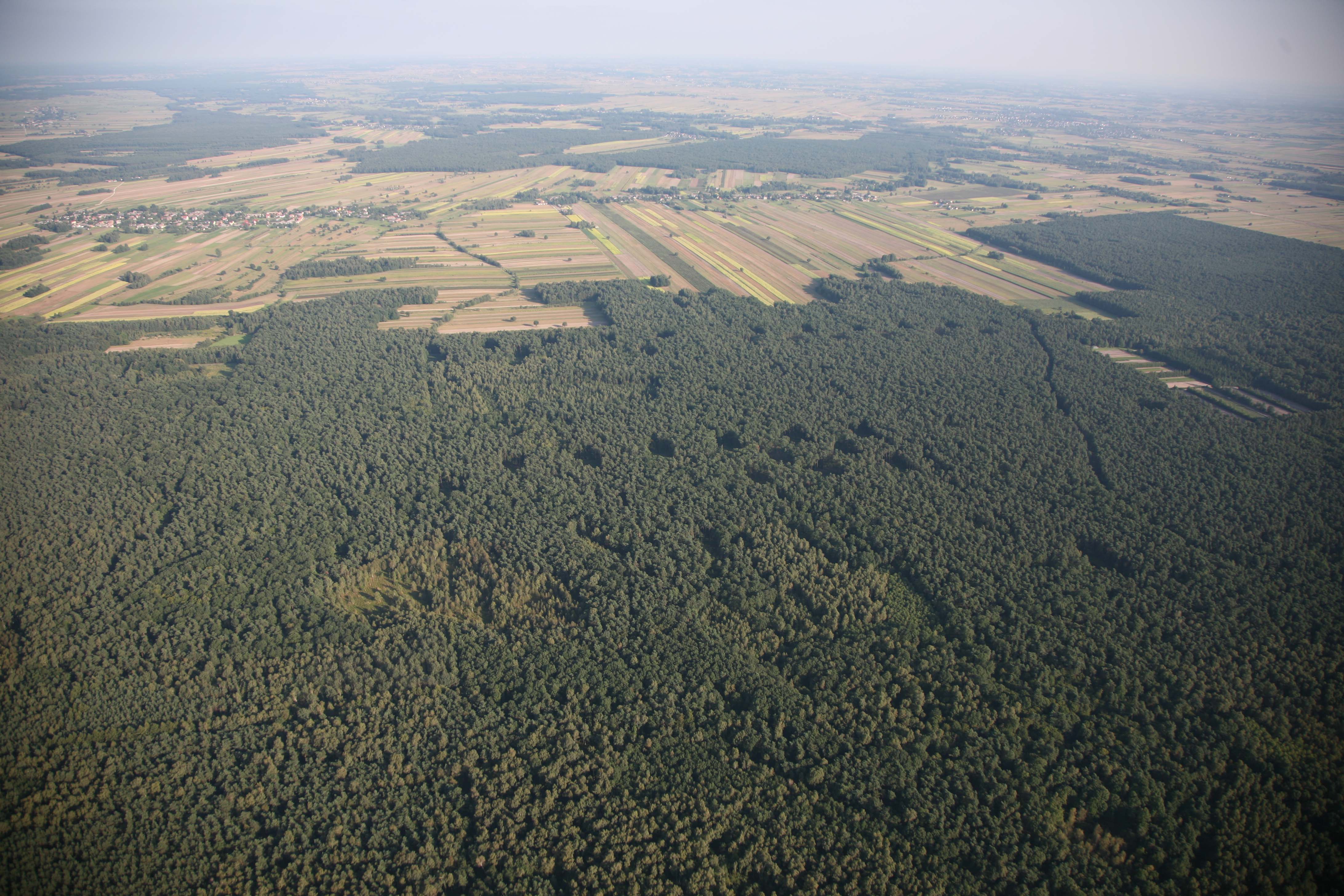
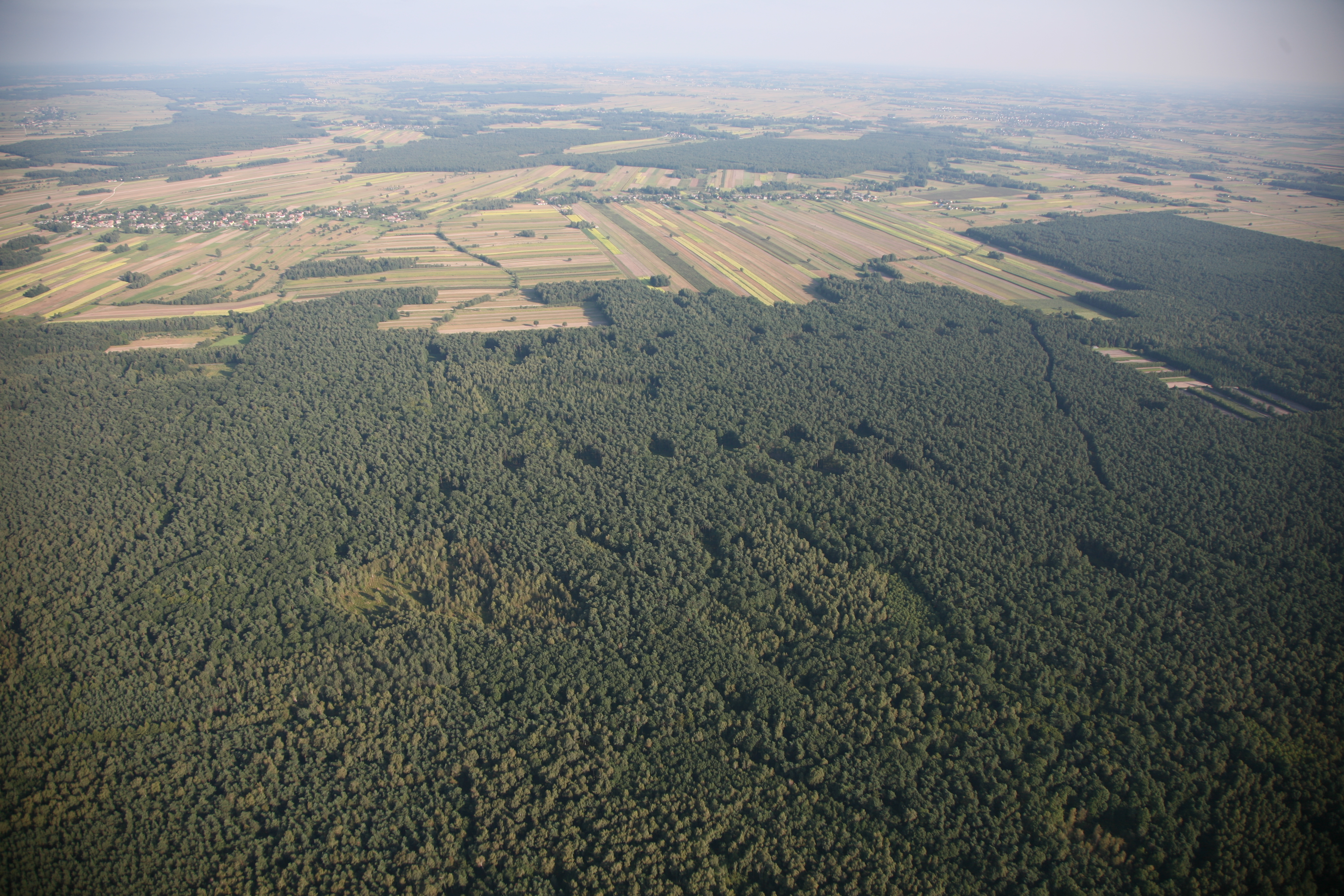
The Kozi Bór Forest is the forest and protected landscape area established in 1989. Its area is dominated by the plain landscape: the majority of its area features mixed forests and fresh sessile oak forests, as well as swamp forests, xerothermic oak forests, oak hornbeam forests, alder forests and riparian forests. In addition to the forest and thicket complexes, the area features large-format meadows and small peat bogs. Kozi Bór Forest boasts a few rare bat species.
You turn left (650 m away from the forest) and enter the village of Wola Osińska, which features an interesting ethnographic site.
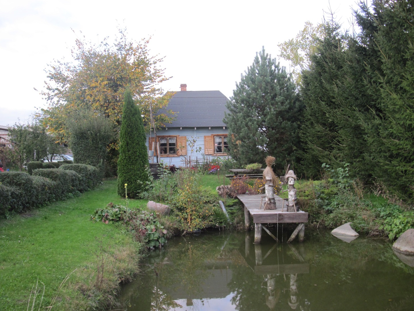
The mini open-air museum in Wola Osińska was established in 2000 thanks to the passion and initiative of Ms. Maria Rodak, a village resident. The founder of the museum calls it the Chamber of Tradition of Generations. It presents an authentic image of a village cottage from her childhood. The chamber consists of a vestibule with the clay floor, the kitchen and the room featuring a collection of every day items used by village residents in the 20th century. You can also see a traditional loom workshop, a symbol of rich weaving traditions of this region. The Chamber of Tradition of Generations is prepared for organization of banquets and occasional folk music encounters.
Having entered the village, you pass by a dilapidated roadside chapel on the right (at 29.16 km), and after 800 m you ride by the Volunteer Fire Department Station in Wola Osińska. It is worth noting a relatively large number of very well kept prewar cottages in the village. You turn right at the small sky-blue and white roadside shrine with a wooden fence, leaving the asphalt road (at 30.21 km) for the gravel road. Crab apple trees grow along the field road, and soon, you pass by the fruit and apple cold storage in Wola Osińska (at 31.05 km) visible in the distance on the left. You pass by a gold-painted metal cross standing under a solitary alder (at 31.32 km). The trail markers placed on the tree confirm that you have to continue straight on. You are quite close to the busy Route 17 running on the left (further on, you can see the chimney of the Puławy Nitric Acid Plant). Looking straight ahead, you can see the forest and you head in its direction. You enter the forest (at 31.6 km) and ride on the main road, as the signpost indicates. First, the forest road turns right and then, it makes a left turn behind the young birch trees (at 31.74 km). You now ride along the edge of the forest on a very sandy road. You turn left at the fork road (at 31.88 km). After less than a kilometre, you ride next to the acacia lane (at 32.4 km) and on the gravel road, which has just began, you turn left (at 32.78 km) into Plebańska Street. The road turns right at the silver cross standing under two acacia trees and takes you directly to the vicinity of the characteristic parish church in Żyrzyn (at 33.2 km).
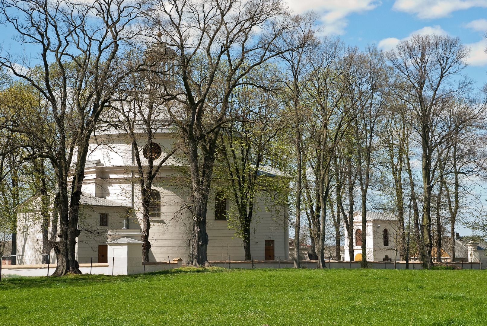
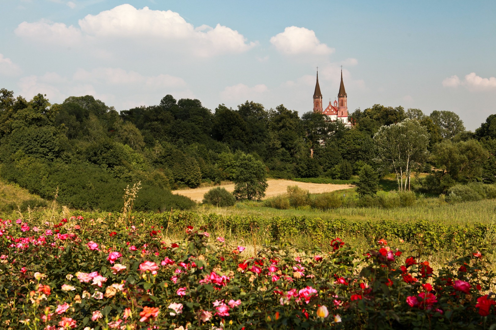
The Church of SS. Peter and Paul in Żyrzyn is a beautiful neo-Classical building in the shape of rotunda, designed by Christian Piotr Aigner, the court architect of the Czartoryski family. The history of the church origin is very interesting. The construction workers managed to build not only the foundations but also the walls of the church up to 5 metres tall in the course of 1803. However, the realization of the impressive architectural design by Aigner was interrupted due to lack of funds for the period of as many as 35 years. A story has been preserved among the county residents that decades later the unprotected walls were covered with birch trees, which the local residents used for making the shafts to the one-horse carts previously used in the countryside. It was only in the years 1839–48 that Adam Wessel, the new owner of the Żyrzyn estate, completed the church construction with the assistance of architect Karol Kremer, who introduced small changed to the original design. In the course of the subsequent decades, the church was finished off, renovated, plastered and painted. The roof with the dome, spreading above the nave, is topped with a turret crowned with a cross. The fronton is ornamented by four columns.
The interior of the church is covered with a beautiful polychrome. The three stained-glass windows, placed in the large window openings, founded by Stanisław and Zofia Wessel in 1912, are an impressive element of the interior design. On the left-hand side, you can see St. Stanislaus and on the right-hand side, St. Sophia the Martyr with Daughters with St. Peter’s Basilica in Rome in the background. The smaller stained-glass window above the high altar represents St. Joseph. The church also features marble epitaphs and plaques dedicated to the memory of church clerk presenters with their portraits.
The brick bell tower, dating from 1869 and incorporated in the fence, is located next to the gate in the close vicinity of the church. The fence itself dating from 1850 is worth noting, as it features four small shrines. An interesting neo-Gothic grave chapel of the Wessel family dating from 1853 is located nearby. The members of the family are buried in the crypt beneath.
Riding along Plebańska Street, you reach the asphalt road. Here, you turn left into Tysiąclecia Street (at 33.3 km). You proceed until the end of the street (about 1.5 km), passing by the Volunteer Fire Department Station in Żyrzyn (at 34.29 km) and a rest area located on the left at the pond (at 34.7 km). You turn left at the intersection into Powstania Styczniowego [January Uprising] Street (at 34.84 km). It owes its name to the most famous battle of the January Uprising which took place not far from here and which had repercussions all over Europe.
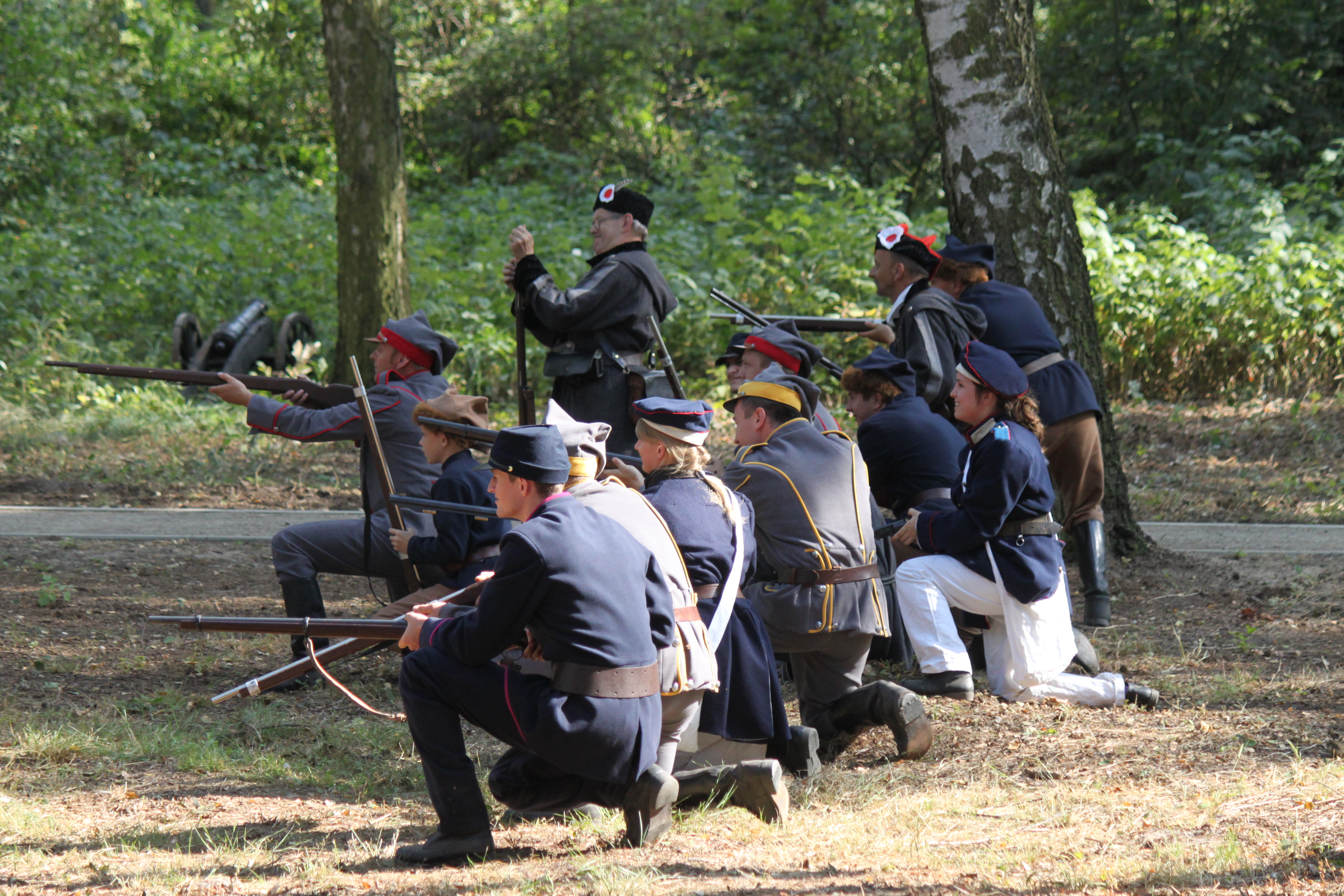
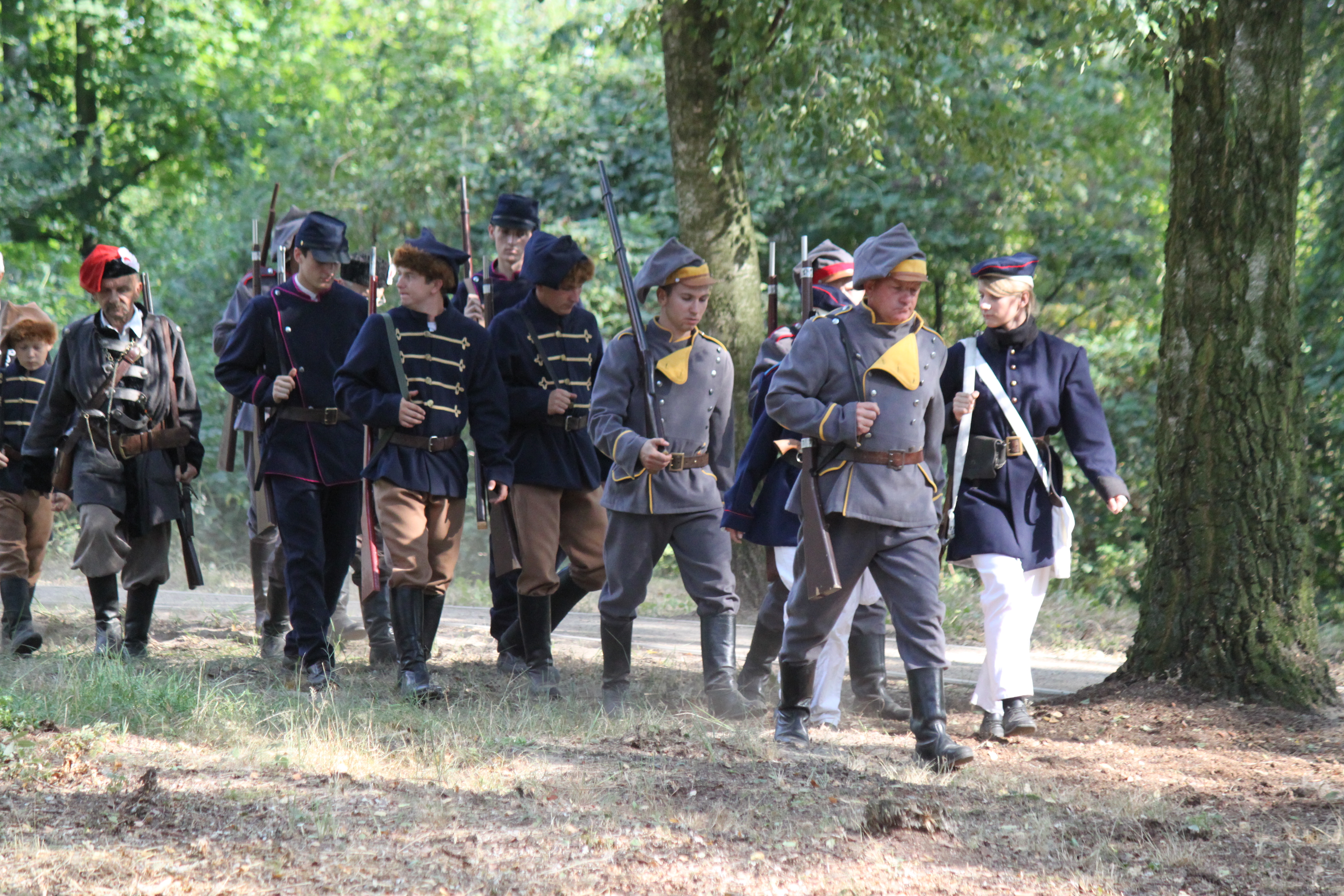
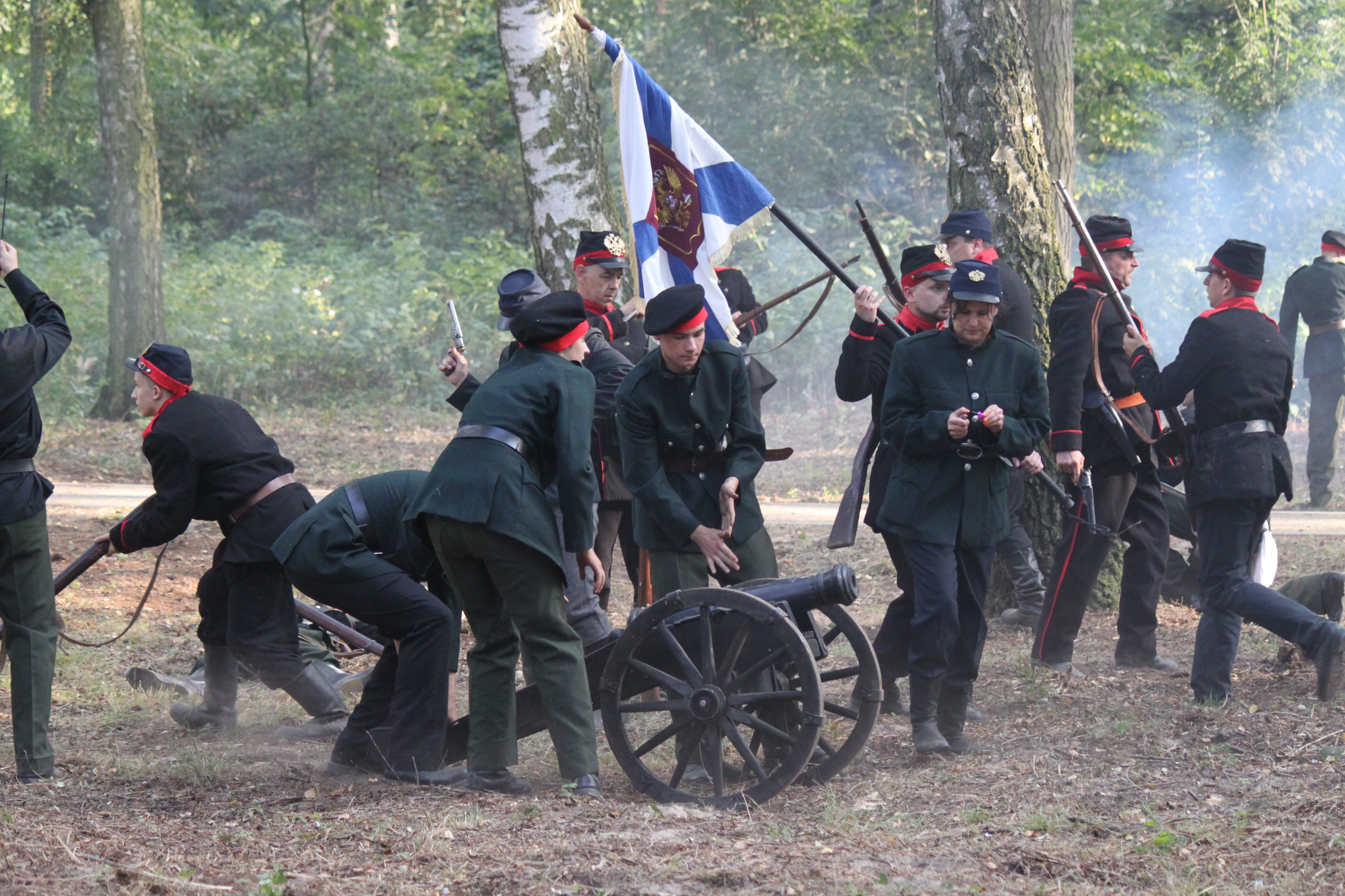
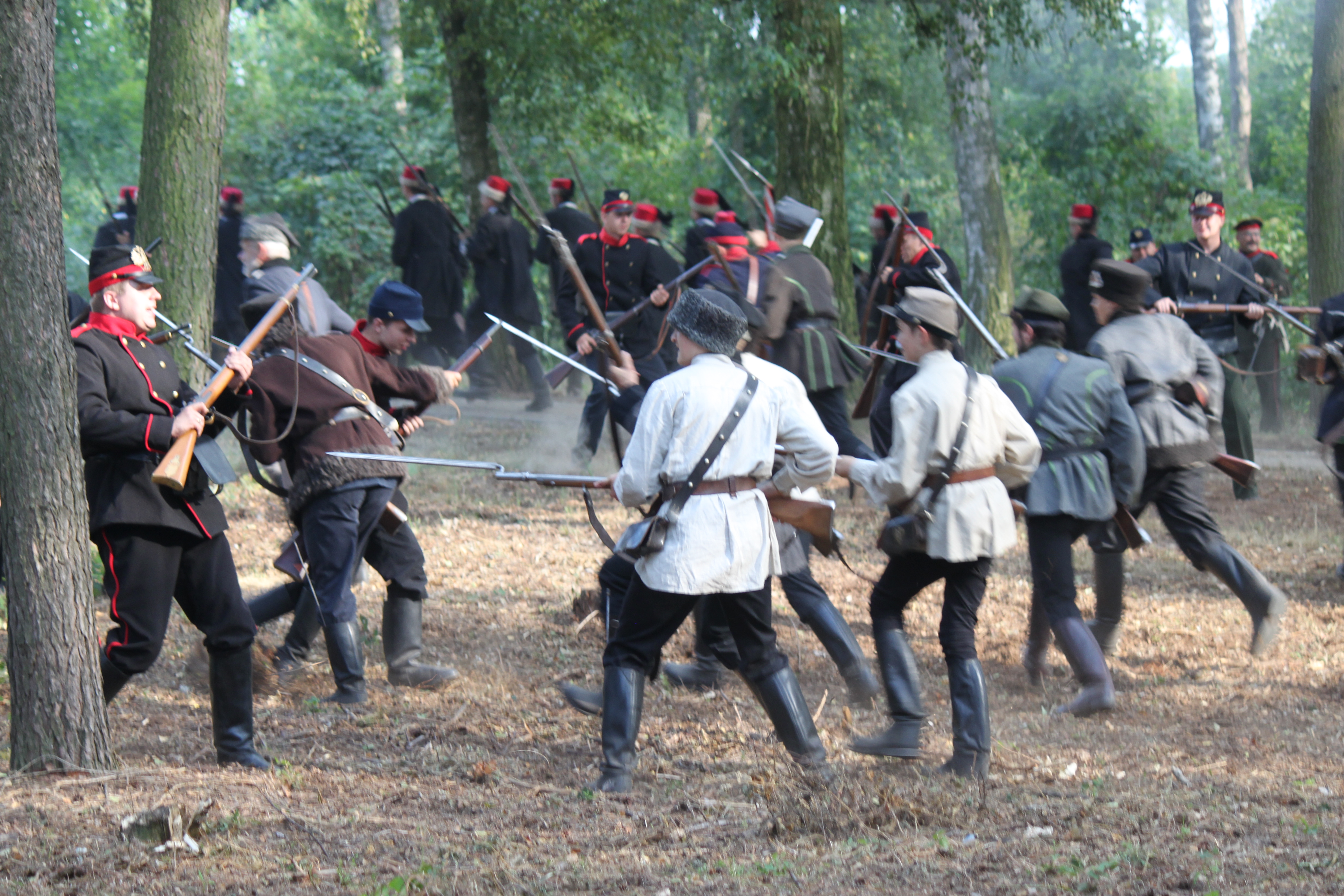
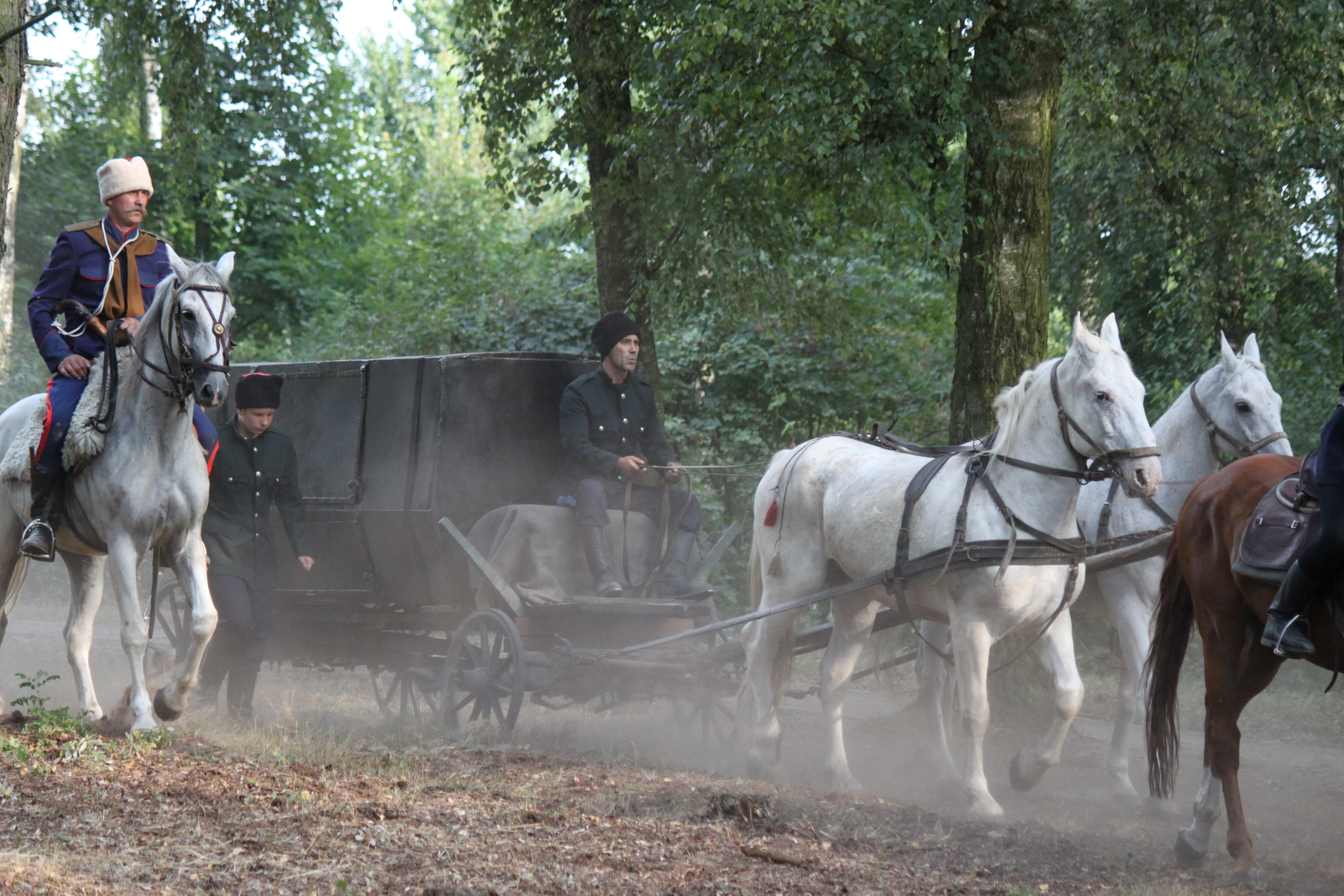
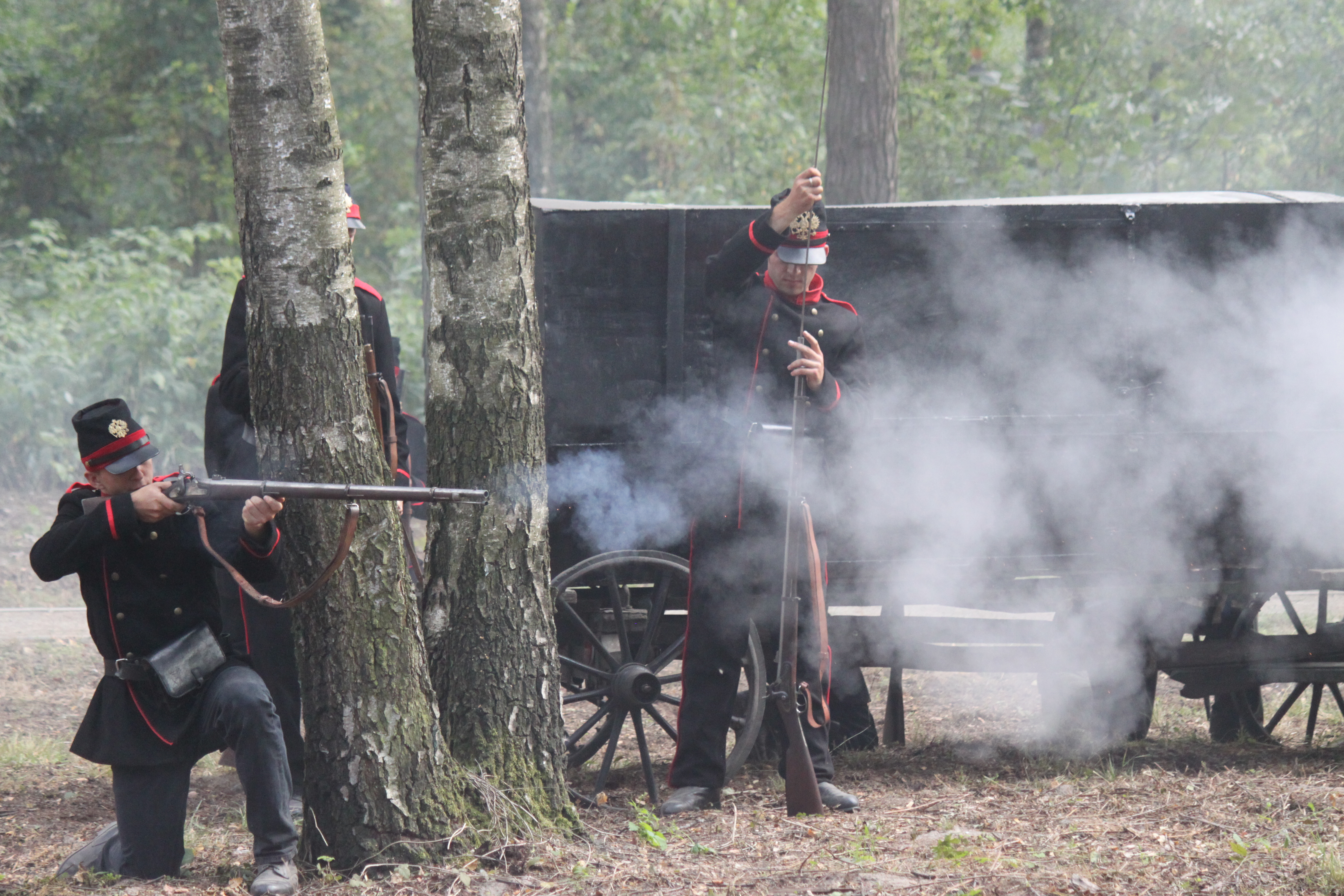
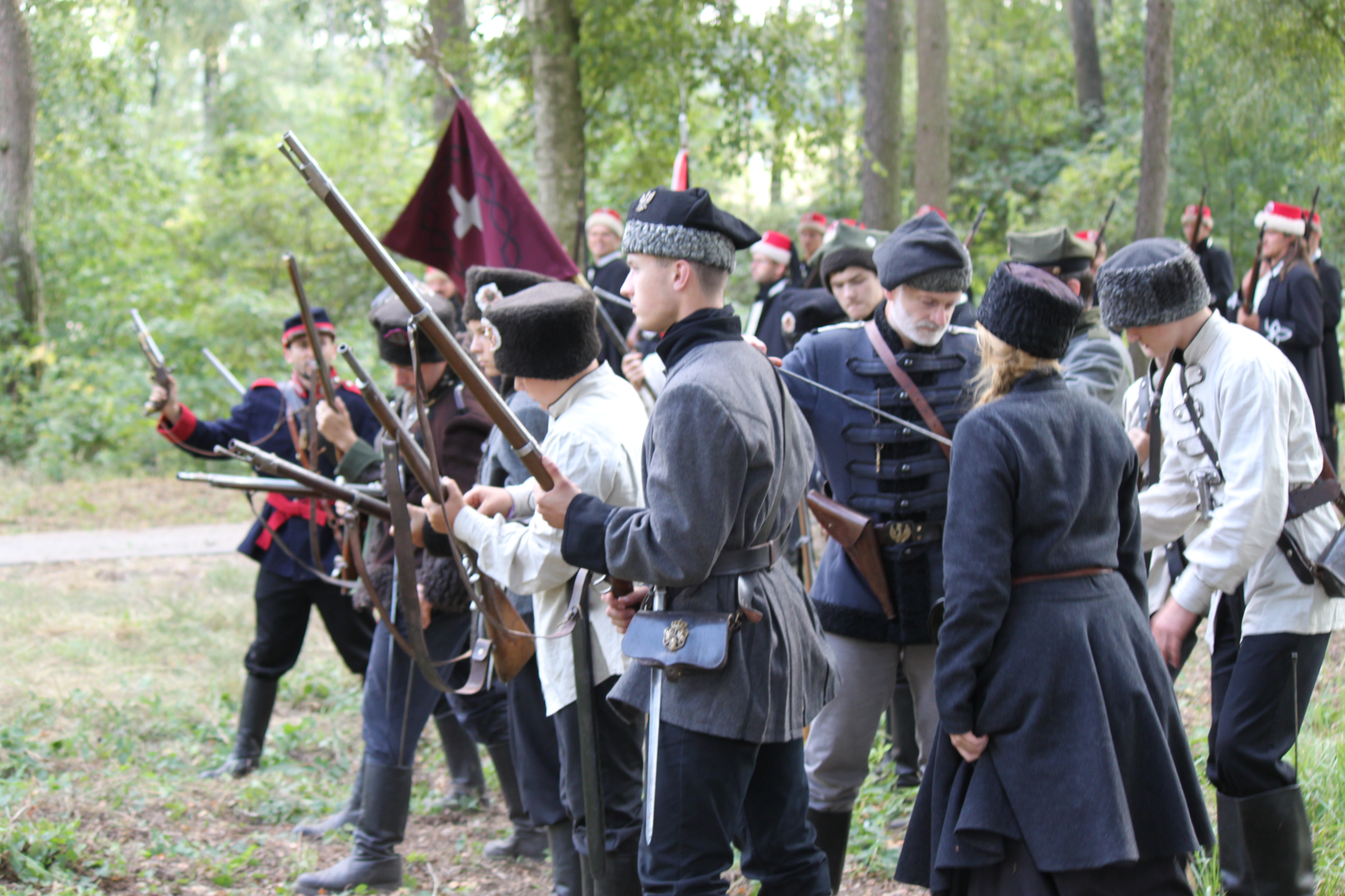
On August 8, 1863, the insurgent squad headed by Michał Heydenreich-Kruk fought a victorious battle with the tsar army. The Poles set up an ambush at the road near Żyrzyn for the postal convoy carrying large sums of money. After a three-hour fight, 140,000 roubles, 400 rifles and two cannons, which unfortunately were spiked, went into the hands of the Poles. As a result of the fight, the Polish insurgent side suffered the loss of 10 killed and 50 wounded, while the losses of the Russian side were much more severe: 84 killed, 140 wounded, and 108 captured. The head of the Russian army, Lieutenant Laudański got out of the ambush with about 90 soldiers. Ensuing the defeat at Żyrzyn, Grand Duke Konstantin was stripped off his position in Warsaw and was replaced by Field Marshall Friedrich Wilhelm Rembert von Berg. The success of the insurgents, who managed to obtain the arms and money indispensable for the subsequent fight, had a widespread impact in Western Europe and contributed to the increased assistance for the uprising, as more and more people began talking about it openly. The rallies of support were held in many countries and the European governments were pressed by their citizens to support the fighting Poles.
According to the data, the Russians carried at least 200,000 roubles in gold in that postal convoy. Allegedly, the missing 60,000 roubles were seized by two insurgents who hid the money somewhere in the vicinity. It is worth looking around; perhaps, the insurgents’ treasure waits just for you.
Still riding along the same street, you head toward the village of Żerdź, which is a bit over 2 km away from here. You enter the village (at 36.96 km).
The village of Żerdź is famous for weaving traditions. The Regional Chamber of Weaving is located here, while the local “Nasza Wieś” [Our Village] Association cultivates local cultural, craft and culinary traditions.
You reach the intersection after 150 m.
This is where the green trail joins the black connecting trail leading to the right to the yellow trail around Baranów County (about 3.5 km long), and then through the villages of Czołna, Baranów and through wild meadows at the bends of the Wieprz River until the mill in the village of Zagóźdź (at 17.3 km). If you turn left and ride through the villages of Jaworów, Borysów, Bałtów and the Piskory Nature Reserve, you will reach Kośmin (at 22.7 km).
A splendid roadside shrine stands here and the Volunteer Fire Department Station in Żerdź is located behind the intersection. You turn left and pass by a stork’s nest on the right (at 37.34 km), and then, a very old log cabin with window shutters on the left, (at 37.53 km) and you make a right turn (at 37.98 km). You ride by the local school on the left (at 38.13 km) and reach the intersection, where the black trail separates from the green trail and turns left (you are 8.6 km away from the blue trail around Puławy, and 11.6 km away from the Piskory Nature Reserve).
You continue straight on toward Strzyżowice (which is about 8 km away), along the shortest way to the Wieprz River. You enter the gravel road and reach the forest 540 m later. Attention! You ride straight ahead into the forest (don’t turn left with the main road). You pass by a wooden cross standing under the lime tree (at 38.7 km). Riding on the forest dirt road, you successively pass by four small hunting blinds; the first one stands on the left (at 38.89 km), and the next three are on the right (at 39.14; 39.29; and 39.46 km). You exit the forest and turn right (at 39.56 km). At first, you proceed along the edge of the forest, then the forest ends and you continue on the very sandy road that is hard to ride on with a bicycle. After about 560 m you make a left turn (at 40.12 km). After another 630 m you turn right. Now, you ride on a less sandy road, with a pine forest on your left, and a beautiful wild meadow on your right, where you can often encounter feeding storks. You ride through the forest again (at 40.9 km), and after 300 m you exit the forest onto a much better, gravel road. About 1 km later the asphalt road begins (at 41.94 km) and you turn left toward Strzyżowice. You are 4.84 km away from the end of the trail.
You are in the village of Wilczanka. If you now turned right, you would reach the village of Motoga located on the yellow trail around Baranów County, by following the connecting trail that is 3.53 km long (Wilczanka – Pogonów – Motoga). But you turn left, pass by two stork’s nests (at 42.06 and 42.52 km), then ride by a slender roadside shrine that was founded by the village residents in 1936 (at 42.68 km) and after several hundred metres, you leave Wilczanka (at 42.92 km).
You enter the village of Skrudki (at 43 km). You cross the small bridge (at 43.23 km) and pass by the Volunteer Fire Department Station in Skrudki on the right (at 43.43 km) and a roadside shrine dating from 1937. It is worth noting several well-preserved log cabins in the village. You make a right turn in the village (at 43.71 km) and then turn left behind the third willow tree (at 44.11 km). You continue in the direction of the main asphalt road, which turns into a gravel road after several hundred metres (at 44.83 km). You turn right at the fork road (at 44.35 km) and turn left after 250 m. This is how you arrive at the levee, passing by the red warning sign (at 45.6 km), which means that the Wieprz River is really close. After about one kilometre on the levee, you will see a brick roadside shrine topped with a white cross located about 100 away on the right. After another 100 m you leave the levee and reach the end of the green trail (at 46.78 km).
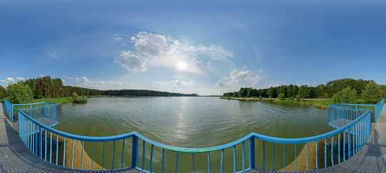
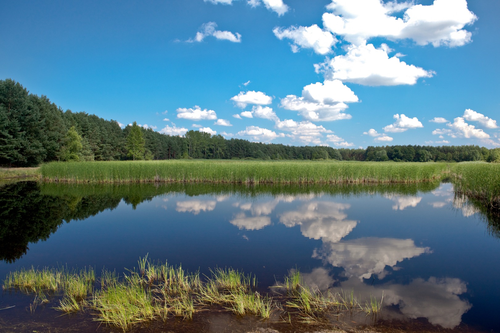
You are in Strzyżowice. The Wieprz River flows on the right, and one of the river bends literally winds beneath your feet. Ahead of you is the opposite riverbank, which is a peculiar peninsula formed by the meandering river.
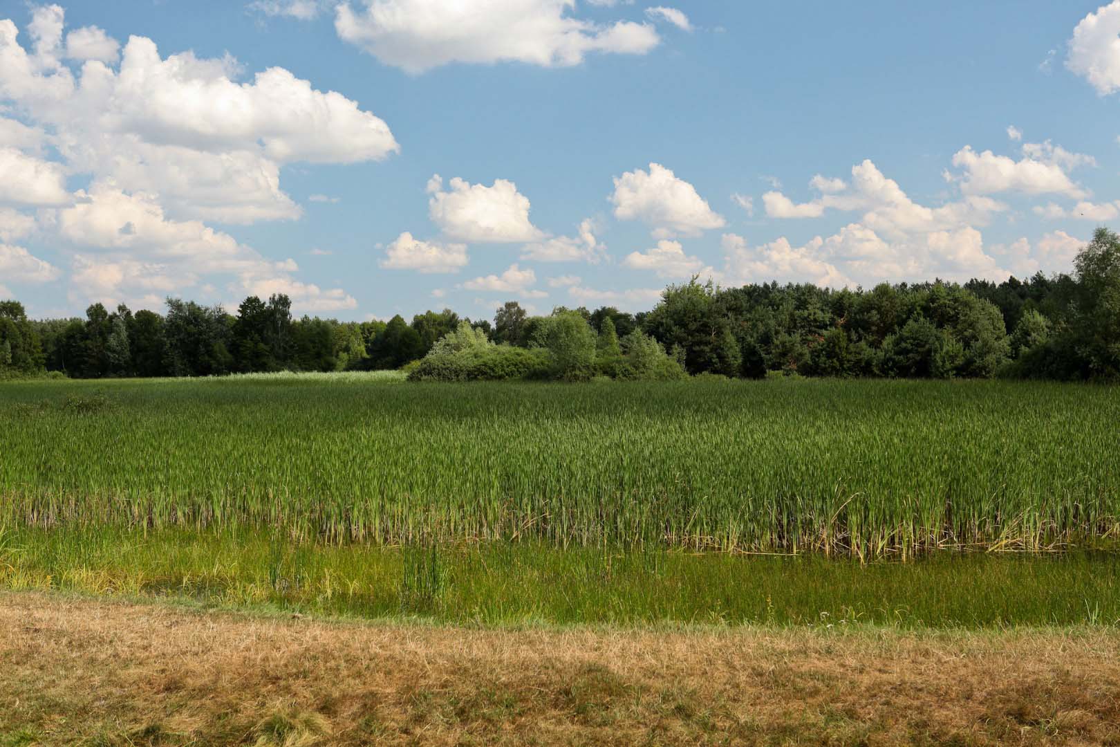
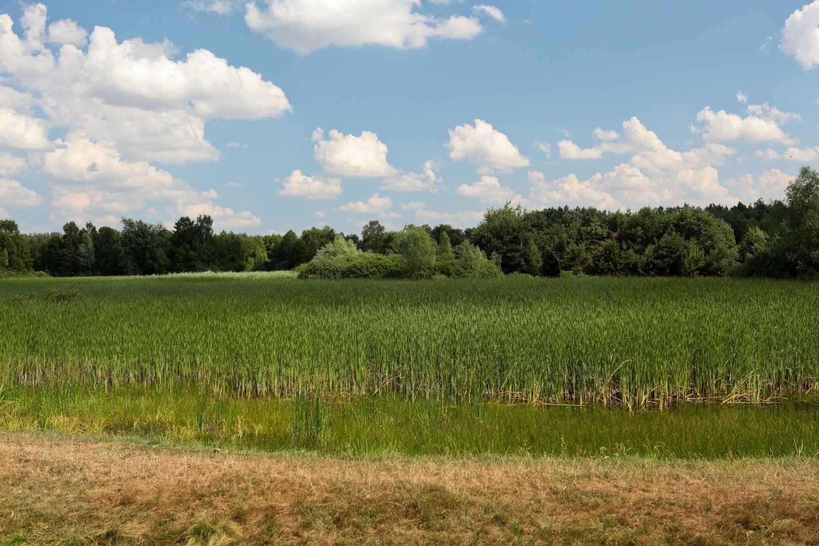
The Lower Wieprz River is one of few areas in the Lublin Region that have preserved its natural and landscape assets. The vast area of the Wieprz oxbow lakes is mostly covered with the Reed Mannagrass, Marsh Callas and Water Pineapples. The water surface is visible only in some places. The oxbow lakes are the habitat of the Kingfishers and Mute Swans, and they are also the preying area of the Black Storks and herons.
The signpost with a map is located beneath a few massive ages-old willow trees. This means that you traversed the entire green trail: from Klementowice until the picturesque bend of one of the wildest rivers of Europe.

The village of Żerdź is famous for weaving traditions. The Regional Chamber of Weaving is located here, while the local “Nasza Wieś” [Our Village] Association cultivates local...
On August 8, 1863, the insurgent squad headed by Michał Heydenreich-Kruk fought a victorious battle with the tsar army. The Poles set up an ambush at the road near Żyrzyn for the postal...
For several hundred years, tanning, fur making and furriery, especially the sheepskin coat making, have been the specific and dominating type of manufacture in Kurów. The village is...
The first archaeologically confirmed traces of the human settlement in the region of the present Klementowice date back to the Paleolithic Age, that is, the early stone age and date from the...
The Church of St. Clement and St. Margaret was erected in the years 1914–27. It is a brick, three-nave church in the neo-Gothic style. The fronton is flanked by two towers. Three wooden...
The Church of SS. Peter and Paul in Żyrzyn is a beautiful neo-Classical building in the shape of rotunda, designed by Christian Piotr Aigner, the court architect of the Czartoryski family....
The Kozi BórForest is the forest and protected landscape area established in 1989. Its area is dominated by the plain landscape: the majority of its area features mixed forests and...
The late Renaissance three-nave church in Kurów was built in three stages. The first founder, Piotr Kurowski, erected the church in 1450. In the mid 16th century the side naves were...
The Lower Wieprz River is one of few areas in the Lublin Region that have preserved its natural and landscape assets. The vast area of the Wieprz oxbow lakes is mostly covered with the Reed...
The mini open-air museum in Wola Osińska was established in 2000 thanks to the passion and initiative of Ms. Maria Rodak, a village resident. The founder of the museum calls it the Chamber of...