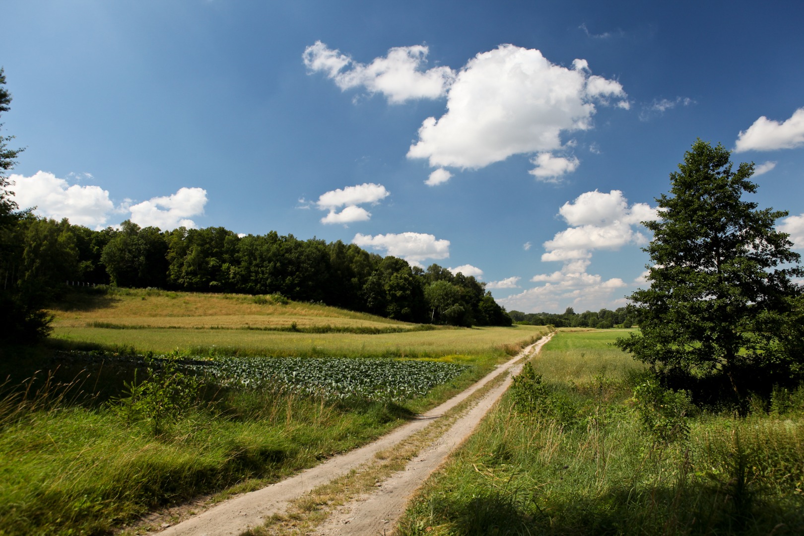
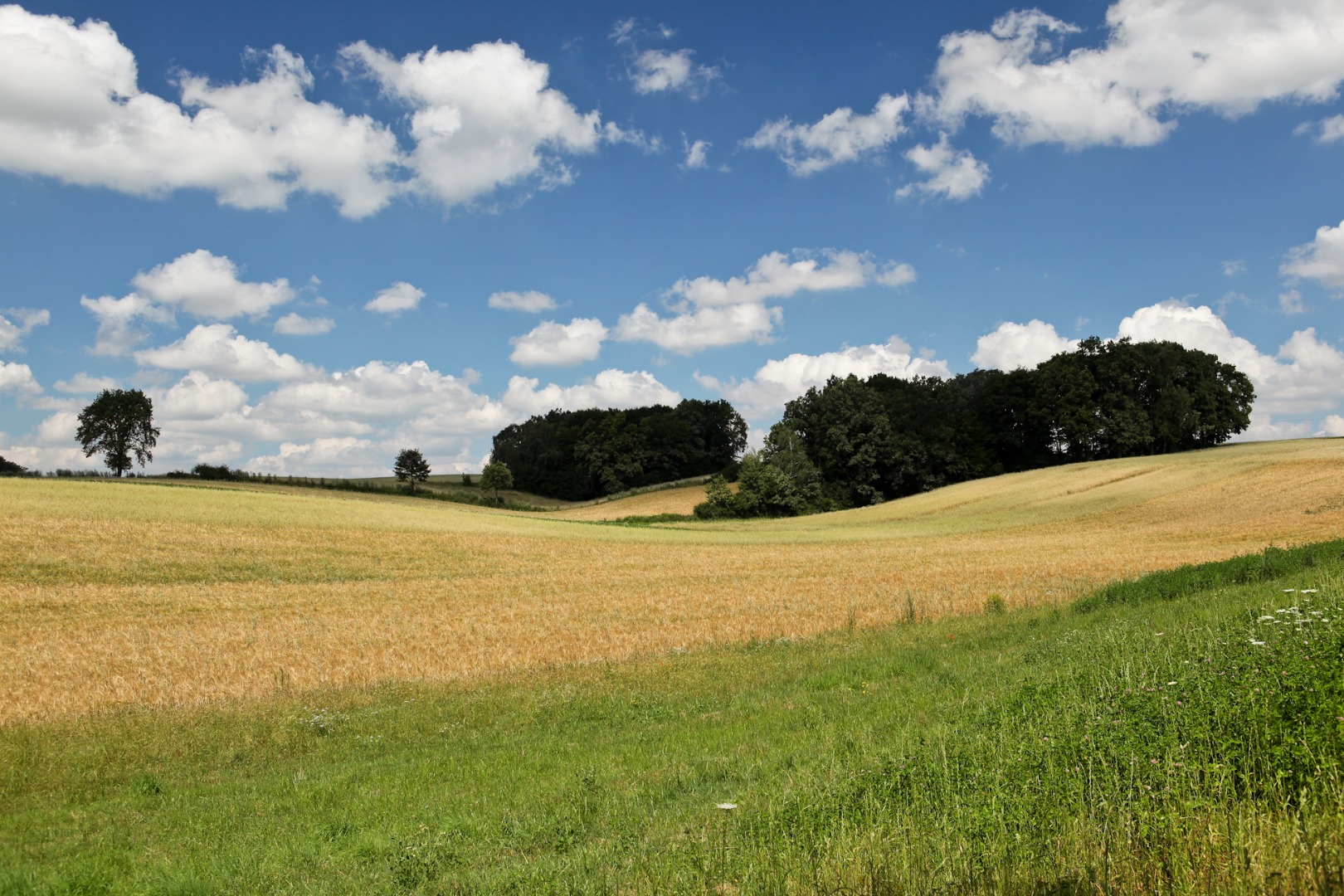
The trail route leads through characteristic elevations and hills of the Nałęczowski Plateau, near Olszowiecki Creek, numerous ponds and meadows and the captivating system of loess ravines.
The trail encompasses sites associated with one of the most outstanding contemporary folk poets, Jan Pocek. You can admire the splendid views he described in his poetry and can have a direct encounter with nature. You will also have an opportunity to see the historical monuments documenting the interesting past of the village of Markuszów and its vicinity.
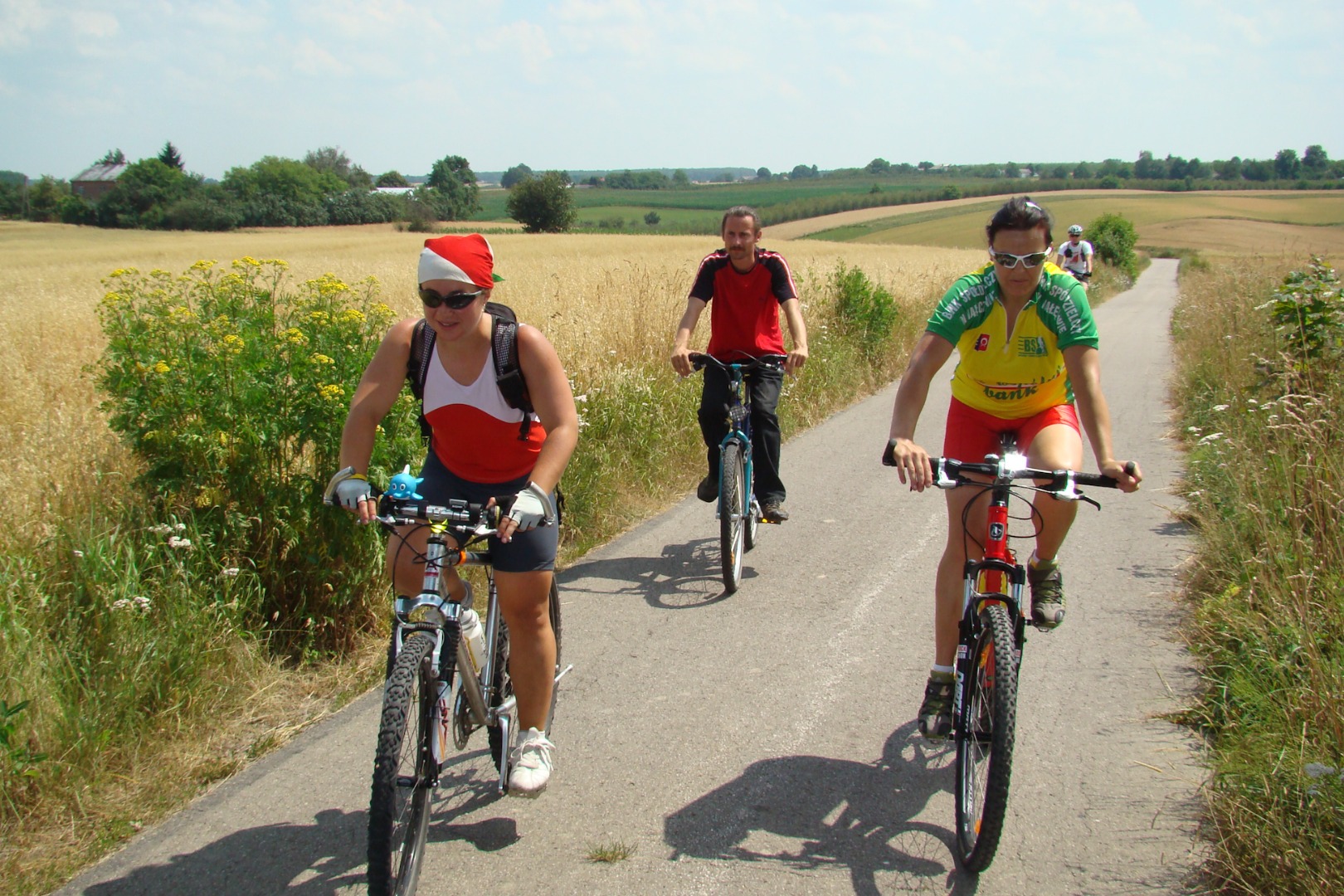
The trail has a form of a loop and runs mostly along asphalt roads with low vehicle traffic volume. From time to time, you may encounter difficulties (after a period of intense rainfall) with passing the unpaved roads in the most picturesque section of the trail (about 1.6 km), which runs through loess ravines in the southern part of the route.
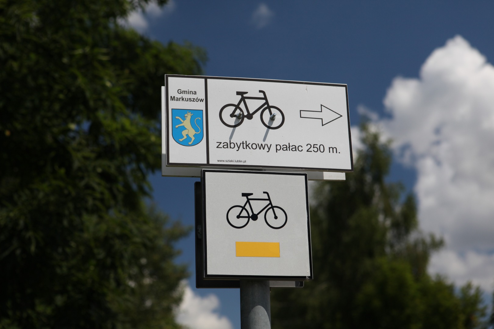
The trail has connections with the green southern trail around Garbów County, and with Nałęczów (through the black connecting trail that is 9.71 long), as well as with the also green trail from Klementowice to Strzyżowice (the connecting trail from Kaleń to Płonki, 2.42 km long, has black markers). It offers a possibility to create several variants of the route along the trails (for instance, to Nałęczów, Garbów, Kurów and Kozłówka).
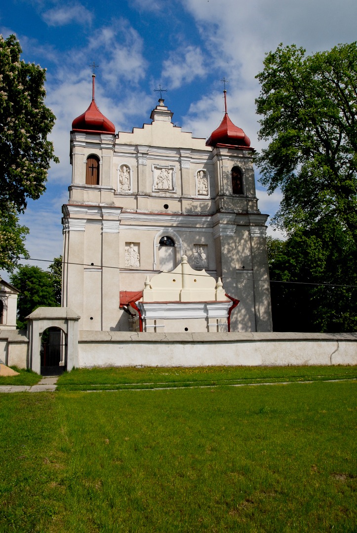
The ride begins at the parish church on the southern side of National Road 17. The information board with the trail map is located near a parking lot, where you can leave the car. From the parking lot you can see the church towering over the vicinity. It is worth stopping for a while to visit this historical building.
The Parish Church Complex of St. Joseph the Betrothed of the Blessed Virgin Mary, St. Michael the Archangel and St. Margaret was erected in the years 1667–82 and founded by Jan and Andrzej Firlej. It was consecrated by Bishop Stanisław Szembek on October 15, 1690. In 1750 a Baroque presbytery was erected at the initiative of Father Józef Zagórski, and a bell tower was built in 1862. The church is a one-nave building with an irregular vestibule, modelled on the churches in the Lublin Baroque style. The chancel features two sacristies (the first one is in the church’s body and the other one is annexed), and the church fronton boasts two towers. Baroque in style from the outside, the church has a Rococo interior. Historical wooden altars featured inside are particularly worthy of attention: the main altar is a Baroque construction with Rococo ornaments and paintings of Madonna of Częstochowa (dating from 1920), the Holy Trinity, and the Holy Family dating from the 18th century. Two Baroque side altars flank the rood beam: the altar on the right features the painting representing the Holy Communion of St. Stanislaus Kostka, and the one on the left – the painting of St. Francis of Assisi. The altar of St. Anthony (Baroque, early 18th century) is located in the nave on the right, and the altar with a figure of the Crucified Jesus Christ (Rococo, 18th century) is located on the left. The organ with six ranks dates from the late 19th century. The church boasts many other interesting historical paintings and tombstone plaques. The noteworthy tombstone of Rafał Amor Count Tarnowski dating from 1803 represents a white, winged Angel of Death.
Among numerous epitaphs gathered in the church, you can see the epitaph of Katarzyna Hryniewiecka, née Stemek – the wife of the last voivode of the Lublin Region before the partitions, Kajetan Hryniewiecki – who died in 1773. Hryniewiecki had a magnificent palace on the island surrounded by ponds in Markuszów. Unfortunately, it has not been preserved until the present day. King Stanisław August Poniatowski himself was a frequent guest here, as was his nephew, Prince Józef Poniatowski. It is interesting to note that the last battle of the Polish-Russian War of 1792 fought in defence of Poland’s May 3rd Constitution, took place near Markuszów on July 26, 1792.
Prince Józef Poniatowski was stationed in the vicinity of Markuszów, when he learnt that King Stanisław August Poniatowski betrayed the country and acceded to the Targowica Confederation. Prince Józef could not believe in the veracity of the news and when the Cossacks, misinformed about the current political affairs, attacked, from the east, the rear guard of the Polish Army located in the vicinity of Markuszów, the Prince took up the fight. Devastated by his relative’s actions [King Stanisław August was his uncle], Prince Józef Poniatowski roused the army loyal to him (12 cavalry squadrons) to fight, leading it himself while displaying a remarkable daring. He was almost killed in the battle; he was saved by a loyal adjutant and a swift horse. If not for this narrow escape, Prince Józef Poniatowski would have died at the Kurówka River, flowing near Markuszów, instead in the waters of the Weisse Elster River. About 20 Poles were killed then, including General Inspector of the Cavalry, General Janusz Stanisław Iliński. Although the battle brought victory for the Poles and the defeated Cossacks had to retreat in the direction of Garbów, it did not change the fact that as a result of King’s betrayal, the entire war against Russia was lost.
It is worthwhile to spend a moment contemplating the rather original fronton of the church. Looking at it from a certain distance from the west, you can see bas-reliefs representing the patron saints of the church in its niches. The Baroque presbytery dating from the 18th century is adjacent to the church.
The presbytery was home to Father Józef Koźmian, the brother of Kajetan Koźmian, the famous Lublin chronicler. Józef Koźmian, a close friend of Grzegorz Piramowicz, was an individual who greatly contributed to propagating reading and education in Markuszów. It was Father Koźmian who introduced the ideas of the May 3rd Constitution to the residents of Markuszów, where he also ran an elementary school and a library.
A bell-tower dating from the second half of the 19th century is located right next to the northern sacristy of the church. The bell inside the tower is contemporary and was founded by Justyna and Marek Zadura. The park adjacent to the church from the north features a historical chapel with the figure of Jesus Christ dating back to 1908 and remembering the stormy times of the Mariavite Church movement, situated among the fine trees that were silent witnesses to the diverse fate of the church,
Before you continue, you can have a look at the information board with the trail map that is located on the square to the south of the church. After proceeding for 50 m, you will see a house on the left, with a mysterious revolving dome. It is a genuine private astronomical observatory.
Mr Sławomir Bogusz, an enthusiastic astronomer-amateur made all the lunettes, telescopes and lenses featured here himself. He is such an outstanding expert in the field that he made mirrors, lenses and telescopes even for the fully professional astronomical observatories. The local and national media, as well as the German RTL television, often presented a portrayal of the astronomer of Markuszów.
After riding for about 140 m, you enter the village of Łany.
The village of Łany was once part of Markuszów. When Markuszów was granted town charter around 1550, the western part of the town, located behind the parish church, was deprived of this honour. The part featuring the manorial form, called Markuszowice-Łany, separated from Markuszów, remained a village. Since the time of King Sobieski, it has functioned as a separate village of Łany.
Riding through the village, you encounter an old wooden building on the right, which is currently under renovation (at 0.41 km). It is the parish church of the Old Catholic Mariavite Church. Noteworthy is the medallion with Our Lady, featured on the northern elevation of the church. Nowadays, the church is practically no longer in use, but previously it had a very large number of the faithful.
The history of the Mariavite Church goes back to the early 20th century. A new curate, Father Piotr Goliński, arrived in Markuszów. He was very pious and he propagated the cult of the Blessed Virgin Mary and the Holy Eucharist, and said the masses in Polish. He was so modest that he walked barefoot even in the wintertime. He soon became very popular among the majority of the Markuszów parishioners. It turned out after some time that he belonged to the Mariavite Movement that was officially condemned by the pope and in consequence, by the entire Catholic Church. The Markuszów curate harshly criticized the Catholic Church hierarchy, and believed the priests’ celibacy should be abolished. Despite a personal appeal from the Bishop of Lublin, Franciszek Jezierski, to cease the propagation of Mariavitism, Goliński did not discard his beliefs and was eventually expelled from the Catholic Church. The excommunicated priest used his popularity to spread the Mariavite movement. Thanks to the donations given by the faithful who continued to support him, he built a modest wooden church in Łany. The history of the Old Catholic Mariavite Church was very stormy, as there were many conflicts with the Catholics. In the course of time, the number of Mariavite Catholics systematically diminished and at present, the Mariavite Parish is practically non-existent.
A small Mariavite cemetery is located behind the church near National Road 17.
You continue the ride, passing by the modern Folk House in Łany on the left (at 1.27 km). You reach Kaleń (at 1.9 km), and if you are travelling in the summer, you can admire hollyhocks in blossom on the right near the slope. The former house of the distinguished poet, Jan Pocek, is located nearby on the left (at 1.94 km). 100 m later you see the local Fire Department Station and the Folk House in Kaleń (at 2 km). It houses the office of the Active Women of Markuszów County Association, which is famous for fantastic traditional regional dishes and delicious Kaleń bread. It is worth visiting the place during the “From Grain to Bread: In the Land of Jan Pocek” Festival. Information about the event’s date and programme is available at Markuszów County website (www.markuszow.pl). The pole in front of the Folk House features an information board with a short biography of Jan Pocek. A rest area and the square where the annual June festival dedicated to the poet takes place, are located behind the Folk House.
After a short break, you continue the ride. You reach the bend, where a roadside shrine is located (at 2.16 km). If you have more time, you can turn right and after about 200 m you will see the captivating ravines and picturesque gorges. If you don’t have much time, you turn left at once and reach the small bridge on the Kurówka River (at 2.25 km). An old watermill, property of the Nowaczyk family, is located on the right (at 2.31 km).
The mill has operated on this site since the 17th century. It was rebuilt several times. At present, it is electrically powered, but initially, it was powered by a water wheel fed by the water from the creek flowing nearby. It is the only mill in the region that has operated incessantly for over 400 years. During the last renovation, the 17th-century bricks were discovered in the walls. King John Sobieski mentioned the “Kaleń mill” in the town charter for Markuszów from 1686; the mill was obliged to pay the King the fee of 2 groszes.
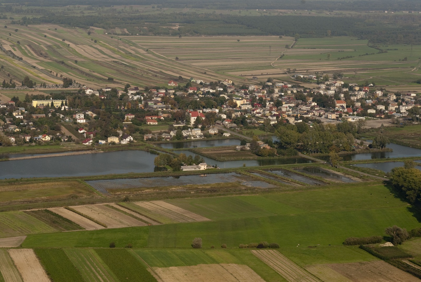
As of 2014 you will be able to admire a beautifully located reservoir on the left (with area of ca. 13 ha). The reservoir, initially planned as a storage reservoir, will also serve recreation and tourism purposes. You pass by a small bridge and continue the ride. You reach a trail junction (at 2.63 km), where the yellow trail is joined by the green trail from Klementowice to Strzyżowice (the connecting trail from Kaleń to Płonki, 2.42 km long, has black markers). You leave Kaleń (at 2.69 km) and enter the village of Olszowiec (at 3.11 km), crossing at the same time the hiking blue trail coming from the left that runs along the former route of the narrow-gauge railroad.
The narrow-gauge railway (750 mm track gauge, steam traction) was used as a local, auxiliary transportation that carried products and people. The first section of the railroad was established between the Garbów Sugar-Refinery and the Wąwolnica Railway Station (as of 1925 called Nałęczów) and was 12 km long. In the mid 1920s the sections toward Bogucin and Kurów were built. The section connecting the sugar-refinery with Bogucin had another three sections added to it, leading to: the sand mine near the village of Marynka, to the distillery and the mill in Garbów, and the offshoot toward the vicinity of the village of Leśce. Since 1916 another narrow-gauge railway with the same gauge track reached the Wąwolnica Station, the present Nadwiślańska Narrow-Gauge Railway. However, because the two narrow-gauge railroads were located on the opposite sides of the Nadwiślańska Railway line and were not permanently connected, the rolling stock exchange was carried out with the help of jetties temporarily placed across the normal track. Unfortunately, the railway network of the Garbów Sugar-Refinery was liquidated in the 1970s. Nowadays, there are still many traces of the narrow-gauge railway visible in many places, mostly embankments and excavations. One of the best-preserved fragments is the embankment along Route 17 between Markuszów and Zagrody. At the same route in Bogucin, you can see the former railway station (at present, an inn) with the loading ramp. A remnant of the former loading ramp is also located in the vicinity of the Palace in Bronice. The railroad switch to the villages of Nałęczów and Józefów (near Kurów) was located in Olszowiec, where an operator’s booth was placed. The operator had a phone connection between the Nałęczów Station and the sugar-refinery, and it was his responsibility that the trains pass each other by safely, avoiding collision. The nearby Olszowiecki Creek, formerly running parallel to the railway tracks, facilitated pumping water into steam locomotive’s water tanks.
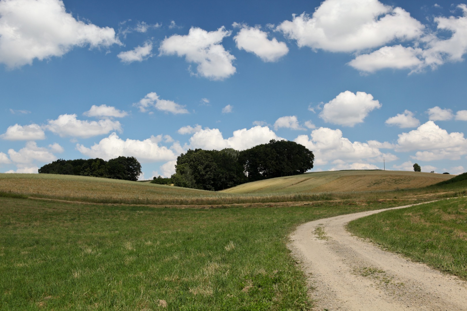
Numerous hills and elevations picturesquely composed into the landscape of Olszowiec fields and meadows form a splendid view for the eyes tired with civilization. The southern part of Markuszów County, situated on the Nałęczowski Plateau, features a very diverse shape of terrain with its unique system of ravines, which are the remainder of the Riss glaciation (Wolstonian Stage). You pass by a hop field on the right (at 3.77 km), and a moment later a splendid view unfolds on the left over the meadows, and the hills, gorges and hillocks located behind them (at 4.08 km). The captivating landscape and the fresh air encourage you to stop for a moment and take in the splendid views. You now begin to understand why the poet of Kaleń loved this land so much.
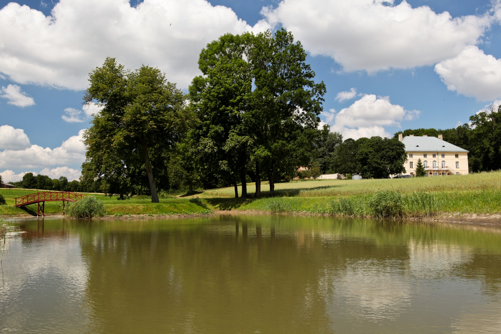
You pass by an exit road toward Zabłocie on the left (at 4.27 km). If you wish, you can follow the exit until you reach the small bridge on Olszowiecki Creek, located several hundred metres away from the trail. Otherwise, you continue riding along the yellow trail and leave Olszowiec. Before the ride uphill, you can see a road on the left (at 4.74 km) with a very old wooden cross 120 m down the road, placed at the crossroads by the residents of Bronice. Once, a patriarchal cross was located several hundred metres further away, erected during the plague. According to legend, when the cross was placed here, the plague ended and people stopped dying. The patriarchal cross has not been preserved, but after the end of the plague, another cross was erected at the crossroads, which still stands there over 100 years later. You continue the ride and soon, you see among the trees on the left the Palace in Bronice (at 4.96 km). You remain on the trail and a moment later you are in Bronice-Kolonia (at 5.39 km). You pass by a drying pond on the right and proceed uphill. On the top of the elevation you turn (in the direction indicated by the signpost) toward the historical Palace in Bronice (at 5.75 km). You ride on the slab road until the building.
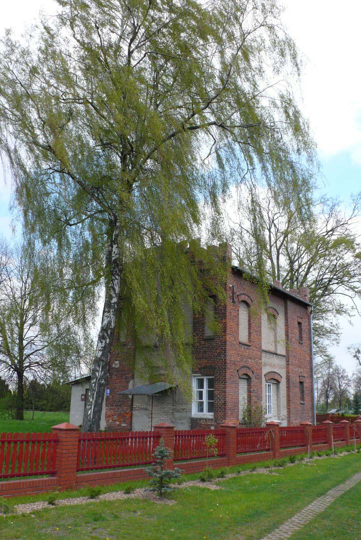
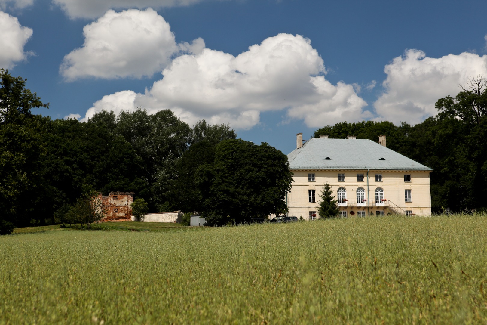
The Palace was built by Piotr Aigner, the architect of the Czartoryski Palace in Puławy. He descended from the Wołk-Łaniewski family. The Łaniewski family’s seal bore the Korczak Coat of Arms. The second part of the family name was added to it in the following manner: Jakub Łaniewski, Rittmeister in the Hungarian army was wounded in one of the battles and was recovering at the house of Teodor Wołek of the Trąba Coat of Arms. The host’s daughter looked after him with such great care that having quickly recovered, he married the caring maiden. This is how the two families were joined and the couple’s offspring used the name Wołk-Łaniewski.
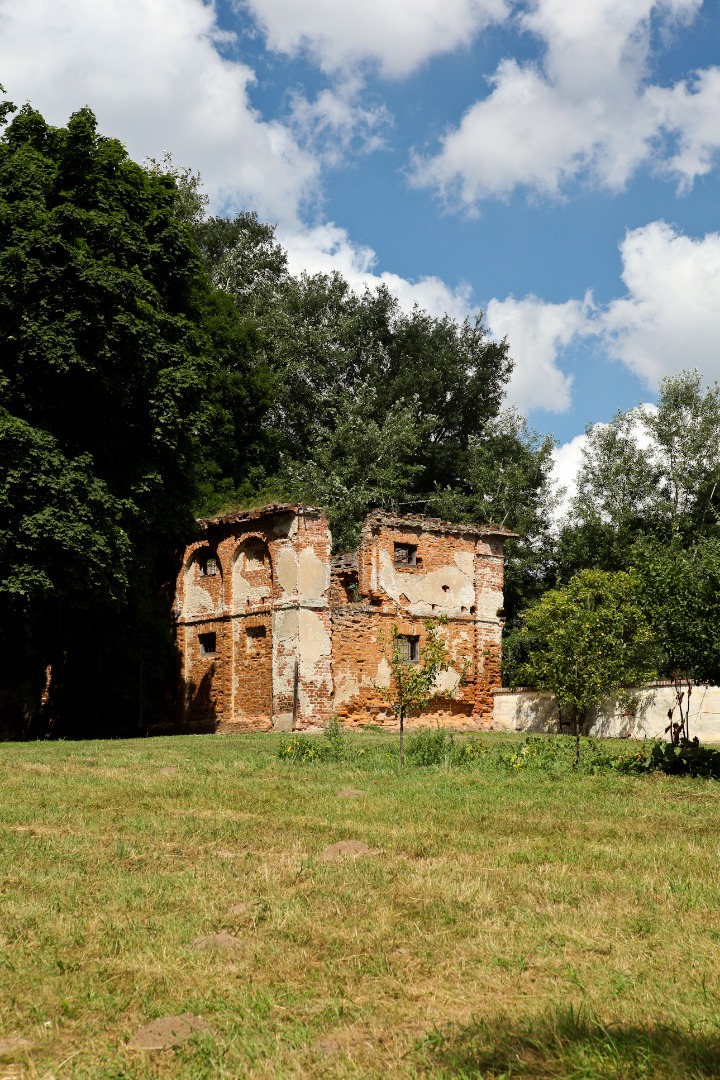
The preserved remnants of the storage building adjacent to the former 16th-century manor are located behind the palace.
The ruins of the storage building are about 500 years old. The palace is surrounded by a historical park, featuring many trees recognized as monuments of nature. One of the more interesting specimens is the Catalpa Tree originally from South America. It is a large, beautifully blossoming tree with impressively long, dark seedpods. It grows in the centre of the park on the northern side of the palace. Until the Second World War, the magnificent residential building was accompanied by a large number of farm buildings, auxiliary buildings, large stables, and other manorial buildings. The entrance gate featured the statues of two lions, while a large water tower, supplying the palace and farm buildings with running water, was built nearby. The Wołk-Łaniewski owned an impressive collection of chaises and carriages and they also ran their own horse-breeding farm. After the war the estate began deteriorating; in fact, communist authorities encouraged the destruction of the palace. A person who died during the removing the ceiling beams in the palace is buried in the Markuszów cemetery. At present, the palace interior has been renovated and the palace is owned by the Hieronim Łopaciński Voivodeship Public Library in Lublin. The library houses collections of old books, and serves as a venue for training events, seminars and conventions.
You continue the ride along the yellow trail. You return to the route and turn left in the direction of the village of Piotrowice (at 6.25 km). You go downhill from a large hill and ascend another hill. On the top of the elevation you turn left before the Fire Department Station (at 7.23 km). This is where the yellow trail is joined by the black trail leading to Nałęczów (at 9.71 km; Bronice – Drzewce – Choszczów-Kolonia – Nałęczów). After a while you reach a historical cross and a roadside shrine facing it (at 7.7 km). It is worth stopping here for a moment in order to read a barely readable inscription on the cross. It is a true mystery how the inscription referring to the soldiers from Piłsudski’s Polish Legions and the “Rifleman” organization has survived the rule of People’s Republic authorities on this site...
A splendid apiary of Mr. Michalewski is located near the cross and hidden behind the fence. The honey produced in the apiary can be also purchased at the market in Markuszów. The agrotourist farm of the Pawłowski family is located nearby, several metres straight on downhill behind the apiary on the right, and if you ride on for another several hundred metres, you will see the hospitable farmstead of the Miksza family who are local regionalists, meticulously cultivating the local history and traditions.
Continuing the ride, you turn right at the cross (at 7.7 km) and follow the yellow trail markers. You make the first – (at 7.86 km) and the second (at 8.31 km) turn to the right, and finally, you reach the slightly tilted roadside shrine with the figure of Jesus Christ, standing at the fork road under the large lime tree (at 8.52 km). Franciszek Olender founded the shrine in 1973 toward the end of his life and placed it near his estate. A field path running downhill is located behind the shrine.
You turn left behind the shrine (at 8.52 km). You pass by several buildings, and you can see the cellular phone mast in the distance on the left (at 9.12 km). You will soon ride near the mast and reach the place, where the asphalt road turns right. But you head left onto the field road (at 9.37 km). A close encounter with nature awaits you. Riding on the road meandering among the fields, you gradually descend lower and lower. You pass by a cherry orchard on the right (at 9.6 km) and soon, you enter the gorge hollowed out by erosion. It takes nature several hundred years to create such a place; it is a slow and continuously proceeding process. This very region, stretching from the vicinity of Nałęczów to Kazimierz Dolny, boasts the largest and richest system of loess ravines in Poland. It is admirable how shrubs and trees desperately cling to the edges of the ravine. Both thick and very thin roots of the trees are exposed in many places: they hang downwards or stubbornly claw into the ground. Someone placed a cross at the exit of the gorge. A few solitary buildings are located on the hill on the left. Having left the ravine, you ride along the edge of the meadow adjacent to the forest. Continuing straight on all the time, you reach the tree that features a signpost pointing out the direction of your remaining ride (at 10.25 km).
If you have the time, and you look for extreme experiences, and also wish to explore the vicinity, you can turn left at the tree with the trail marker, leave the trail and venture into the forest visible in the distance. Riding on the meadows and along the animal paths, you reach the foot of the forest located on the hill slope. On the right you can see hills covered with natural wild meadows adorned with flowers. It is a very difficult and swampy but absolutely gorgeous terrain. You can hear the song of many forest birds, and even see the birds of prey nesting in the vicinity. People rarely venture into this area and therefore, the vicinity is a mainstay of wild nature. You can return to the trail along the same way, or turn in the forest. En route you will pass by an anthill and a field road emerging from among the trees halfway through the forest – you can follow the field road for a while and come out of the forest in order to view the vicinity. On the right in the distance you can see forested hills with numerous ravines, and on the left you can see a belt of trees stretching high. The local residents call this forest “Doły [Holes]” because it features a large number of deep gorges. A prehistoric settlement was once located on the top of the hill next to the forest belt. It boasts a splendid view of the entire vicinity. You can also see from your current position that the forest, which you have just left, is cut off evenly, as if it was cut along the ruler. Why is that so? You need to reach into the past in order to find out.
After the January Uprising of 1863 and the enfranchisement of the serfs, part of the forest that belonged to the Wołk-Łaniewski family, the Bronice heirs, was granted to the serfs in the vicinity. It was exactly the same tract of the forest through which you have just ridden, which in fact is called the peasants’ forest until the present day. And it is still divided between the local residents living in the vicinity. The remaining larger part of the forest that belonged to the Wołk-Łaniewski family was leased for a period of time to a certain Jew. The lease did not specify what the leaseholder can or cannot do with the forest. The enterprising leaseholder erected a large sawmill at the edge of the forest near the road, which at present separates the counties of Markuszów and Nałęczów. In a very short period of time, he cut down all the trees and processed them into boards. The heir’s protests were in vain and everything happened in the majesty of law. The Jew made a great business out of it, while Wołk-Łaniewski only lost on this unreasonable contract. In addition, the heir of Bronice had to later pay for the workers who grubbed out the remaining stumps, used for heating up the manorial buildings. Thanks to the tsar’s enfranchisement decree, the remainder of the forest, which was now the property of the peasants in the vicinity, was spared from grubbing.
You return to the peasant’s forest and continue riding uphill. When you emerge out of the trees, you continuously head straight on riding on the concrete slab road, until you return to the trail, to the roadside shrine founded by Franciszek Olender.
If you didn’t look for extreme experiences and simply continued the ride along the yellow trail, having passed by a meadow adjacent to the forest, and the tree with the trail marker, you arrive at a very small stream meandering among the grass. From time to time, it can become much larger, after periods of intense rainfall or thaw. The local residents call the stream Jadwiga, since an old legend is associated with it.
Once upon a time, a shepherdess called Jadwiga watched the oxen belonging to the Markuszów heir. The animals were grazing on the neighbouring meadows, which were abundant in lush grass. However, after many days of intense rainfall, the entire area was pretty boggy and the oxen were sinking into the soft soil. In order to water the satiated animals, the shepherdess drove the oxen toward the creek. The oxen began drinking water, and looking for fresh grass, they moved toward the nearby quagmire. The heavy animals started sinking in the boggy mud. First, they submerged themselves up to their bellies and then deeper and deeper, until you could only see their heads. The more they were trying to get out, the deeper they sank. The shepherdess attempted to rescue the animals, and tried to pull them out in many ways, but she wasn’t able to do anything on her own. When she held the terrified animals’ heads up and pulled them with all her strength, one of the struggling animals pressed her with its body, so that she herself was unable to get out of the mud. In vain, she called for help, as no one was nearby. After some time, the swamp swallowed both the girl and the animals, and the local residents pass down this tragic story as a warning from generation to generation.
Jadwiga Stream flows into the Kurówka River, which you passed by earlier on. Behind the stream, you enter another shallower ravine (at 10.27 km). Now the road runs uphill. Blackthorn grows on the top of the ravine, and if you look around carefully, you can see bracket fungi or stumps with fantastically twisted roots. You continue on the field road behind the ravine (at 10.48 km). A splendid view of the peasants’ forest and the forested hills opens up on the left. Before you enter the third ravine (at 10.62 km), you can see an apple orchard on the right, and a chokeberry plantation on the left. When the ravine ends, you reach the asphalt road (at 10.97 km) and turn right.
You are now in the village of Góry. Several hundred metres later you pass by the intersection (at 11.28 km) and you can see several horses on the nearby estate on the left. You pass by the cellular phone mast located on the highest point in the area (at 11.62 km), from which a splendid view unfolds over the villages of Markuszów, Kurów and Garbów. Several hundred metres later you cross Route 826 leading to Nałęczów (at 11.86 km) and continue the ride through Góry and Góry-Kolonia.
First, you turn left (at 12.11 km), pass by several farms, and then by numerous orchards, while going slightly uphill. You turn right (at 13.5 km) and about 200 m later you turn left at the cross. Then, you ride straight on, admiring the impressive views unfolding on the left over the hills and “fields bulging with hills,” as Jan Pocek wrote. You can see the Chapel in Gutanów in the distance on the right (at 13.88 km). You go downhill along the orchard, until you make a left turn (at 14.55 km). This is where the yellow trail joins the green trail. Both trails are bound with the poets who lived and wrote in this region. This land was the subject of their local patriotism. A close friend of Jan Pocek, Bronisław Pietrak, poet, blacksmith artist, and also author of beautiful paper cutting works, lived within the borders of Garbów County.
Having reached the main road, you turn left, pass by a roadside shrine on the right, and the signpost with the bicycle trail map (at 14.61 km). On the same side of the road, you can see the water towers located within the former Garbów sugar-refinery (at 14.89 km). You cross Route 826 toward Nałęczów again (at 15.14 km) and stop a moment later. The site of a historical battle from the January Uprising of 1863 is located behind the intersection on the left. The Poles fought against the several times larger Russian army.
In the winter of 1863, the insurgents, pursued all the way from Krężnica, searched for supplies, since they needed warm clothing, shoes and food. When the Russian units stationed in the vicinity found out about the uprising unit present in their section, they sent all their forces to liquidate the insurgents. Well equipped, armed to the teeth, and a few times larger, several Russian squads were literally treading on the Poles’ heels. The insurgents marched incessantly, trying to detach from the enemy. On December 19, 1863, they quickly marched through Wąwolnica and reached the village of Góry, where the overwhelming Russian forces caught up with them and attacked them. At the edge of Góry, your current location, the combined units of Majors Leniecki, Marecki and Gozdawa fought a battle against the terrifying Russian forces. Despite the enormous disproportion in the forces, the insurgents managed not to get dispersed and for several hours successfully beat off the attacks of the Russian hussars and dragons. However, faced with the threat of encirclement by the Russians, the insurgents fought their way through the enemy’s forces through the village of Przybysławice toward Wola Przybysławska. The detailed description of the battle is available under the history tab at the website www.markuszow.pl. Amateur historians with metal detectors found tsar soldiers buttons and rifle bullets on the battle site.
You continue straight on. A cluster of very high poplars of identical height is visible on the right on the horizon line (at 15.29 km). This is where the so-called New Jewish Cemetery, established in the early 19th century, is located. It is administered by the Jewish Community of Warsaw. At present, the cemetery is unfortunately in a state of neglect, but a few tombstones (matsevot) of high artistic value, have been preserved.
You pass by Góry and reach the village of Zabłocie (at 16.3 km), passing by the bicycle sculpture located on the right (at 16.37 km). A bicycle-friendly place is located here, next to the “Nature Treasures” Chamber of Local Products.
Using old, entirely natural methods, this unique oil mill cold presses oil from the plants grown on the farm, such as blue flax, dwarf golden flax, big seed false flax, canola, white mustard, buckwheat, grain, and many others. The oil mill also serves an educational-instructional purpose. Here you can see with your very own eyes how the real healthy oil is pressed, made without any chemical treatment like in the times of our grandmothers. “From the Seed to the Oil Drop” is a unique authorial educational programme for children, youth and adults, which presents the oil pressing process from the seed sowing to the final product. The programme participants become familiar with oleaginous plants grown on the Lublin Upland, the devices and equipment used for the seed processing, as well as superstitions, customs and rituals associated with the plant cultivation. The programme is combined with a multimedia presentation and the demonstration of selected tools and items of the equipment. At the end, a demonstration of oil pressing from a selected plant is given, and is followed up by fresh oil tasting. The Discoverers’ Expedition, “Out of Love for Nature,” was prepared for the quest lovers. More information is available at the website www.skarbynatury.eu.
Continuing the ride, it is worth noting the Folk House located on the right (at 16.69 km).
The Folk House, erected in 1907 by the residents of Zabłocie and Góry, was previously located on the site of the current building, opened for use a few years ago. It used to house a library, consumers’ cooperative, and the first in the vicinity, milk cooperative. Local residents learnt how to read and write here. Regular patrons of the place included Stefan Żeromski, as well as Bolesław Prus and social workers and educators of great merit who contributed to the region’s development, such as Kazimierz Dulęba, Stefania Sempołowska, Wanda Wejcherówna and Irena Kosmowska. In other words, the Folk House in Zabłocie was full of activists willing to propagate education. What is more, they were greatly respected by the local residents. Naturally, the list of visitors also includes Jan Pocek who was born and raised in Zabłocie. The visits and lectures of eminent guests must have had an impact of the development of the later glorifier of the region.
Proceeding along the trail retracing the poet, you turn right (at 16.9 km) and after several dozen metres you will see the parish church in Markuszów, near which you began the ride. You pass by a school farm on the left you, and a splendid view opens ahead of you over the village of Markuszów surrounded by meadows (at 17.28 km). You ride near the ponds (at 17.85 km) famous for delicious fish (you can turn left and buy fresh fish directly from the farmers). The closer you are to Markuszów, the more likely it is that you will feel the delightful smell of freshly baked bread, emanating from the bakery that diffuses the appetizing scent around the entire village in the evening. You turn left (at 18.14 km) and arrive at the parish church, where your ride comes to an end.
If it is not too late, and you still have the time and strength to continue sightseeing, you can visit the above-mentioned Jewish Cemetery located on the southeast outskirts of Markuszów. The cluster of very high poplars growing on the cemetery, visible from afar, will help you located the place.
The small Church of the Holy Spirit, erected in the unique style of Lublin Renaissance, located at the intersection of Chopina and Lubelska Streets is also worth seeing.
The small church was founded by Jan Firlej and Gertruda née Opalińska Firlej in the years 1608–09; (the Protestant Firlej family converted back to Catholicism and as neophytes, they founded a church together with a shelter for the poor and elderly). The church was built by famous Lublin architect of Italian origin, Piotr Durie. For several years, he was also a Markuszów resident, as he purchased a magnificent house with a manorial farm and a garden, located at Zamkowa Street at the corner of the parish church near the pond, from Marcin Zając, and Wojciech Kapusta and Mikołaj Gil were his neighbours. He then moved to Lublin where he died in 1623 during the plague epidemic. Adjacent to the church are the bell tower dating from the early 17th century and the fence and a roadside shrine featuring the Lewart Coat of Arms of the Firlej family dating from 1609.
An obelisk, founded in 1925 on the anniversary of Poland’s regaining independence by the Bronice heir and the residents of Markuszów, is located behind the church on the southeast side.
The centre of Markuszów features the 1983 statue of Jan Pocek, sculpted by Jarosław Furgała and located on the square at Lubelska Street. A bicycle-friendly place with a first-aid kit is also located here.
You can find the tomb of Jan Pocek, designed by excellent sculptor Marian Świst on the parish cemetery. The necropolis is located at the road leading to Bobowiska, north of Markuszów. The image of the poet with an open book featuring his name, dates of birth and death, sculpted in a several-hundred-year-old oak, commemorates the memory and the site of eternal rest of the outstanding poet of Kaleń.
While in Markuszów, it is worth trying to solve the “Markuszów of King Sobieski” Quest. One of the first games of this type in the Lublin Region presents many mysteries of this small town, boasting an unusually colourful history, in a very interesting way. You can download the quest questionnaire from the village’s website www.markuszow.pl or get a copy at the County Culture Centre (ul. Marka Sobieskiego 1), where you can also get a stamp to your passport of the Bicycle Land at the Amber Trail Greenways.

A splendid apiary of Mr. Michalewski is located near the cross and hidden behind the fence. The honey produced in the apiary can be also purchased at the market in Markuszów. The...
The Folk House,erected in 1907 by the residents of Zabłocie and Góry, was previously located on the site of the current building, opened for use a few years ago. It used to house a...
The Parish Church Complex of St. Joseph the Betrothed of the Blessed Virgin Mary, St. Michael the Archangel and St. Margaret was erected in the years 1667–82 and founded by Jan and...
Once upon a time, a shepherdess called Jadwiga watched the oxen belonging to the Markuszów heir. The animals were grazing on the neighbouring meadows, which were abundant in...
The small church was founded by Jan Firlej and Gertruda née Opalińska Firlej in the years 1608–09; (the Protestant Firlej family converted back to Catholicism and as neophytes,...
Prince Józef Poniatowski was stationed in the vicinity of Markuszów, when he learnt that King Stanisław August Poniatowski betrayed the country and acceded to the Targowica...
The history of the Mariavite Church goes back to the early 20th century. A new curate, Father Piotr Goliński, arrived in Markuszów. He was very pious and he propagated the cult of the Blessed...
The narrow-gauge railway (750 mm track gauge, steam traction) was used as a local, auxiliary transportation that carried products and people. The first section of the railroad was established...
The Markuszów necropolis features the tombstone of Jan Pocek made by distinguished artist Marian Świst. The image of the poet with an open book featuring his name, dates of birth and...
Using old, entirely natural methods, this unique oil mill cold presses oil from the plants grown on the farm, such as blue flax, dwarf golden flax, big seed false flax, canola, white mustard,...