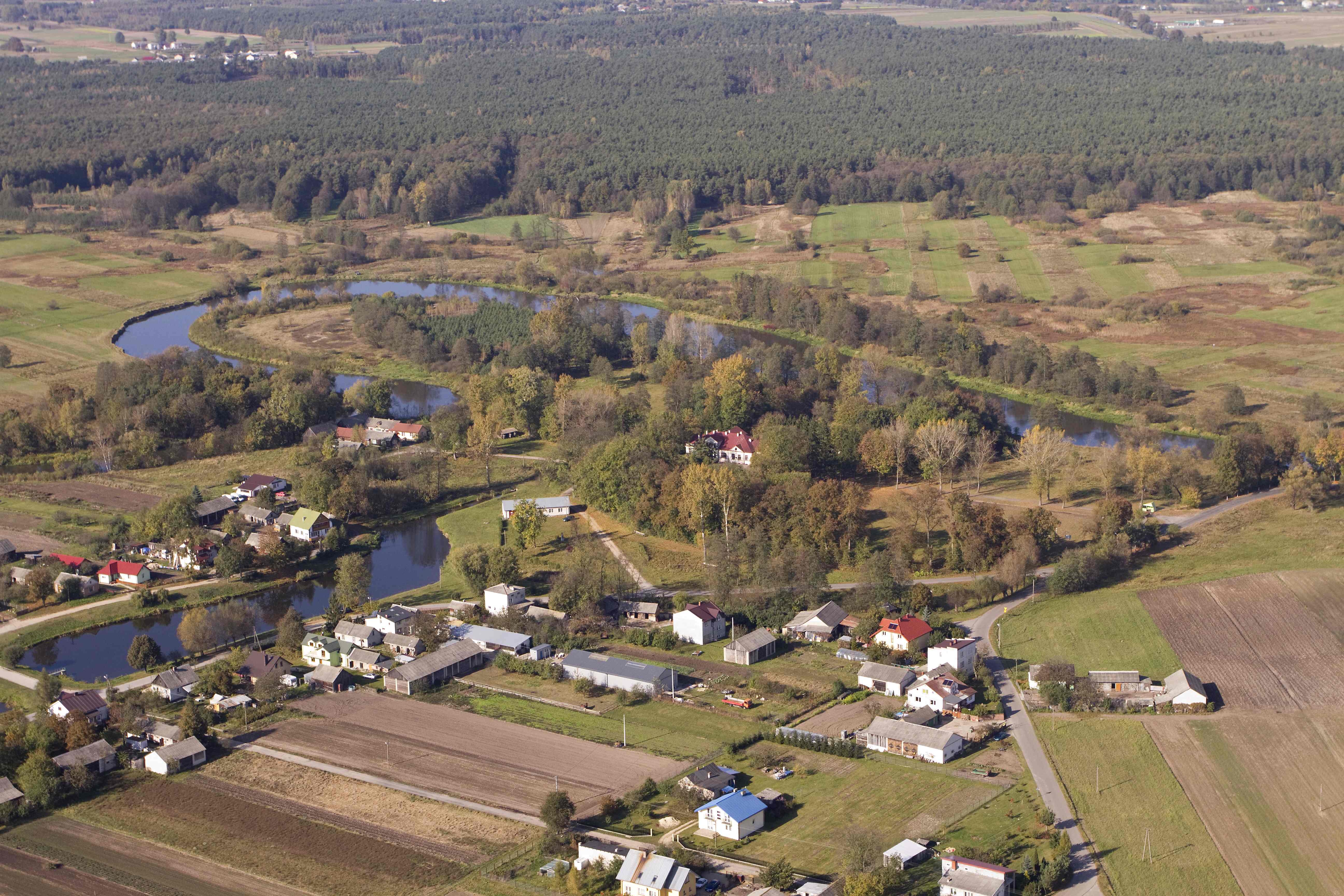
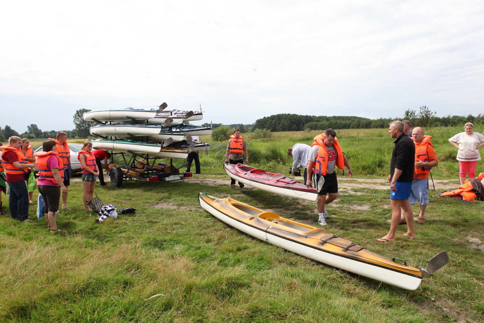
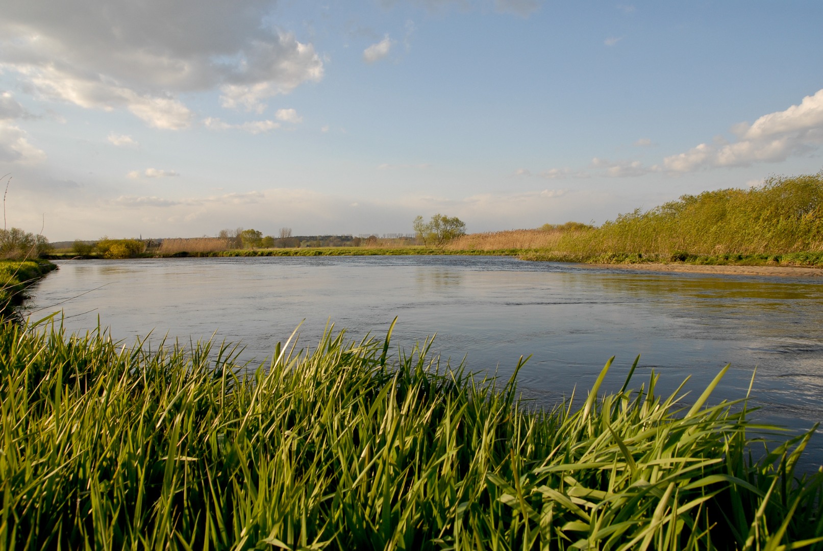
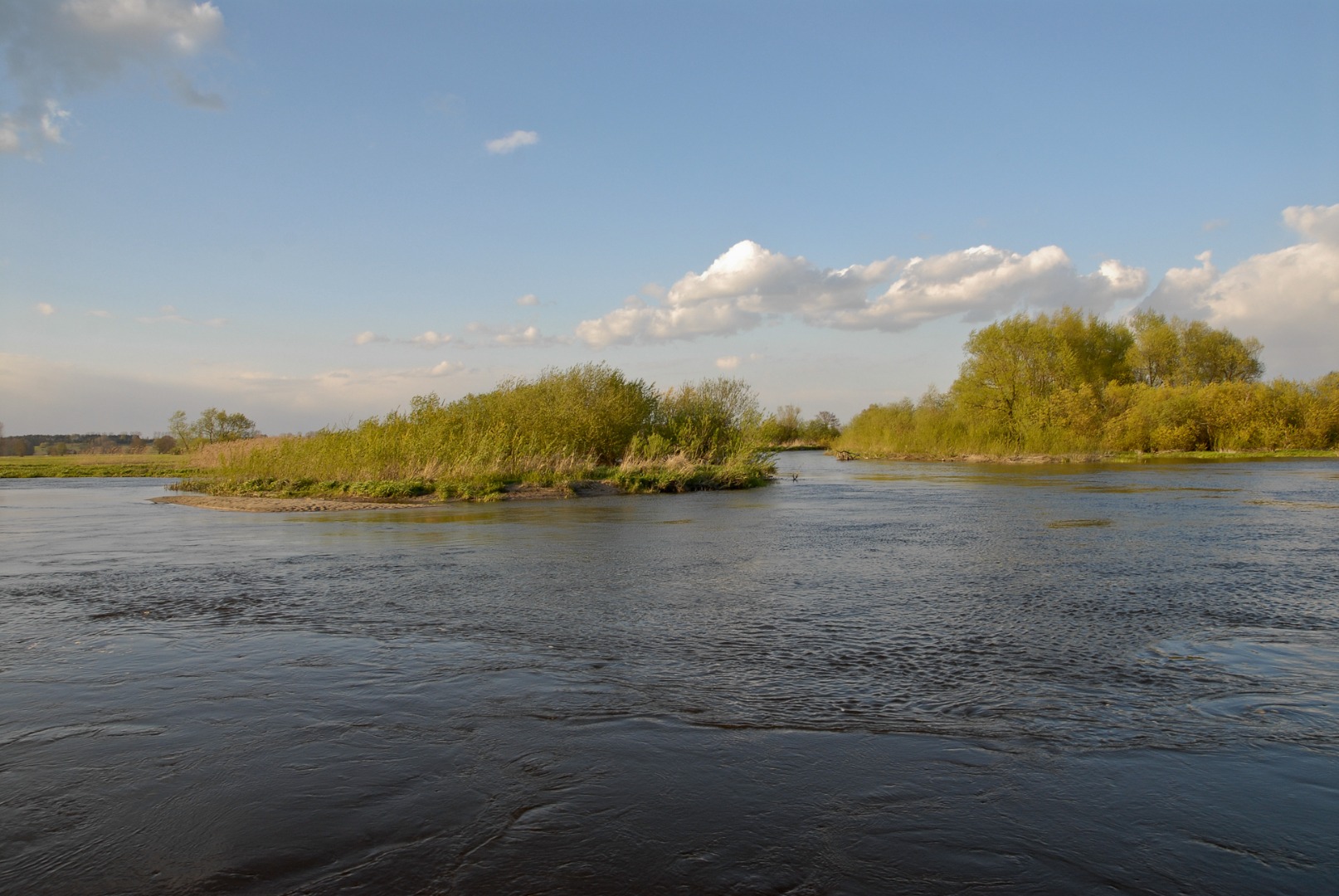
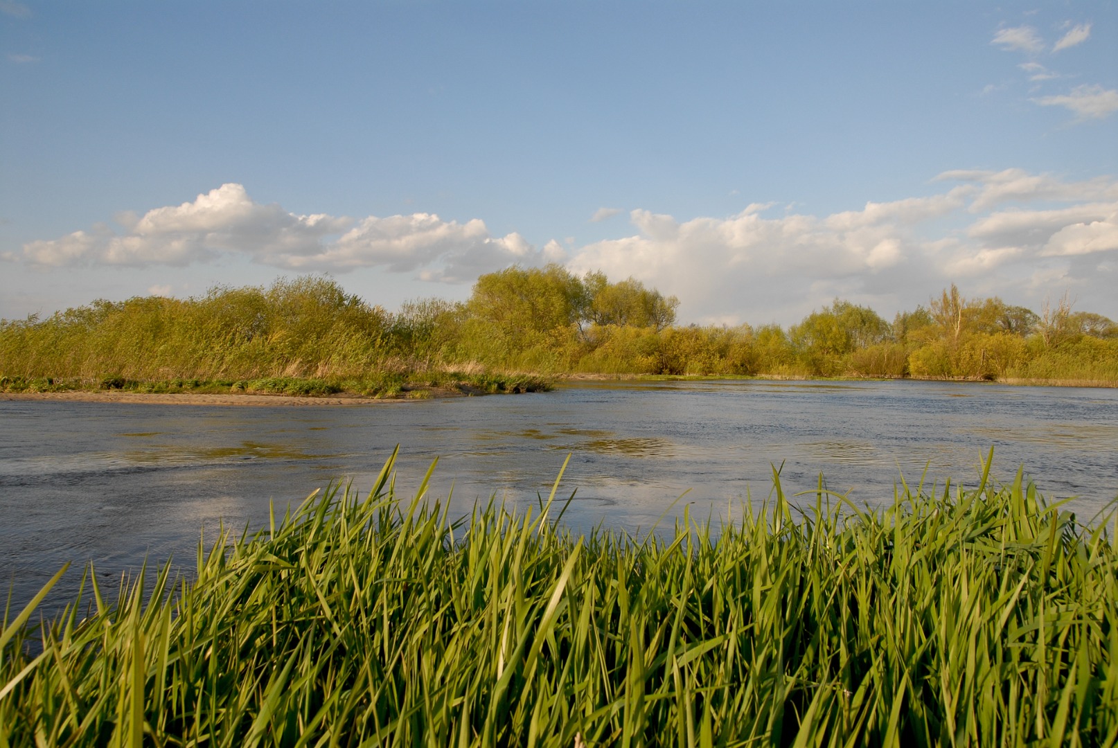
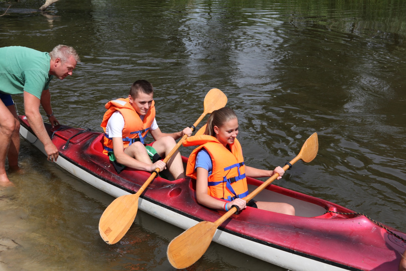
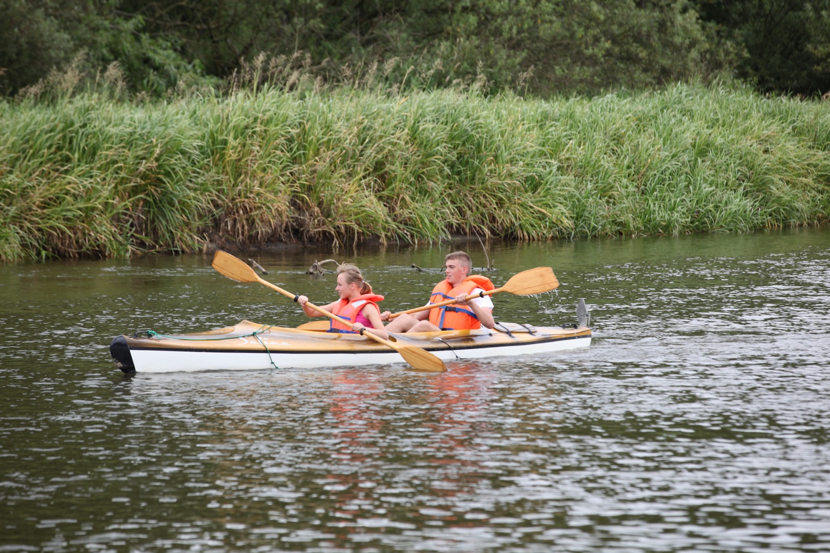
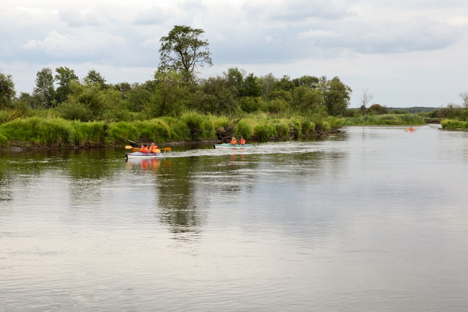
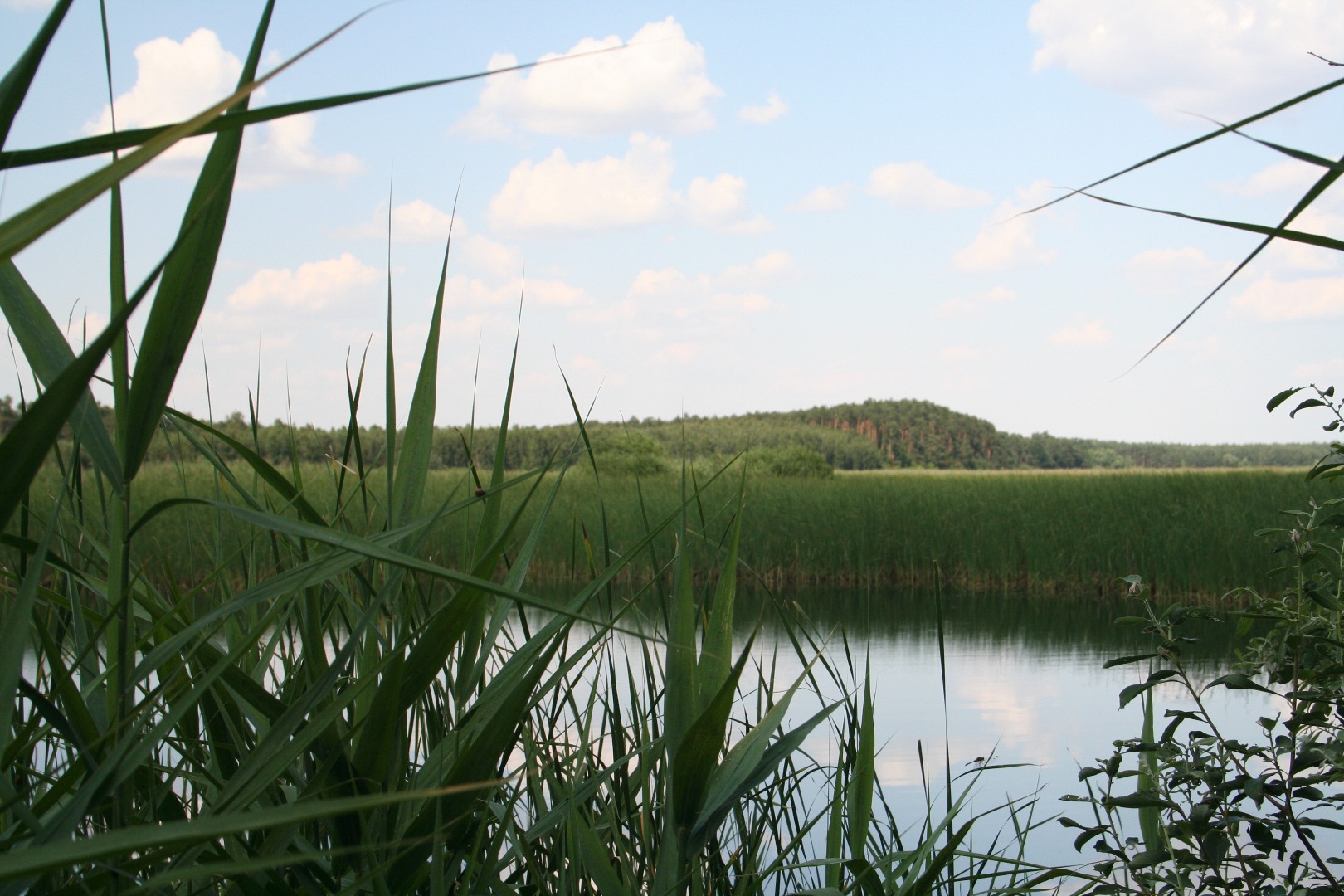
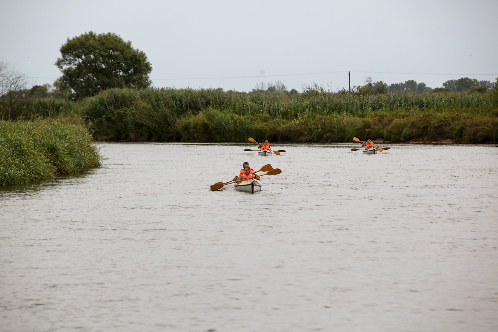
The trail route runs through the Wieprz Ancient River Valley Protected Landscape Area. The magnificent and wild river forms here picturesque meanders that house habitats of wildfowl and of European pond turtles, otters, muskrats, and beavers. This area is of high landscape value: it is a unique mosaic of forests, meadows and peat bogs. The beautiful Piskory Nature Reserve is also located on the trail.
The trail presents interesting local arts of pottery, weaving and basketry, and also enables you to relax in the natural environment and encounter pure nature.
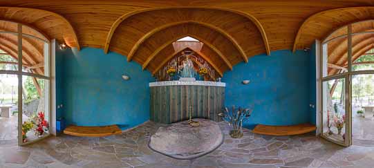
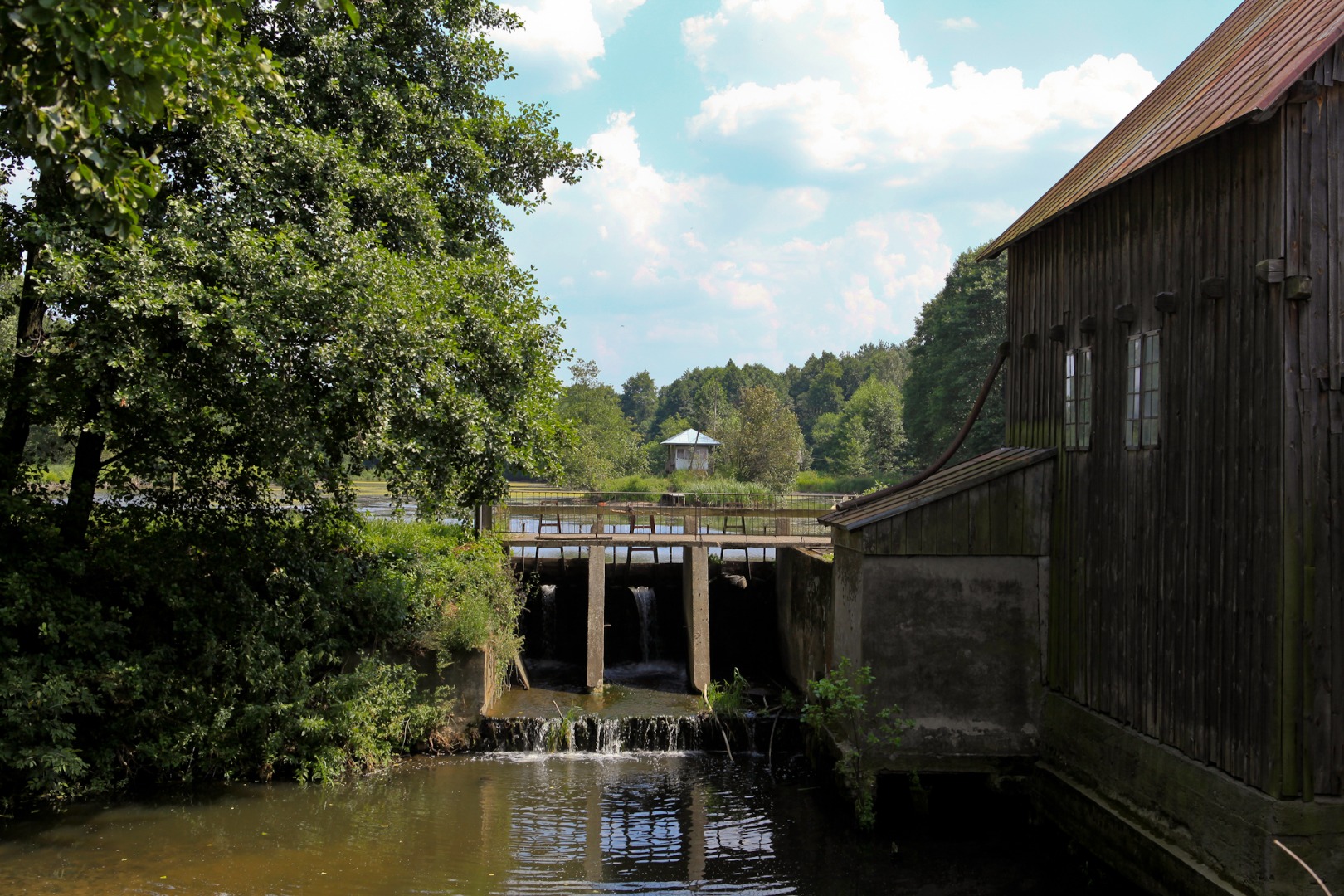
The ride begins in the village of Zagóźdź, at the intersection with the road leading to the village of Baranów, where a rather large orange roadside shrine is located. The yellow trail turns in the direction of Baranów (at 6 km), while the black trail – that you are following – heads in the direction of the village of Składów toward the Wieprz River. About 100 m after the intersection you pass by a wooden watermill on the Bylina River on the right (a left-bank tributary to the Wieprz River). A sluice damming up the water operates at the mill, and there is also a small pond.
The watermill in Zagoźdź was established in 1946 as one of seven such mills in the region, built in the stead of the mills destroyed during the war. It was made entirely of wood. At present, it is a private property. You can obtain there a stamp of the Bicycle Land at the Amber Trail Greenways.
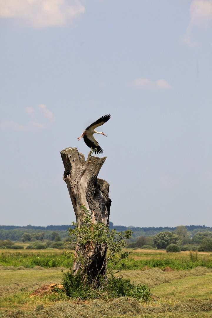
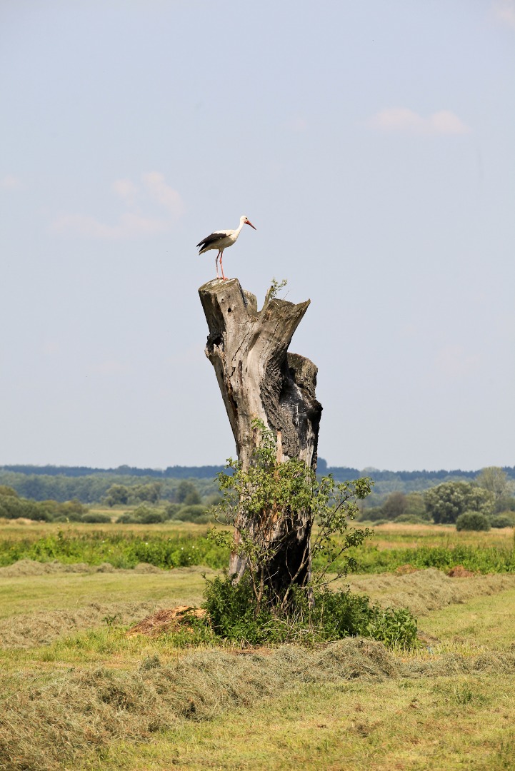
You cross the small bridge behind the mill and on the left you pass by a splendid blue roadside shrine dating from 1907, founded by Wincenty and Zofia Jarosińscy (at 0.2 km). The small Volunteer Fire Department Station is located nearby. Continuing the ride, you pass by a stork’s nest on the right, and farm log buildings on the left (at 0.27 km). You turn left at the intersection at the small metal cross (at 0.93 km). After about 500 m you pass by another cross, and both sides of the main road become surrounded by meadows that turn into reeds here and there (at 2.39 km).
You enter the village of Składów (at 2.7 km) and turn left at the black cross (at 2.95 km). The village boasts many original and well-preserved old wooden houses that are worth noting. The asphalt road ends behind the village and turns into a concrete surface road (at 3.25 km). You pass by another stork’s nest and reach the signpost stating that the black trail turns left (at 3.39 km). A rest area for cyclists is located 200 m later. If you wish to rest a little before the remainder of the ride, turn right before the signpost: the area where you can rest for a while is located behind the deteriorating wooden house.
Proceeding along the black trail, you turn left before another stork’s nest onto the field road (at 3.44 km). This is where the wildest part of the trail begins. You ride among the meadows and reeds, here and there interlaced with clumps of trees. You turn right after 500 m at the intersection and continue riding on the field road. You then turn left onto the wider and more comfortable dirt road (at 4.35 km). The slender tower of the Church of Exaltation of the Holy Cross in Sobieszyn is visible in the distance. The road meanders among the bulrushes that are one metre high, and gradually heads south (at 4.88 km). You continue among clumps of willow trees, and then the road heads west along the lane of pine trees (at 5.2 km). You turn left behind the conifers (at 5.39 km). After about 130 m you reach the signpost directing you to continue straight on. You leave the current road and enter the very narrow path. You pass by a drying pond on the left, where you can encounter herons. After about 20 m you reach another signpost confirming that you are still on the trail (at 5.54 km). You are now in the territory ruled absolutely by nature. The wild landscape slightly resembles the savannah, and you tear through the reeds surrounding the very narrow path and pass by another signpost (at 5.67 km). You turn right onto the very narrow path leading toward the nearby bend of the Wieprz River. You ride on the hardly passable path along the meandering riverbed but your effort is rewarded by the surrounding views.
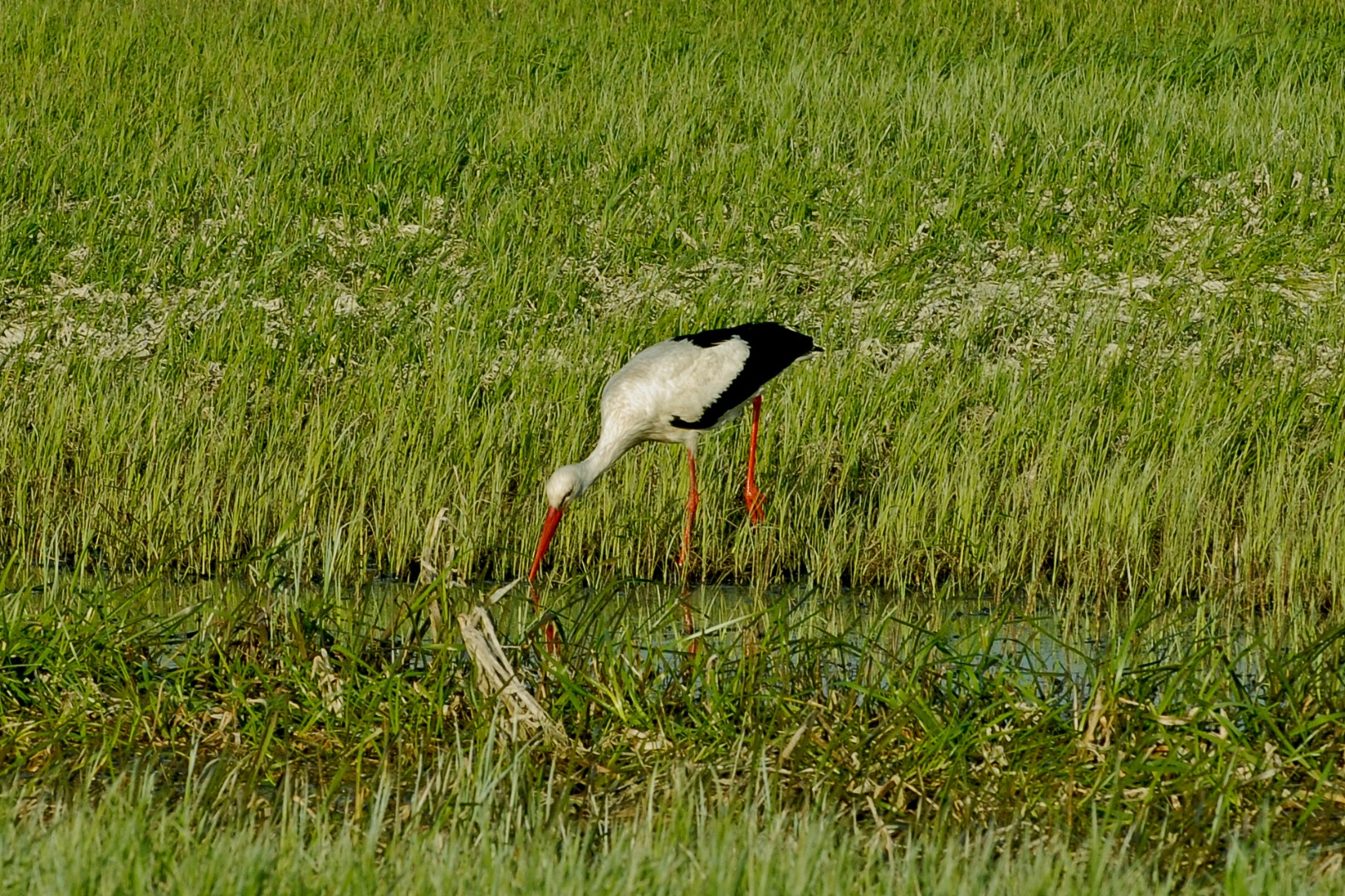
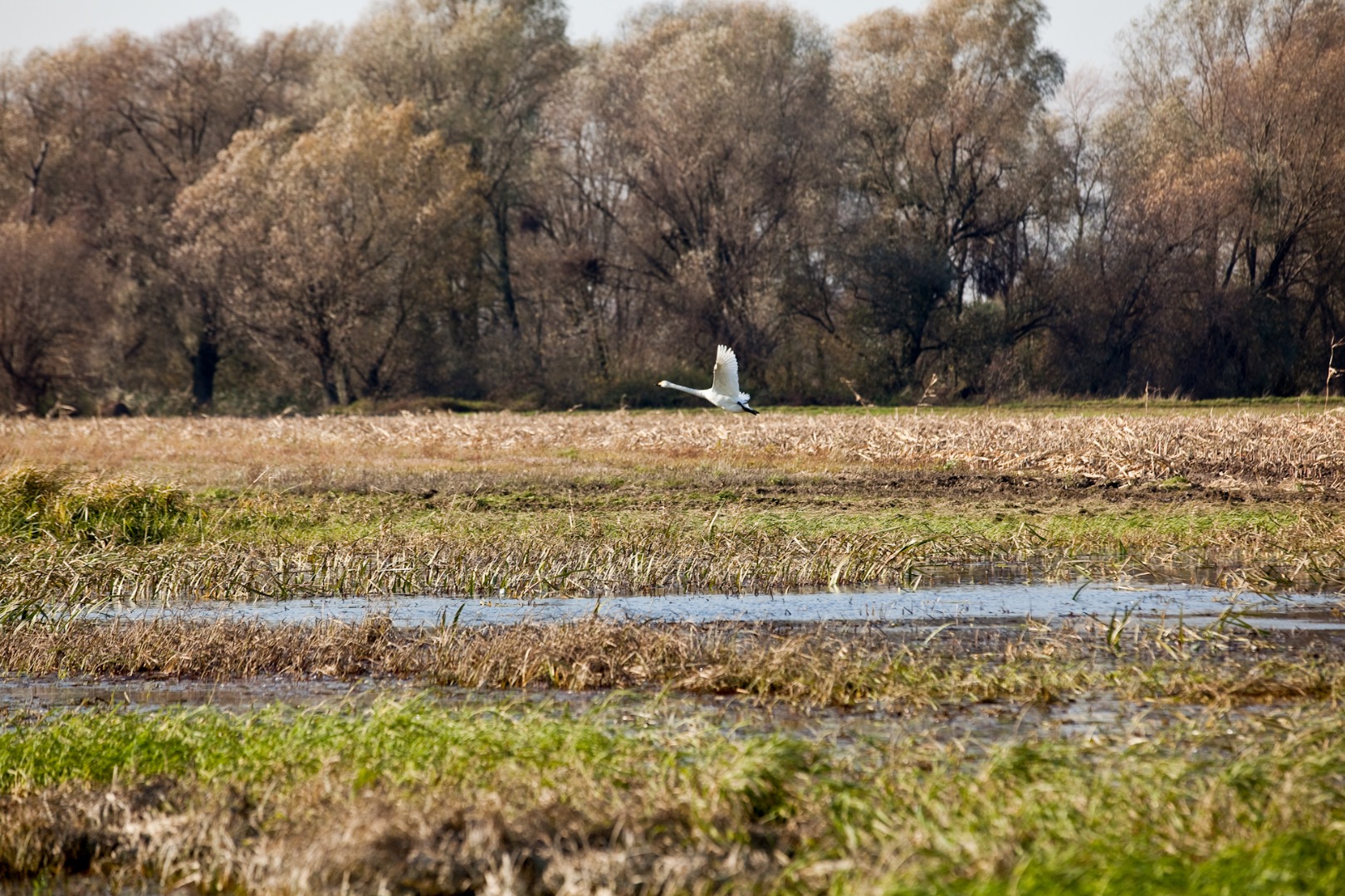
Here you can encounter abundant waterfowl, which finds ideal living conditions on this territory. The area is a nesting site for the Grebes, Corn Crakes, Remizes, Common Kestrels, Mute Swans, and Marsh-harriers. The vicinity is also abundant in fish as is manifested by the anglers you can see here.
You turn left after several hundred metres, moving away from the Wieprz River, and ride along the former dry riverbed (at 6.45 km). You pass by another signpost about 100 m later. You ride on the field path among wild meadows, passing by drying water gardens on both sides of the road (at 6.86 km). You cross the small bridge with metal railings (at 7 km) and continue on the slightly more comfortable field road near the Wieprz River again (at 7.51 km). You reach the crossroads (at 7.56 km) where the black and yellow trails meet. The yellow trail proceeds straight on, and you turn left (in the direction of Baranów) and for about 850 m you ride along the route, where the black and yellow trails overlap. On the left you pass by a clearing with an abandoned wooden shed (at 8 km), and 400 m later you reach the asphalt road. You have arrived in Baranów.
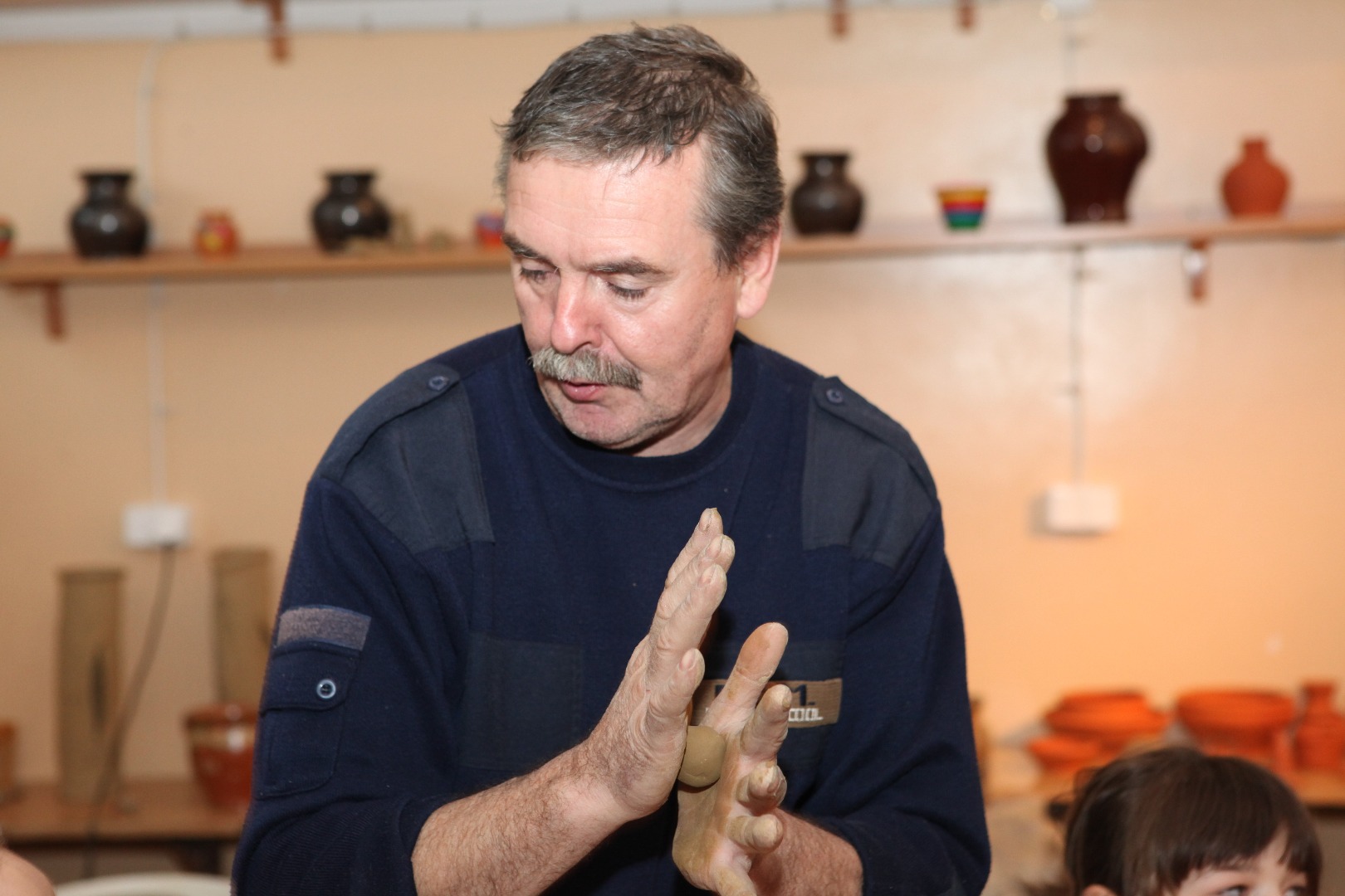
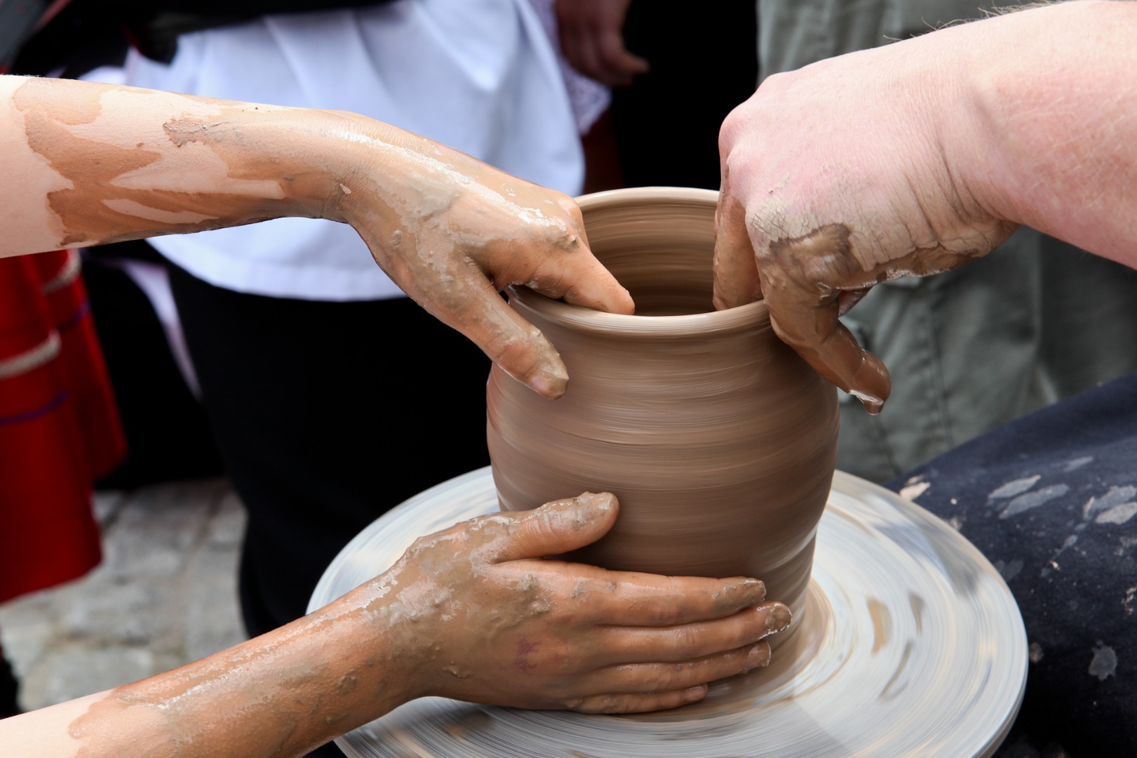
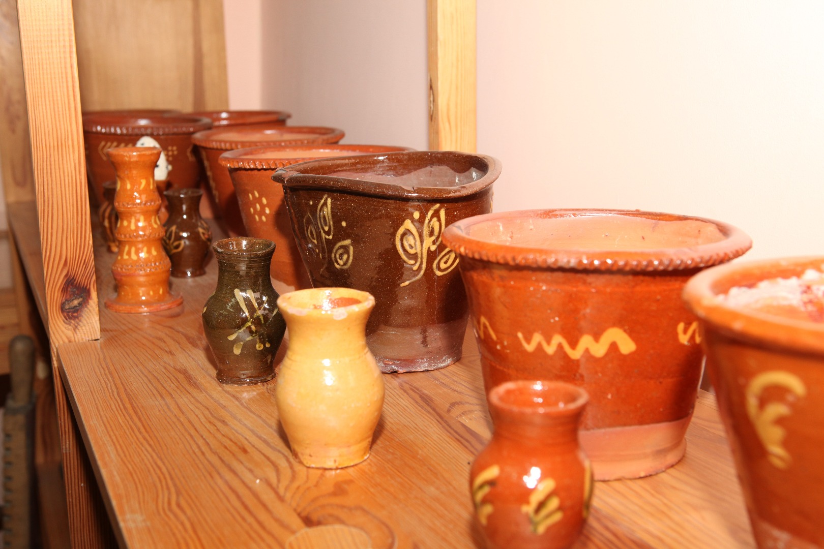
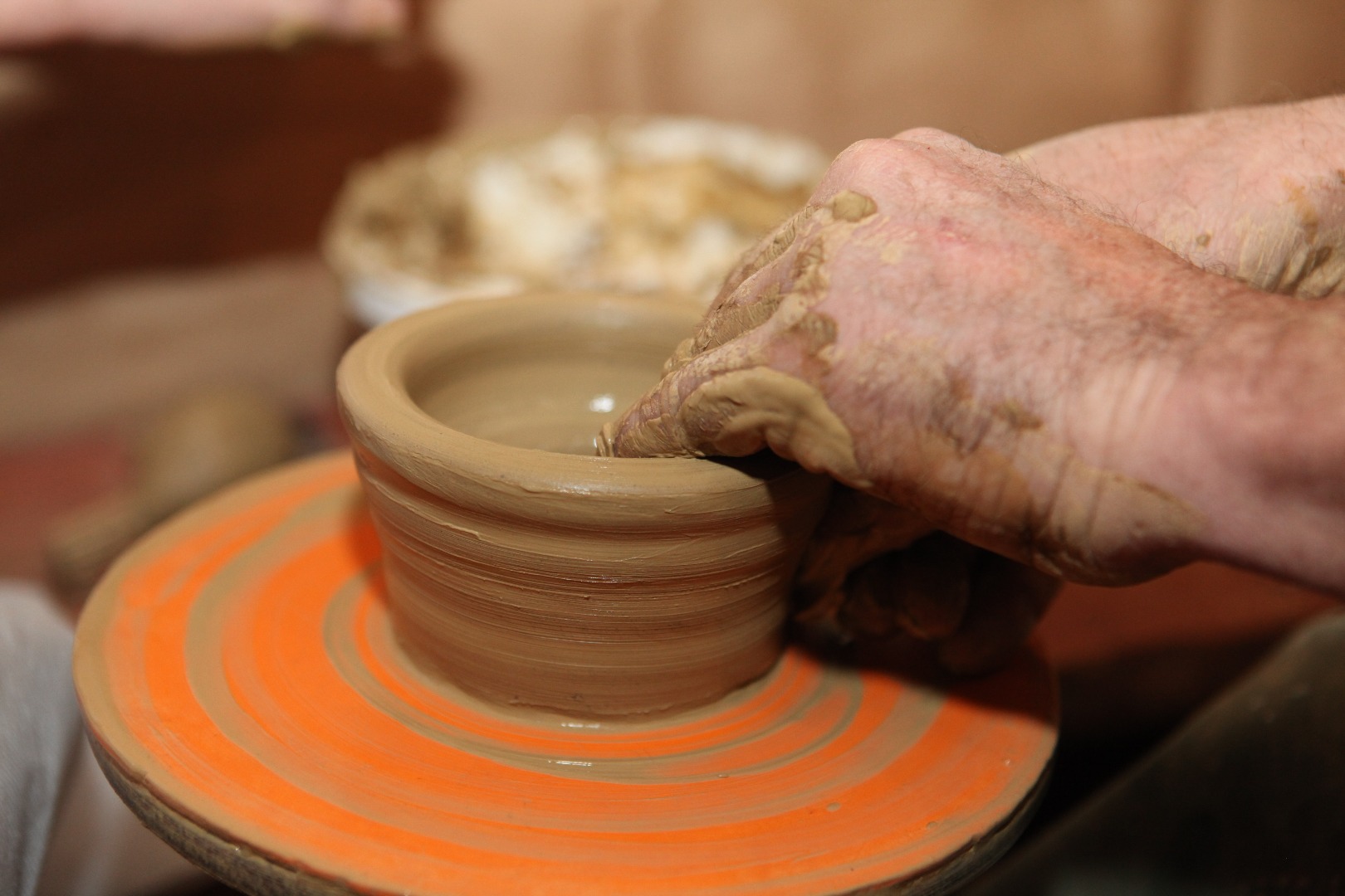
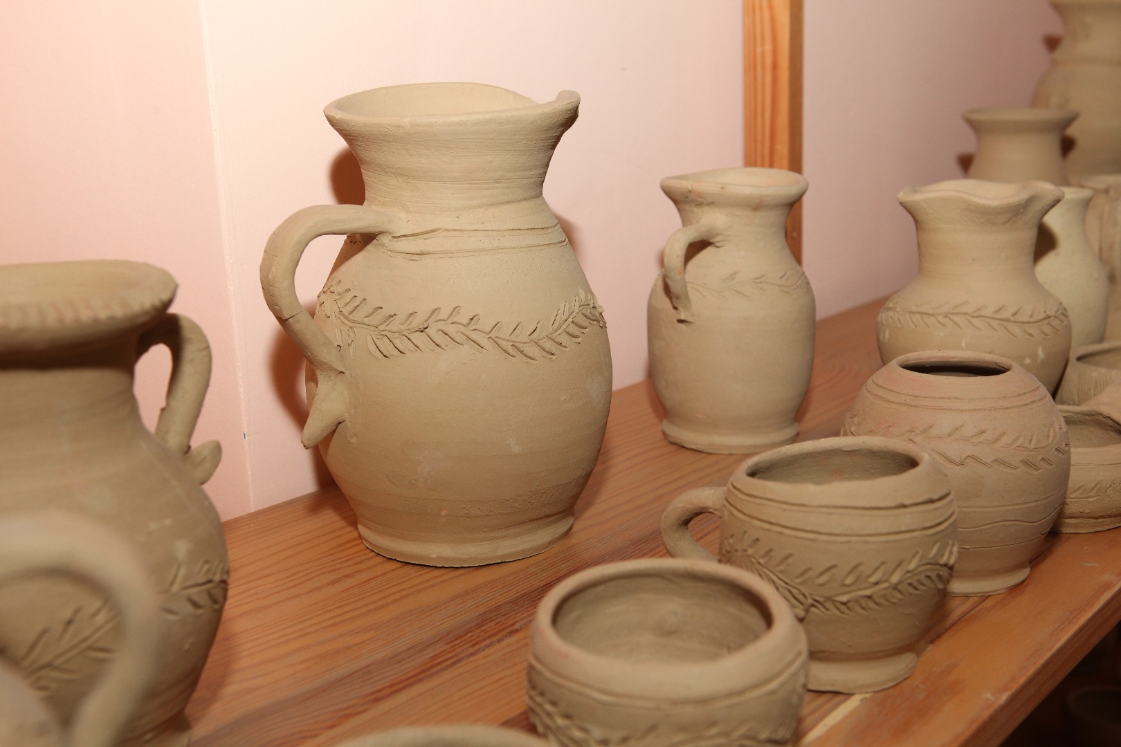
The village of Baranów has for centuries been famous for its pottery traditions. They date back to the 16th century. The occurrence of the suitable raw material – clay, the deposits of which were located in Baranów itself and in its vicinity – contributed to the development of the craft. The heirs of the old family pottery traditions engaged in this craft until the late 20th century. They created jugs, flowerpots, mugs, moneyboxes, twin jugs, vases and toys for children, rooster whistles and fifes, among others. Their earthenware products could be purchased at markets and fairs in Kazimierz Dolny, Wąwolnica, Puławy, Kurów and Markuszów. In the past, the Baranów potters were united in their guild (established in 1779). The potters disappeared from the landscape of small town markets and fairs in the 1990s. The local Chamber of Tradition (also known as the Pottery Chamber), located in the County Culture Centre, is worth visiting. It features collections of the old masters, documents, valuable memorabilia and photographs donated by the potters’ families. Pottery workshops for children and adults are also organized here.
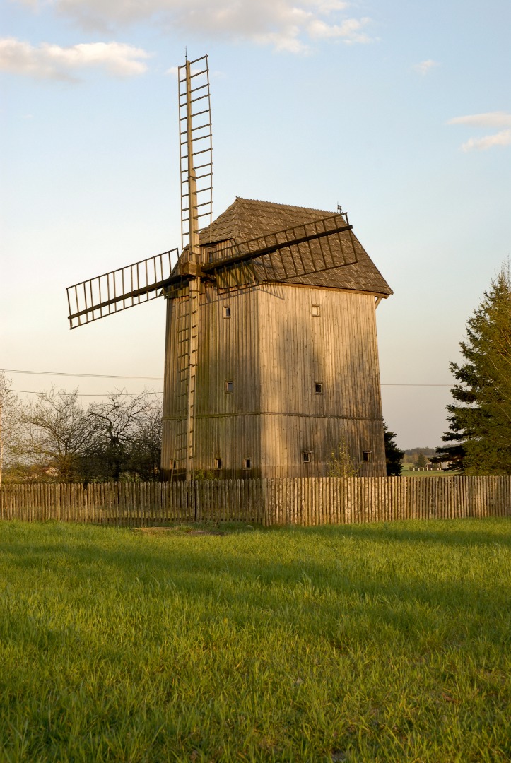
The trails part ways at the intersection near the entrance to Baranów (at 8.41 km): the black trail turns right into Zagrody Street, while the yellow trail turns left and runs through the forest toward the village of Dębczyna. Following the black trail markers, you pass by a tall wooden cross standing sideways to the main road on the right (at 8.58 km), and turn left into the cobbled Środkowa Street (at 9.42 km). 100 m later you cross Michowska Street. Having passed by the roadside shrine topped with a patriarchal cross, you ride straight on along Czołnowska Street. Leaving Baranów (at 10 km), you pass by an information board that says that the village of Czołna features fruit cold storage. The historical wooden windmill is located in the village on the left side of the road (at 10.73 m).
The frame construction Windmill was built of pine in the late 19th century. The elevation is lined up with vertical boards. The door is placed in the front, and the rear elevation features the wind shaft drive with the sails. The windmill operated until 1961, when it had an electric engine installed, and this was how it was transformed into a mill. A journalist from Warsaw purchased it in 1976, and transformed it into a summer pavilion, retaining part of its former furnishing. When the windmill was adapted for residential purposes, the underpinning was made, the floor was redone, the interior was modernized and a bathroom was added on the right side.
You can obtain a stamp of the Bicycle Land at the Amber Trail Greenways at the “Ostoja pod Czarną Piłą” Agrotourist Farm (Czołna 52).
You pass by the local Fire Department Station and turn right at the white and green roadside shrine (at 11.61 km) in the direction of Żyrzyn. After about 1.84 km a careful hiker will note mysterious ruins located on the right next to the main road at the edge of the forest.
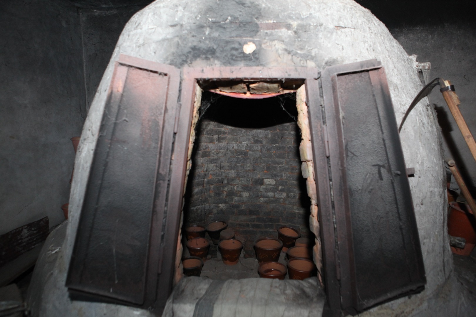
Four curved entrances lead to the ruins of the brick building located in the forest. What kind of strange structure is it? It is the former abandoned brickyard, or more precisely, the collapsed kiln of the old brickyard. Although the last bricks were fired here several decades ago, people who used to work here are still alive.
You reach the village of Niwa, where you turn right. This is where the black trail joins the yellow trail for the last time, and they overlap on the stretch of 1.65 km. You ride along the edge of the forest for about one kilometre. The main road then turns left, but you leave the asphalt road and turn right into the forest. You pass by a tree with the yellow trail marker (at 14.82 km) and after 100 m you see the markers of both trails on another tree. You pass by a small clearing at the end of the forest (at 15.15 km) and ride among young birch trees. 400 m later the trails separate (at 15.55 km). The yellow trail turns right and you proceed straight on, following the black trail markers. You make a right turn into the field road at the metal cross (at 15.61 km) and cross through a birch grove. You ride straight on for about 400 m, and then turn right (at 16.17 km), continuing through the forest uphill along the shallow ravine and then straight on through the intersection (at 16.35 km). You exit the forest (at 16.96 km) and turn left. Having reached the asphalt road (at 17.39 km), you turn right. You pass by a few buildings of the Żyrzyn Colony and turn left (at 18.85 km). About 120 m later you reach the splendid roadside shrine in the village of Żerdź.
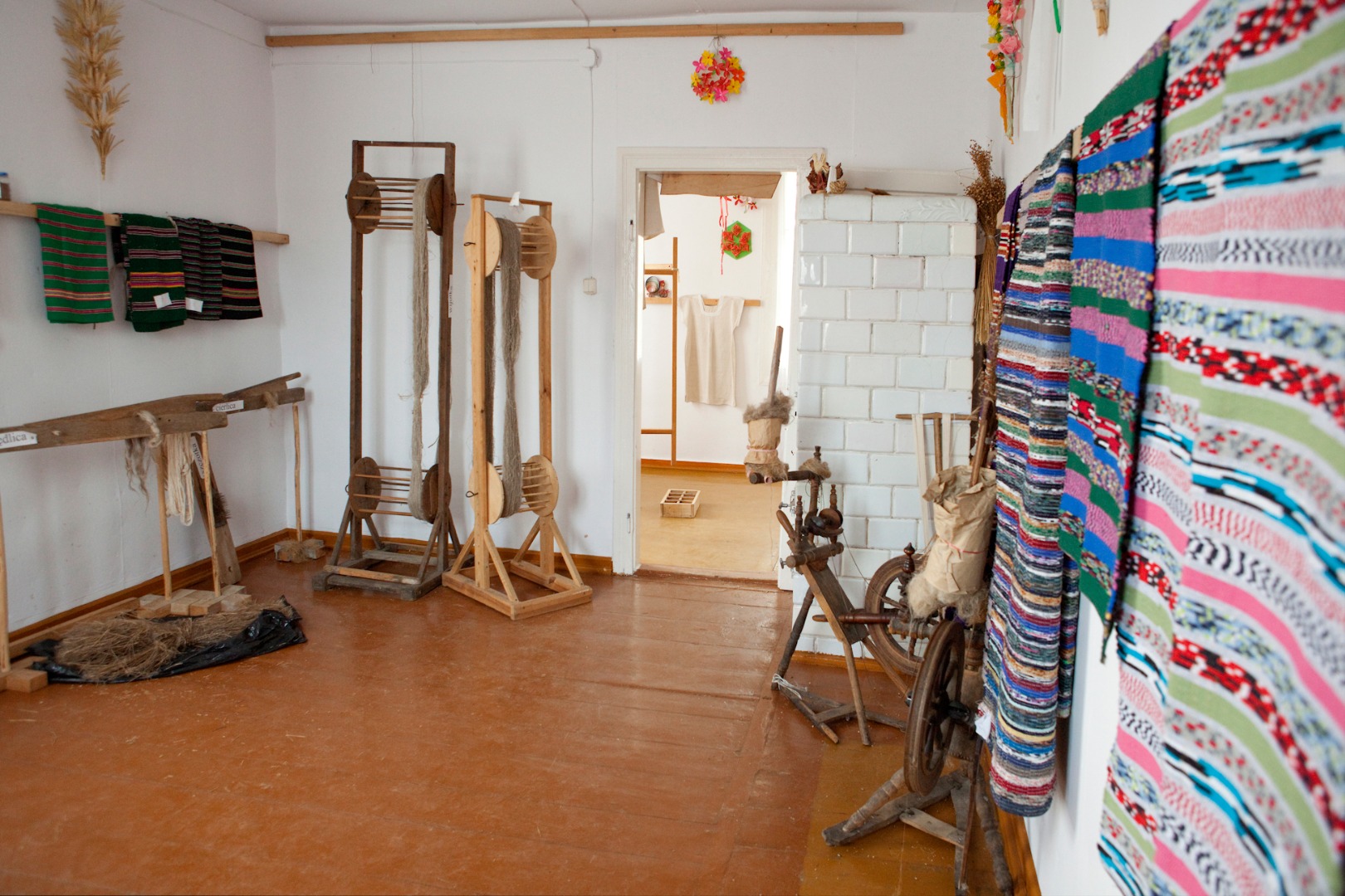
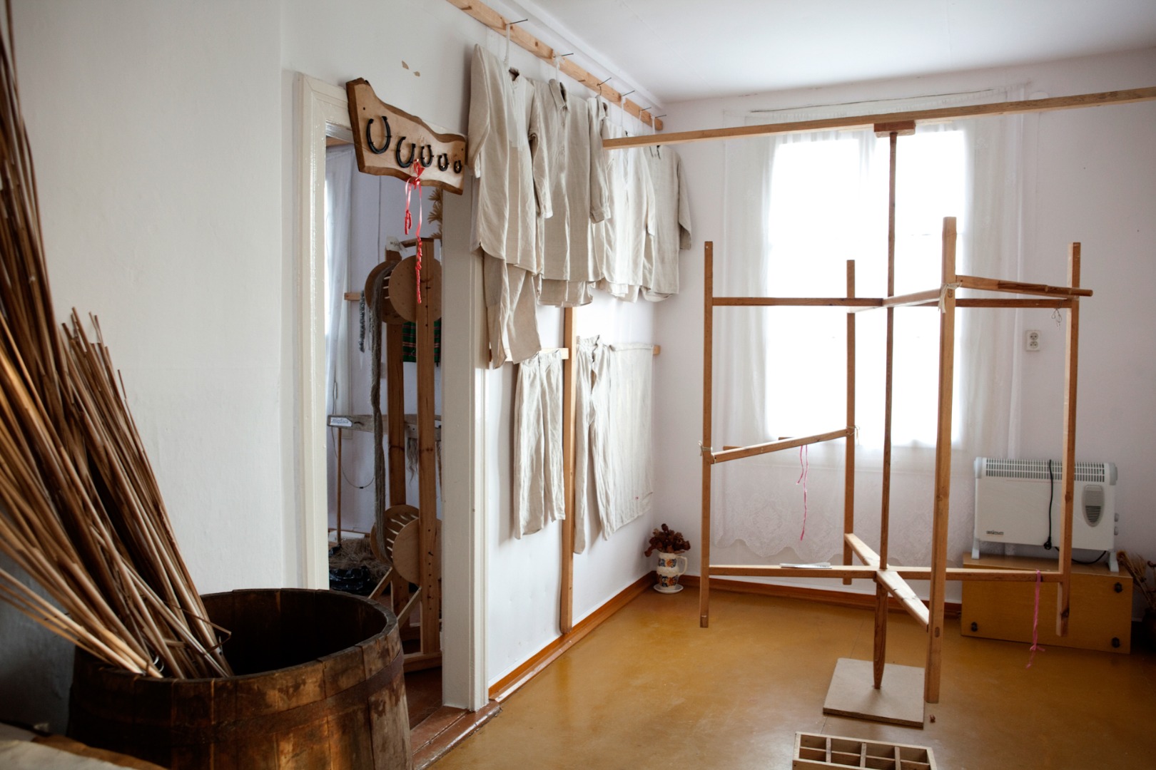
The village of Żerdź is famous for its weaving traditions. The Regional Chamber of Weaving is located here, and the local “Nasza Wieś” [Our Village] Association cultivates local cultural, craft and culinary traditions.
This is where the black trail joins the green trail leading through the villages of Jaworów, Borysów, Bałtów and the Piskory Nature Reserve to Kośmin (22.7 km).
The Żerdź Fire Department Station is located right behind the intersection (at 18.97 km). A bit further down, you pass by a stork’s nest on the right, and a very old log house with window shutters on the left (at 19.4 km), and you turn right (at 19.85 km). You pass by a school building (at 20 km) and reach the intersection, where the black trail parts ways with the green trail and turns left.
You are 8.6 km away from the Puławy blue trail, and 11.6 km away from the Piskory Nature Reserve.
Having looked at the trail map, you continue in the direction of the village of Kośmin. You turn left (at 20.14 km) at the cross in the colour of dark walnut, and then you leave Żerdź and turn right (at 20.32 km). After about 300 m you cross the very busy National Road 17 and head in the direction of Jaworów (at 20.62 km).
The 830-metre stretch of the route runs through the forest. In Jaworów (at 21.45 km) you reach the 1951 white and green roadside shrine with a green cupid. If you turn right behind it, in 100 metres you will arrive at a rest area for cyclists located at the picturesque pond. Continuing the ride along the black trail, you pass by the second roadside shrine with a cupid, which is blue this time (at 21.66 km). It is worth noting the old wooden houses on the right. You turn left about 140 m behind the roadside shrine (at 21.8 km) onto the field road and 130 m later you again turn left at the crossroads, and a moment later you turn right at the old, wooden and dilapidated cross. At first, you proceed on the very sandy road among the trees, but you soon ride out into the open space (at 22.41 km). The white and red cellular phone mast is visible ahead. You ride through the forest (at 22.79 km) and cross the small concrete bridge at the edge of the forest (at 23.18 km). You pass by the pine forest on the left, and the young birch and pine forest on the right. You go straight on at the field crossroads (at 24.67 km). In the distance on the right you can see the chimneys of the Puławy Nitric Acid Plant. You reach the intersection in Borysów with a splendid roadside shrine on the left, and the Borysów Volunteer Fire Department Station located behind it. On the right you can see the office of an organization promoting regional traditions.
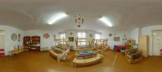
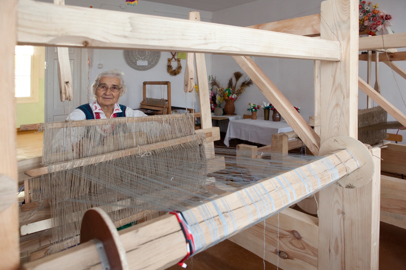
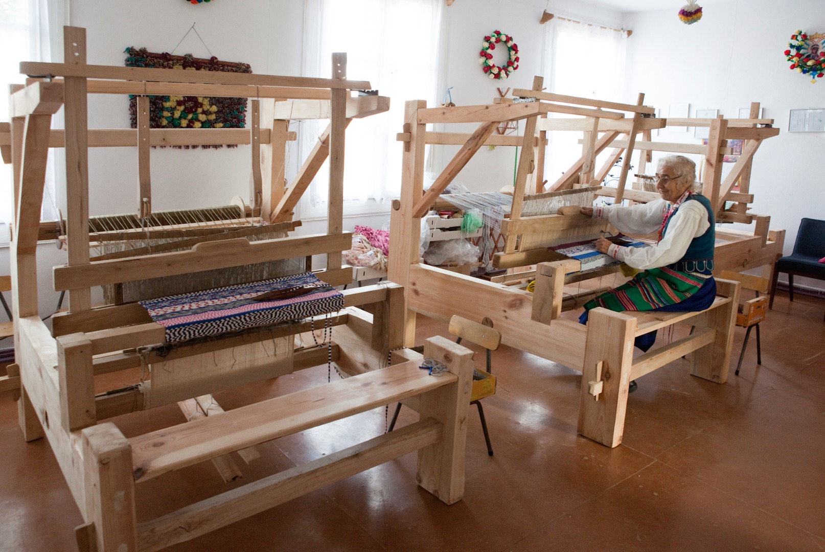
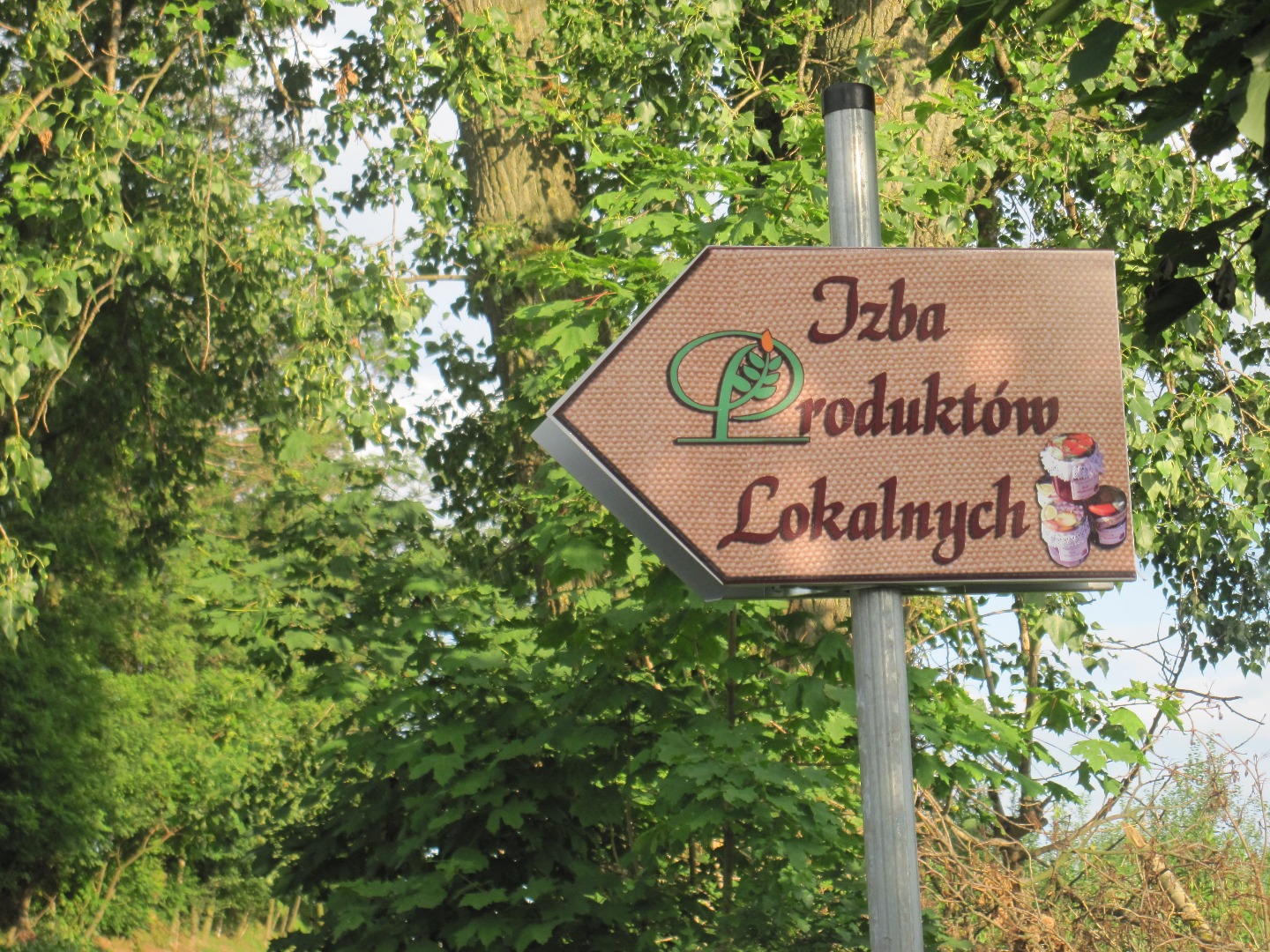
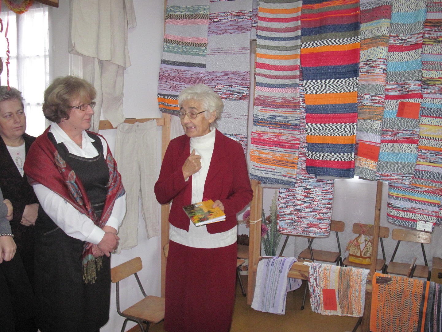
The Chamber of Local Products in Borysów features an information board with a map of 11 other Chambers of Local Products and bicycle-friendly sites, as well as a metal sculpture of a bicycle, all located in front of the building. Inside, you can see most beautiful rugs, hand made by local weavers, old looms and other devices that were once used to produce clothing and tapestries. Apart from weaving exhibits, you can also admire bulrush baskets. After a reservation of the date in advance (Ms. Krystyna Nakonieczna, phone: +48 81 88 14 611), you can participate in rug weaving workshop and try your hand at this dying profession.
Ms. Krystyna Nakonieczna, the curator of the Chamber, has engaged in folk arts since childhood – her mother taught her the basic weaving techniques. Nowadays, she is one of the most highly valued weavers in the region and she passes her skills on to others by leading workshops for children and school students. Apart from weaving, she also does bulrush basket weaving and religious arts and crafts.
You can obtain a stamp of the Bicycle Land at the Amber Trail Greenways in the Chamber.
The two old wooden houses face each other on the other side of the intersection. You ride straight between them and having reached the asphalt road, you leave Borysów (at 25.12 km). After about 750 m you arrive in Bałtów, where you turn right behind a stork’s nest (at 26.47 km) and you pass by the Chamber of Local Products in Bałtów located in the former school building on the left (at 26.7 km). The nearby sculpture of a bicycle with square wheels is very interesting, and there is also a bicycle-friendly place located here.
Bałtów, similarly to Borysów and Żerdź, is famous for weaving. Two ladies, Ms. Janina Furtak and Ms. Józefa Furtak, the two best-known local representatives of this dying profession, are associated with the Chamber of Local Products in Bałtów. They have engaged in weaving since the early childhood. They grow flax for linen, which they turn into clothing, aprons, and tablecloths. They use the fabric remnants to weave traditional colourful rugs. Janina Furtak has engaged in weaving since 1949. She creates traditional striped tapestry: rugs, runners, and pinafores. She weaves her works from colourful scraps of fabric or wool. Both ladies have received numerous awards and distinctions for their long-term involvement in the popularization of folk culture.
You can obtain a stamp of the Bicycle Land at the Amber Trail in the Chamber.
Continuing the ride, you pass by the Volunteer Fire Department Station in Bałtów (at 27.16 km) and the renovated 1950 roadside chapel ornamented with a cupid figure (at 27.32 km). You reach the crossroads and turn right (at 27.72 km).
This is where the black trail is joined by the Puławy blue trail (and they overlap on the stretch of 5.44 km).
If you turn left, you will reach a monument dedicated to the memory of the residents of the Bałtów village murdered by the Nazi Germans [Hitlerites] on June 12 and 13, 1943, during the pacification of the village.
You pass by the signpost (at 27.78 km) saying that you are 13 km away from the end of the trail and 6 km away from the Piskory Nature Reserve. You pass by a recently renovated brick roadside chapel dating from the turn of the 19th and 20th centuries with a bell installed above the doors (at 27.85 km). In the vicinity of the nearby meadows you can see wooden ricks for hay storage.
The ricks for hay storage were usually directly adjacent to barns from the side of the fields, but were also often placed on the meadows. The hay gathered in summer was stored in the ricks and would be transferred to the farms in sledges only in the wintertime after the muddy fields froze. The simplest form of a rick consists of four poles or thick perches embedded in the ground, outlining a square and covered with a mobile roof. Near Bałtów, you can encounter ricks with sidewalls, which are in fact mini-barns.
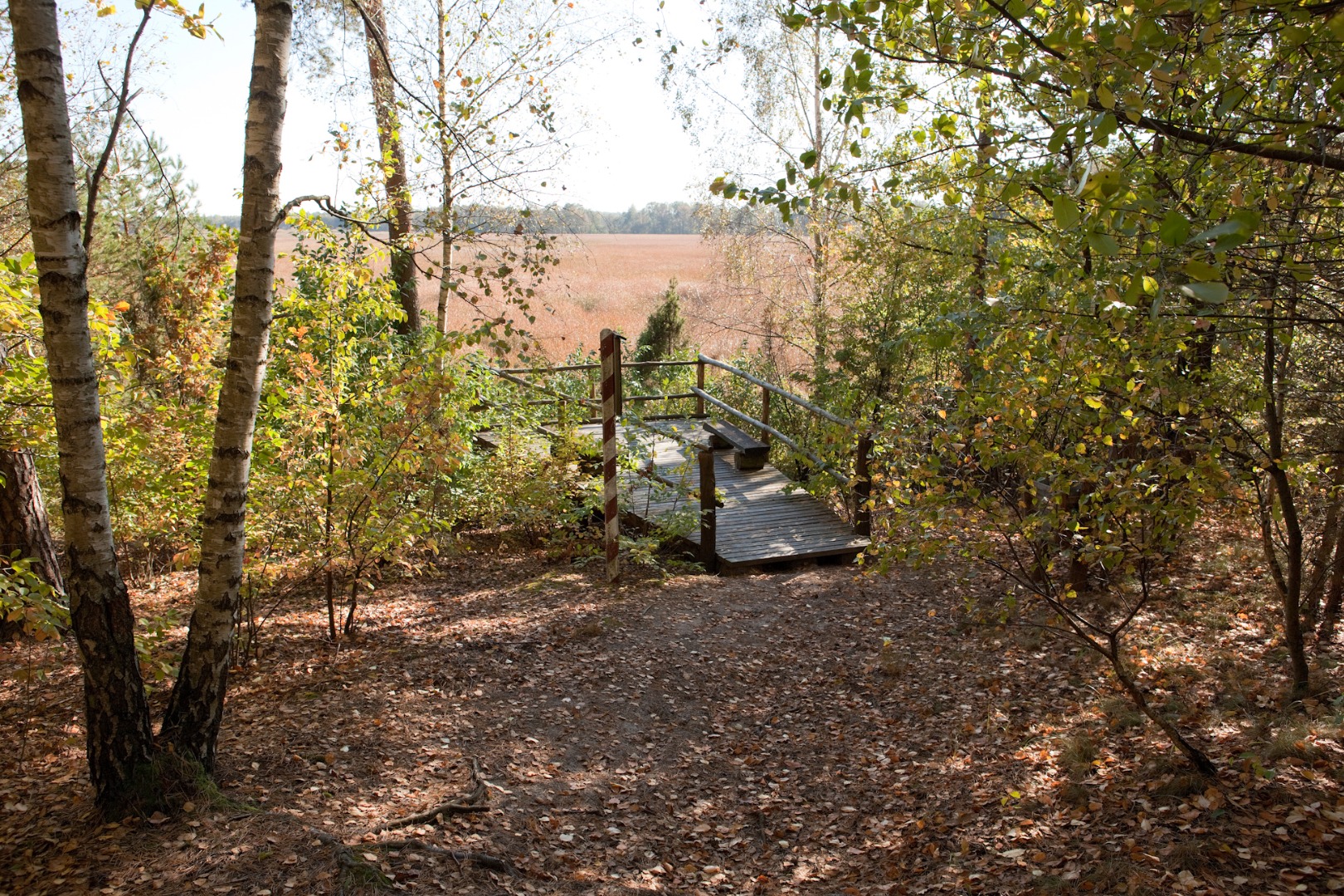
You leave the asphalt road (at 28.17 km) and enter the gravel road, which turns into a field path. A hunting blind is visible on the right near the forest (at 28.97 km), and you can often encounter roe-deer herds in the vicinity. Proceeding straight on, you reach the forest (at 29.31 km), pass by the signposts confirming that you are on the black and blue trails (at 29.52 km), and on the right you pass by the “Bird Alarm” educational board (at 31.19 km), placed here by the Puławy Forest Inspectorate. You enter the Piskory Nature Reserve (at 31.4 km). The information board placed at the entrance lists actions that are prohibited in the reserve.
The mid forest Piskory Lake and the Nature Reserve (area of 203.02 ha) are located within the borders of the Wieprz Ancient River Valley Protected Landscape Area. This place is exceptionally abundant in fauna and flora species. The system of didactic paths with information boards presenting descriptions of birds and interesting facts from their lives, and special platforms facilitating animal watching, which have been created in the nature reserve, allow you to not only passively contemplate the local nature but also actively explore it.
On the left you pass by a forest pond covered with duckweed with the fallen trees above the water (at 32.12 km). 100 m later you reach the observation point at the lake. A platform placed there facilitates bird watching, and a splendid view opens up in front of you over the larger part of the lake covered with reeds.
This rather shallow lake (up to 1.8 m deep) is in 98% covered with littoral zone plants, and therefore, this reservoir is considered as notably rich in natural assets. All waterfowl species can find very good conditions for nesting and preying here.
An information board placed nearby informs you how trees “wander.” Continuing the ride, you pass by other ponds covered with duckweed (at 32.37 km) and another educational board, called the “Trees” (at 32.68 km) and you get deeper in the forest. You finally reach a trail junction, where the trails part ways: the blue trail turns left and the black trail continues straight on (at 33.16 km).
You ride on the forest fire road. You pass by a large anthill and reach the crossroads at which you turn right into Fire Road 16 (at 33.22 km). After about 230 m you turn right and climb up a small hill where you turn left (at 33.57 km). You continue the ride on the paths among the trees, passing by a footbridge below (at 33.75 km). You then turn left and proceed downhill again (at 33.8 km). After a while you exit from among the trees onto the main forest road and turn right (at 33.87 km). About 1 km later you turn right again and after about 200 m you make a right turn again (at 35.09 km). You turn slightly left (at 35.17 km) and ride on the sandy forest road (at 36.06 km). You reach the fork road and turn left (at 36.2 km). You turn behind the hunting blind standing on the left (at 36.37 km). You leave the forest (at 36.55 km) and pass by an abandoned wooden house on the left with several dozen beehives adjacent to it (at 37.18 km).
Soon, you ride through the forest again. You proceed straight on at three consecutive crossroads (at 37.45; 38.01; and 38.99 km) and about 2 km after the apiary you leave the forest (at 39.33 km). You pass by two wooden crosses and ride straight on at the crossroads near the forest edge. You then reach the fork road (at 40.6 km) and turn left. After about 300 m you arrive at the signpost with a trail map saying that you have reached the end of the trail (at 40.88 km). The black trail, which you have just traversed, is one of the most difficult trails in the Bicycle Land, but your effort is rewarded by the pleasure and satisfaction from completing the trail.
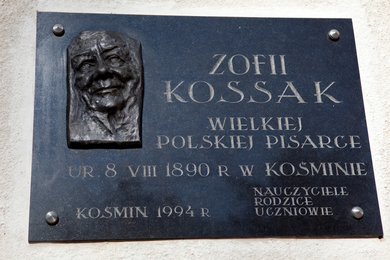
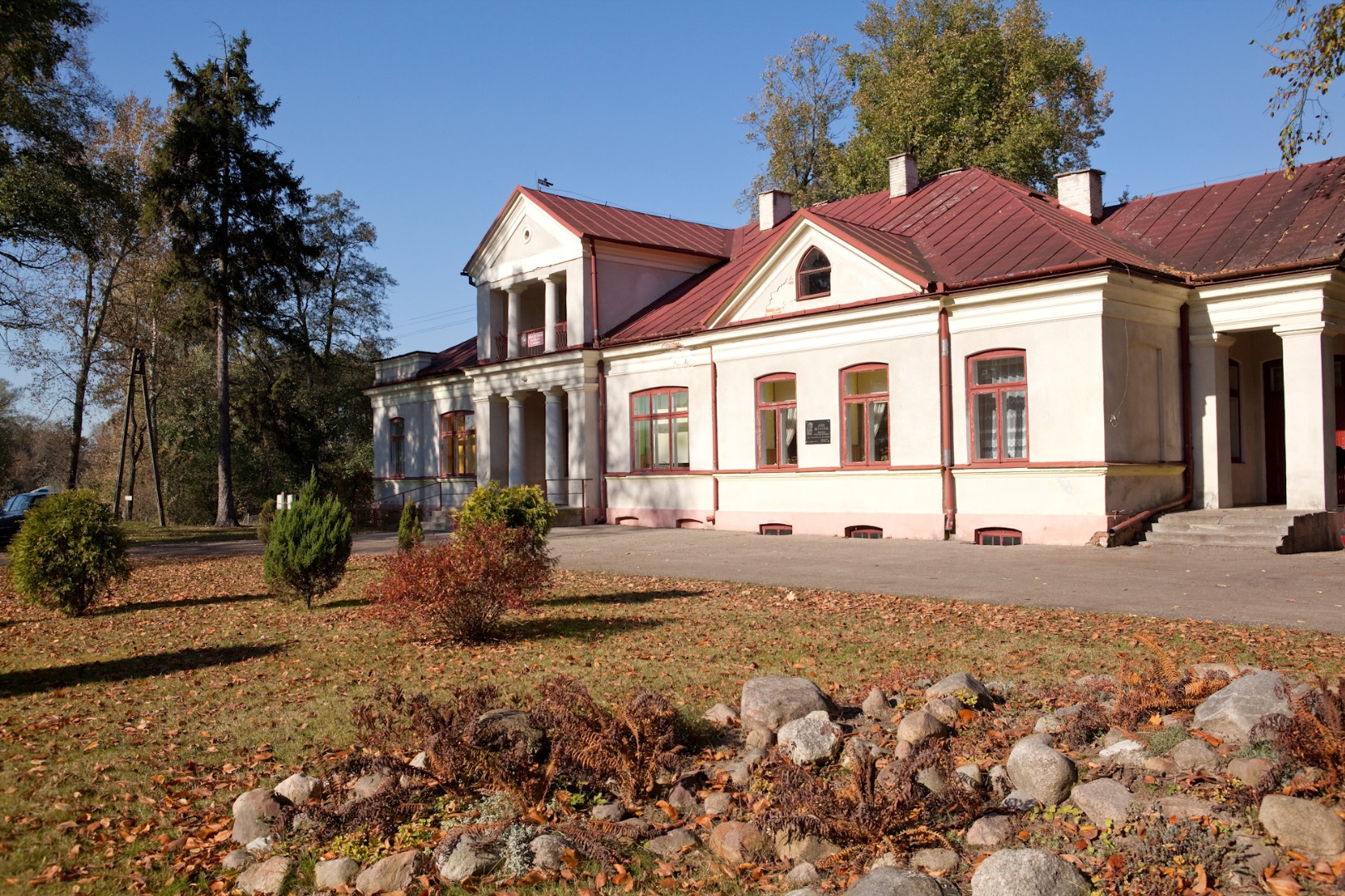
If you have some strength left, you can turn left after another 50 m toward the manor in Kośmin. A 150-metre-long tree alley leads to the manor. A 1994 memorial plaque commemorating Zofia Kossak is placed on the manor’s wall.
This is where outstanding writer, Zofia Kossak-Szczucka, descending from the family of famous painters, was born in 1889. She was the daughter of Tadeusz Kossak (the twin brother of Wojciech) and Anna Kisielnicka-Kossakowa, cousin of writer Magdalena Samozwaniec and poet Maria Pawlikowska-Jasnorzewska, and granddaughter of Juliusz Kossak. For some time, the estate belonged to Zofia’s mother, related to Maria Kossak, the wife of the eminent painter Wojciech Kossak.
The picturesquely situated building housed the County Public Library until recently. At present, the county authorities attempt to renovate and revitalize the historical manor.
The present manor in Kośmin was erected in the years 1907–11, on the site of the former building dating from the first half of the 19th century, retaining its initial location in the valley of the Wieprz River picturesquely meandering beneath. In her novel Trembowla, Zofia Kossak begins the description of the place as follows, “The manor, the farmyard and the plum house were located within a loop created by the Wieprz River, capriciously meandering through the plains.”
The old growth of trees from the former park has been preserved next to the manor. It consists of the European White Elms, Small-leaved Limes, Norway Maples, European Ashes, and Eastern White Pines, among others. The Canadian Poplar alley growing along the drive to the manor that ends with the thick spruce lane have been recently planted. The park has also retained the spatial relation with the picturesque river landscape and the village. As of 1945, the palace of the former owners of the Kośmin estate houses the Zofia Kossak Elementary School. The Memorial Chamber dedicated to the school patron located inside is open to public. The colourful figures painted on the classroom doors attract attention. This is how the characters from Zofia Kossak’s book, Kłopoty Kacperka, góreckiego skrzata [The Troubles of Kacper the Mountain Gnome] were illustrated.
A rest area for cyclists is located near the manor at the pond. You can also see a memorial obelisk erected to commemorate the 50th anniversary of the establishment of the local Fire Department with the names of firemen of merit, and members of the local Farmers’ Wives Club. A historical fire truck stands near the obelisk. Well-developed ponds are located nearby, where you can encounter angling enthusiasts.

The village of Żerdź is famous for weaving traditions. The Regional Chamber of Weaving is located here, while the local “Nasza Wieś” [Our Village] Association cultivates local...
The present manor in Kośmin was erected in the years 1907–11, on the site of the former building dating from the first half of the 19th century, retaining its initial location in the...
The mid forest Piskory Lake and the Nature Reserve (area of 203.02 ha) are located within the borders of the Wieprz Ancient River Valley Protected Landscape Area. This place is exceptionally abundant...
The watermill in Zagoźdź was established in 1946 as one of seven such mills in the region, built in the stead of the mills destroyed during the war. It was made entirely of wood. At present,...
The frame construction Windmill was built of pine in the late 19th century. The elevation is lined up with vertical boards. The door is placed in the front, and the rear elevation features the...
The village of Żerdź is famous for its weaving traditions. The Regional Chamber of Weaving is located here, and the local “Nasza Wieś” [Our Village] Association cultivates local...
From: 09:00
08-08-2014
To: 16:30
09-08-2014