The trial runs through the Kozi Bór Protected Landscape Area near two picturesque lakes: Rejowiec and Duży Ług Lakes. These areas boast numerous bird species and very rare butterflies.
You can conduct your own bird watching, and encounter the beauty of nature and unpolluted environment.
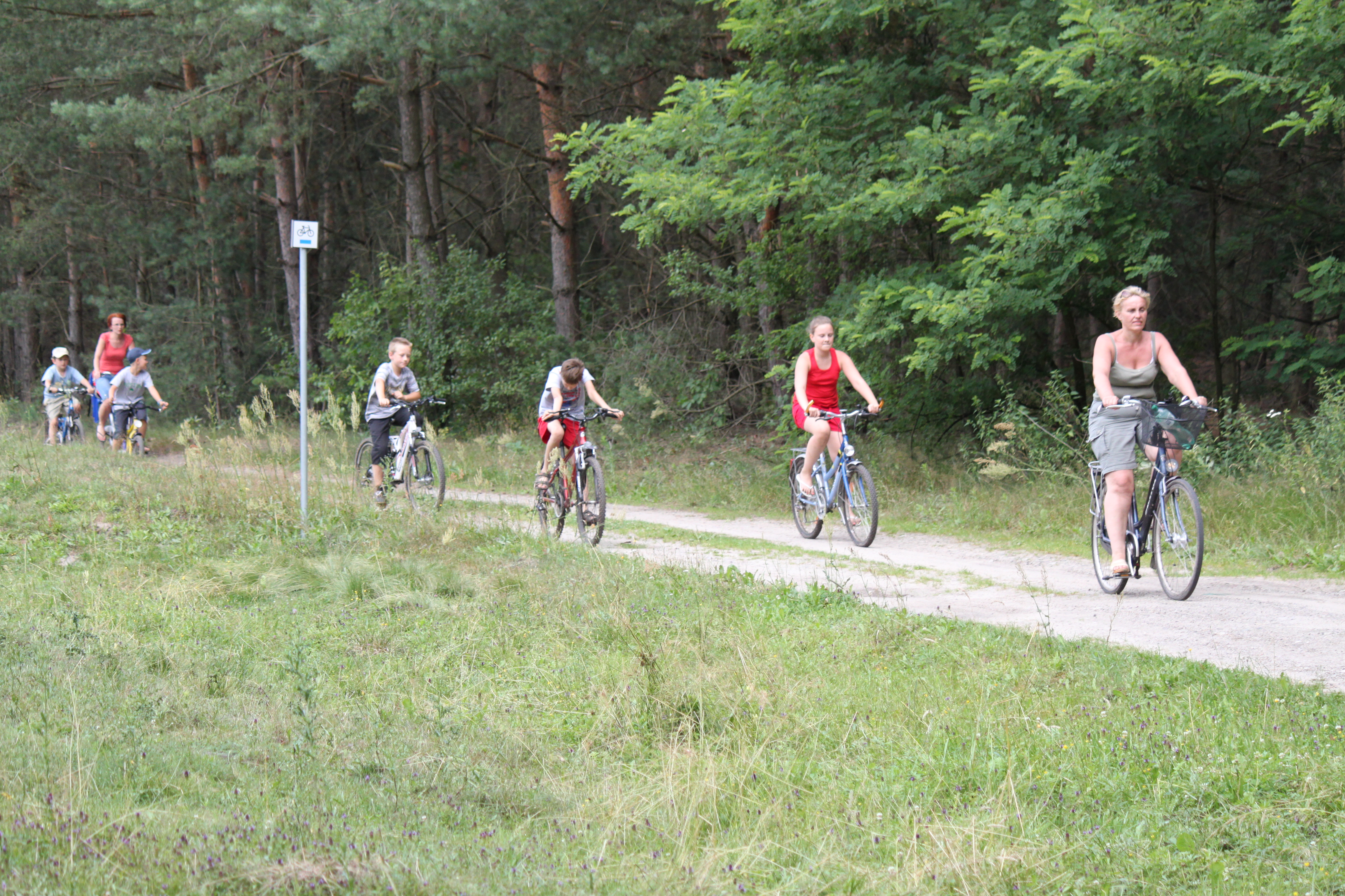
Most of the trail route has a paved surface, so you don’t need an all-terrain bicycle to traverse the trail, since it only occasionally runs through mid forest paths.
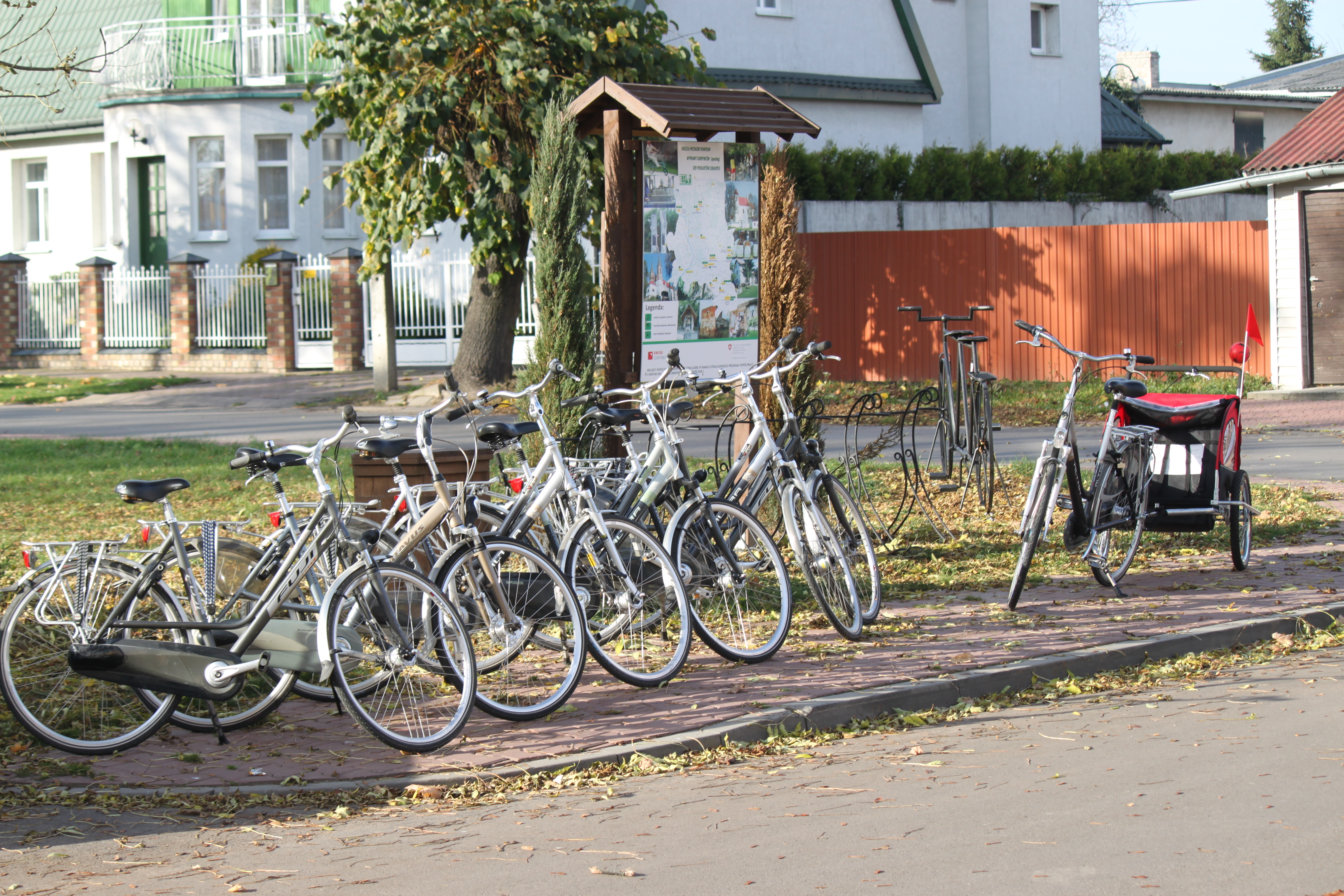
The ride along the blue trail begins in Markuszów near the intersection of Kościelna and Łany Streets, at the information board with the trail map located on the southern side of National Road 17. The area located north of this road is part of the Lubartowska Upland mesoregion. The vicinity you are going to cross lies within the borders of the Kozi Bór Protected Landscape Area established in order to protect the forest, meadow and peat bog landscape as well as rare and endangered species of fauna and flora.
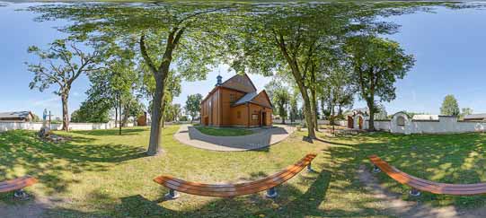
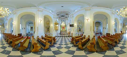
From the parking lot, where you can leave the car, you can see the Church of SS. Joseph, Michael the Archangel and Margaret, dominating over the vicinity. Detailed information about the church is included in the description of the “In the Land of Jan Pocek” yellow trail (see p. XXX).
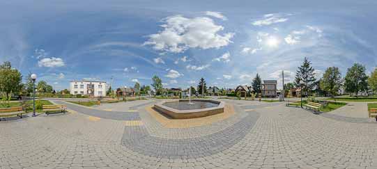
You turn left, ride around the parish church and continue straight on, crossing Road 17 (at 0.22 km). The safest way to get across the busy highway is to walk the bicycle on the pedestrian crossing located about 100 m away on the right. You continue riding along a small street located between the “Biedronka” Supermarket and the square. The 1983 monument of Jan Pocek sculpted by Jarosław Furgała (see p. XXX) is located in the centre of Markuszów at Lubelska Street. Before the Second World War a popular market was held on the site of the present square.
For several hundred years, the Markuszów markets and fairs attracted merchants and customers not only from the vicinity and the region, but also from abroad. The then owner of Markuszów, John Sobieski (the later King of Poland) confirmed the town’s privilege of organizing six markets lasting three days in 1667. The centuries-long tradition of markets has prevailed until the present day; nowadays, the market is held every Monday.
A bicycle-friendly site with a first-aid kit is located on the opposite side of the square. Before you continue the ride, you can take a souvenir snapshot on the sculpture representing a tandem bicycle.
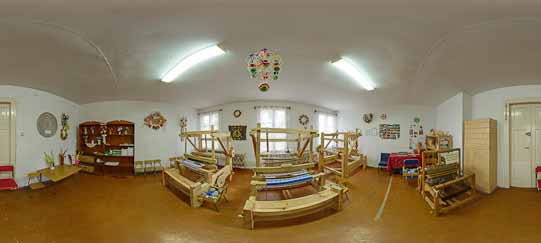
While in Markuszów, it is worth participating in the “Markuszów of King Sobieski” Discoverers’ Expedition. This is one of the first games, called after the English term – the Quests, in the Lublin Region, which in an interesting way presents many mysteries of this small town boasting an exceptionally rich history. The Quest questionnaire can be downloaded from the website www.markuszow.pl or can be obtained in the County Culture House (ul. Marka Sobieskiego 1). There, you can also receive a stamp in the passport to the Bicycle Land at the Amber Trail Greenways.
You turn left after 80 m into Rynek Street and pass by the former municipal authorities’ office. At first, the building housed the so-called Little Town Hall, and then it housed the county office and a pharmacy. You turn right 50 m later into Cmentarna [Cemetery] Street (at 0.35 km), which owes its name to the parish cemetery in Markuszów located there (at 0.66 km).
The Markuszów necropolis features the tombstone of Jan Pocek made by distinguished artist Marian Świst. The image of the poet with an open book featuring his name, dates of birth and death, sculpted in a several-hundred-year-old oak, suitably commemorates the memory and the site of eternal rest of the outstanding poet of Kaleń. The cemetery also features the graves and a monument commemorating the partisans who fought against the Nazi Germans during the last war. It is worth knowing that a very well-organized, strong underground resistance movement operated in the area of Markuszów County.
An interesting tombstone is located south of the partisans’ monument – it is the tombstone of Wadi Gluzman, the last Jew of Markuszów who managed to survive the Holocaust. Closely bound with the local population, he remained in Markuszów after the war and worked as a carpenter. Because he was a prewar communist, his funeral was a significant event in the times of the People’s Republic of Poland. The communist authorities erected his tombstone; however, a careful reader will find a mistake on the tombstone plaque.
The route continues straight on for 7 km behind the cemetery. You leave Markuszów and enter the overpass over Express Road S17 (at 1.7 km). After the exit, you pass by the remnants of the former private brickyard (at 2 km), and after 400 m you arrive at the site of fierce fights between retreating Russians and attacking Germans during the First World War.
The line of Russian trenches stretched from the village of Olempin, visible in the distance on the left, to the Borek Forest (on the right). During the fights held in the early August of 1914, the buildings of Olempin were burnt down. Also Markuszów, fired at by the Russian artillery, burnt down almost completely. The soldiers killed during the fights were buried in the cemetery located in Olesin at the road from Lublin to Puławy. The grave contains the ashes of 230 Nazi German soldiers.
If you turn right near the former trenches, and then turn left after several hundred metres at the former county refuse dump, riding parallel to the blue trail, you will reach a very picturesquely located sand and sandy gravel mines, which no longer operate. Once, this used to be the bottom of a prehistoric sea.
The former sand and sandy gravel pits, re-cultivated and returned to nature, are very interesting in terms of its natural assets. Several years after the trees were planted, new specifically ecological niches formed on the site with many interesting specimens of fauna and flora. The vicinity also features operating sand mines and water reservoirs filling in the former pits. All this creates a unique landscape.
Continuing the ride along the blue trail, you pass by the exit road on the right, leading to the former sand mine located right next to the road (at 3.49 km).
This place is called Kamienna Górka [A Stone Mount]. During a nature cataloguing of the area, several rare plant species were discovered here, together with large numbers of the sand martin nests, as sand martins had their nesting colony on the edges of the mine. Unfortunately, the steep escarpments had to be shoved aside for safety reasons and the sand martins moved to another location.
You now enter the village of Bobowiska (at 3.74 km). At the beginning of the village stands a cross with a barely readable plaque, commemorating the village residents who were executed on this site by the firing squad on June 30, 1943. Continuing the ride, you reach the intersection (at 4.85 km) featuring a trail junction: the blue trail joins the red trail running from Kurów.
The red connecting trail that is 7.09 km long will take you through the village of Kłoda to Kurów and to the green trail running from Klementowice to Strzyżewice. You are 4 km away from Rejowiec Lake and 8.35 km away from the end of the blue trail.
Continuing along the trail, you pass by the Folk House in Bobowiska and an adjacent store on the right (at 5.05 km). 400 m later on the left, a bit further away from the route, you can see the former school building, currently a private property (at 5.42 km). Proceeding straight on, you reach a site where the road turns right in the direction of Wólka Kątna (at 6.12 km). Riding through the village, you pass by the community club with an adjacent rest area and a playground for children (at 6.48 km) on the right. The trail turns left at the intersection behind the community club (at 6.54 km). A panoramic view of the vast meadows encircled by the forests unfolds ahead of you behind the buildings of Wólka Kątna on the left (at 7.07 km).
The marshy meadows retained the tracts of alder forests and riparian alder forests; the forest of highest value is located west of the village of Bobowiska. It boasts many rare plant species. Beneath the tree stand of black alder, you can find the undergrowth of blackcurrants and redcurrants, and the multi-varietal ground cover featuring the Marsh Ferns, Water Parsnips, Milk Parsleys, Lesser Pond Sedges and Elongated Sedges, Yellow Irises, Bittersweet Nightshades and Marsh Marigolds, less often – Marsh Callas and Water Violets. In fact, the entire area surrounding Bobowiska and Wólka Kątna boasts natural unpolluted forests, access to pure water, and excellent sites for mushroom pickers, anglers, hunters, bicycle ride lovers and enthusiasts of hiking amidst silence and tranquillity.
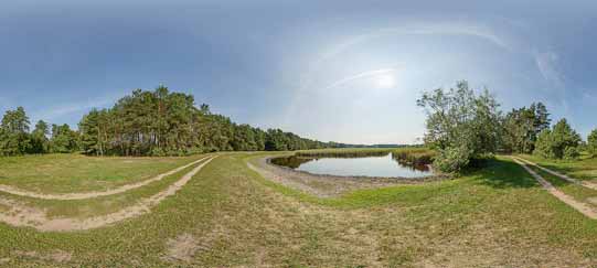
You turn right, proceeding on the asphalt road, and ride along the edge of the forest (at 7.19 km). You pass by an old blue house with window shutters on the left (at 7.42 km). Right behind the metal cross (at 7.89 km) the asphalt road ends and you soon reach the field fork road at Duży Ług Lake surrounded by forests.
The vicinity of Duży Ług Lake features small tracts of fresh pine forest. The undergrowth boasts junipers and European mountain ashes, while the ground cover includes the Blue Whortleberries, Sheep’s Fescues and Rough Small Reeds, as well as the grass with the Grey hair-grass, Morison’s Spurreys, Goldmoss Stonecrops, Iceland Mosses and Cup Lichens. The fields located south of Duży Ług Lake are a habitat to the Northern Wheatears and Tawny Pipits.
The marshy meadows boast rare non-migratory butterflies, strongly associated with the given territory. Their presence testifies the durability and invariability of biotope. The local lake is the habitat of such species as the Violet Coppers, Scarce Large Blues, Dusky Large Blues and pericallia matronula. The nearby forests also feature rare butterfly species, including the Lesser Purple Emperors, Purple Emperors and Caloptilia suberinella (the only habitat in Poland).
The lake is rather vast, but it is mostly covered with reeds and canes, so not everyone is aware that the blue trail runs right along the shore of this specific water reservoir. The road to the left takes you to a site that offers a better view of the lake and also gives you an opportunity to try out bird watching.
The lake and its vicinity are an ideal habitat for many species of waterfowl, wetland birds, and birds of prey, among others. Among the species living here are the Corn Crakes, Thrush Nightingales, Marsh Warblers, Red-backed Shrikes, Black-tailed Godwits, Common Redshanks, Common Rosefinches, Northern Lapwings, Eurasian Coots, Mallards, Grebes, Common Moorhens, Tufted Ducks, Common Pochards, Eurasian Teals, and White Storks. The direct vicinity of the lake boasts the Common Buzzards, Buntings, Woodlarks, Wood Warblers, Eurasian Blackcaps, Tree Pipits, Eurasian Jays, Common Blackbirds and Song Thrushes.
Continuing the ride along the blue trail, you proceed along the shore of Duży Ług Lake, passing by a pine forest on the right. Later, the route turns left (at 8.27 km) and you gradually leave the lake behind. You pass by a stylish old house on the right, and a stork’s nest located in its neighbourhood (at 8.54 km). You now proceed along the forest wall (on the left), on a slightly sandy road. Fields and meadows stretch on the right, and you can see a hunting blind in the distance (at 8.7 km). You arrive at Rejowiec Lake (at 8.85 km).
Rejowiec Lake is an ecological site; therefore, an information board located at the shoreline offers instruction on how to behave in this place. A sheltered area belonging to the “Derby” Hunting Club No. 57 in Lublin, which manages the lake, is located near the shoreline. The Lodge of the Hunting Club is located on the left, with an adjacent rock featuring a memorial plaque, erected to commemorate an anniversary of the club establishment. The lake’s region boasts the Little Bitterns, Eurasian Bitterns and beavers, and if you are lucky, you may be able to spot a moose.
When taking a break, it is worth noting several picturesquely located natural islets covered with trees. You will have a chance to admire them again, when riding along the trail around the lake. You continue riding through the forests around the lake, staying close to its shore. You then ride by the floodgate located at the very shore of Rejowiec Lake (at 9.28 km). Marshes stretch on the left, and you can see one of the islets on the right. You may be bothered by mud in some places on the way very close to the lake. After about 500 m the trail turns left. You leave behind the sandy slope at the end of the lake, where large numbers of swimming enthusiasts gather on warm summer days.
The lake’s bottom is mostly covered with mud, but from the side of your current location the bottom is sandy. The water’s specific colour comes from tannins contained in the leaves, which fall into the water from the trees growing at Rejowiec Lake’s shorelines.
Soon, you exit the forest (at 9.71 km) and ride along its edge. You pass by a clearing in the forest and turn right at the fork road (at 9.97 km). You ride among the trees, leaving the forest behind and reach the highway between Abramów and Wola Przybysławska (at 10.21 km). You turn right and continue the ride along the highway. At first, you ride among the meadows, and then you enter the forest again (at 10.57 km). At the exit from the forest you pass by a wooden cross on the left and enter the village of Wola Przybysławska (at 12.99 km). After about 200 m you reach the local school, where the blue trail comes to an end (at 13.17 km).
According to the signposts, you are 10 km away from Borków, if you turn right and follow the black trail around Garbów, and 15 km away from the village of Leśce. You can also turn left and following the black trail, reach the village of Meszno (at 4.7 km). Heading left, and then continuing straight on all the time following the markers of the yellow connecting trail (which is 7.31 km long), you will reach the blue trail around Kamionka County (at 3 km). From there you can get directly to the gate of the Zamoyski Museum in Kozłówka. The total length of the route is about 15 km.

Rejowiec Lake is an ecological site; therefore, an information board located at the shoreline offers instruction on how to behave in this place. A sheltered area belonging to the “Derby”...
The vicinity of Duży Ług Lake features small tracts of fresh pine forest. The undergrowth boasts junipers and European mountain ashes, while the ground cover includes the Blue...
For several hundred years, the Markuszów markets and fairs attracted merchants and customers not only from the vicinity and the region, but also from abroad. The then owner of...
According to the signposts, you are 10 km away from Borków, if you turn right and follow the black trail around Garbów, and 15 km away from the village of Leśce. You can also...
The lake and its vicinity are an ideal habitat for many species of waterfowl, wetland birds, and birds of prey, among others. Among the species living here are the Corn Crakes, Thrush...
This place is called Kamienna Górka [A Stone Mount]. During a nature cataloguing of the area, several rare plant species were discovered here, together with large numbers of the sand...
The marshy meadows retained the tracts of alder forests and riparian alder forests; the forest of highest value is located west of the village of Bobowiska. It boasts many rare plant species. Beneath...
The Markuszów necropolis features the tombstone of Jan Pocek made by distinguished artist Marian Świst. The image of the poet with an open book featuring his name, dates of birth and...
While in Markuszów, it is worth participating in the “Markuszów of King Sobieski”Discoverers’ Expedition. This is one of the first games, called after the...
From: 17:00
22-06-2014
To: 21:00
22-06-2014